1/25 CBS2 Sunday Afternoon Weather Headlines
By Matt DeLucia
CBS2 Meteorologist/Weather Producer
Good Afternoon!
I'm sure you've heard by now: The latest data suggest a major winter storm is headed this way! Things will likely change some as this unfolds, but as of now, all signs point to some significant snow for the region. Let's get right to it, and you can be sure we'll be on top of this for you.
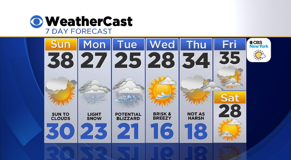
We're getting a brief break today. Partly sunny skies with some increasing clouds late. It'll feel seasonable today, with highs in the upper 30s. A cold front passes tonight, and tomorrow's high will be in the upper 20s in the city.
If you're wondering what happened to the "clipper" we've been talking about, it's still on track to pass to our south late tonight and tomorrow. This will likely throw some light snow to us during the day, especially south. A dusting to a few inches is possible.
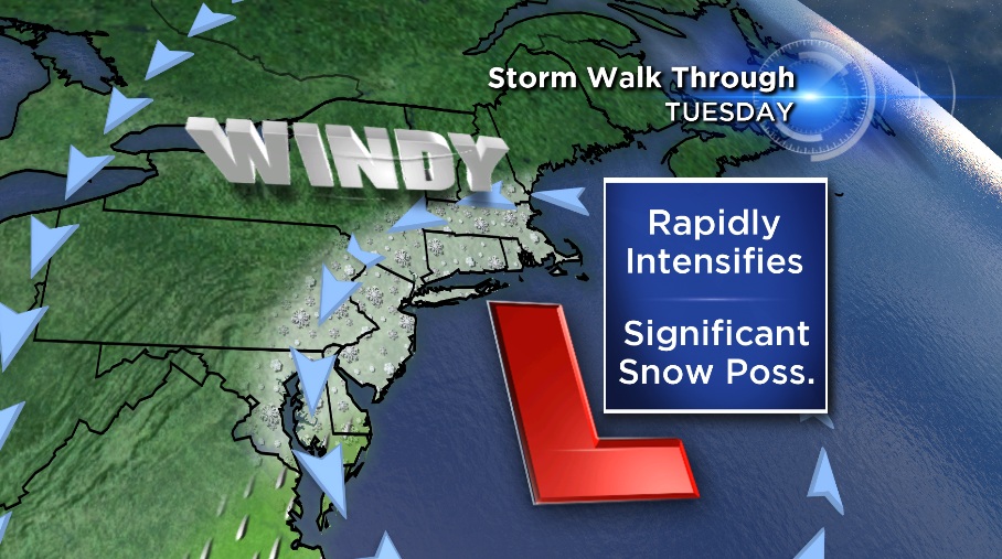
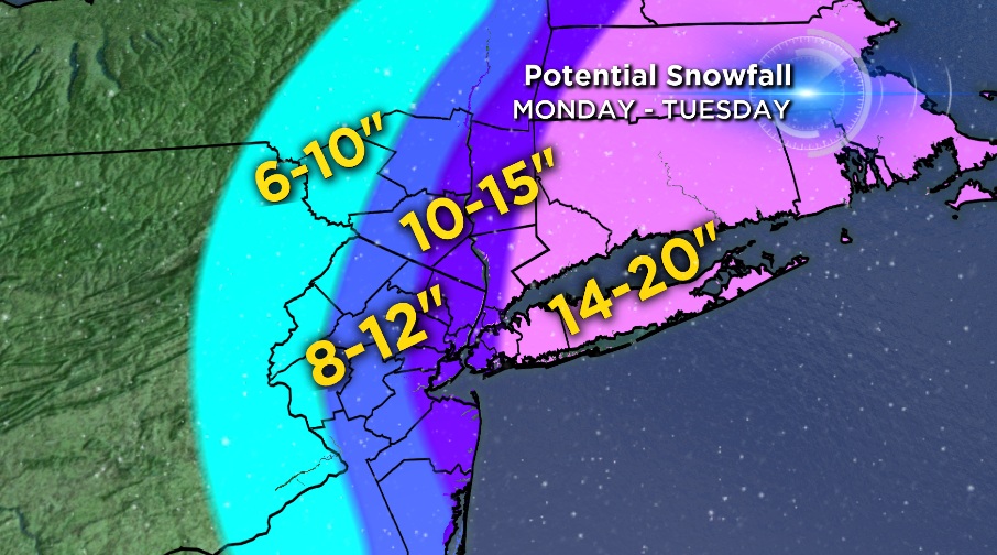
The major change is that our clipper now looks to move off the coast and turn into a major coastal storm for Monday night through Tuesday. The entire area is under a winter storm watch, with a blizzard watch for Long Island. Snow, heavy at times on Tuesday with highs in the mid 20s. The totals will likely change as we get closer, but this is the thinking as of now. The general trend is key -- less to the west, more to the east. The other big story will be the winds; they will be crankin' on Tuesday, with gusts of 40-50 mph at times, especially along the coast.
We clear out on Wednesday, but it remains cold and breezy as the storm pulls away. It definitely looks like Wednesday will be the dig-out day!
Check back in soon for the latest developments on this potential blockbuster!