2/7 CBS2 Saturday Evening Weather Headlines
By Mark McIntyre Jr, CBS2 Meteorologist/Weather Producer
Good evening, everybody! It's been a chilly day across the area and even some flurries/snow showers from time to time earlier today. If you have Saturday night plans you'll be OK for the most part, just a few flurries north/west of NYC. Expect a cold night with lows around freezing, colder in those 'burbs.
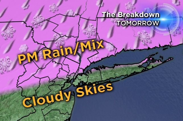
Sunday features a nice start and a not so nice finish. Some showers move into the region late in the day, but in NYC it'll be rain. Folks north and west will have more of a rain/snow mix. Again, those northern spots will have the better chance of seeing precipitation. More concerning will be the Monday morning commute, with more snow north of I-84 and a mix of snow/rain/ice south of there - including NYC and Long Island. Temps on Monday in NYC are only expected to reach 34 and that may be a bit optimistic.
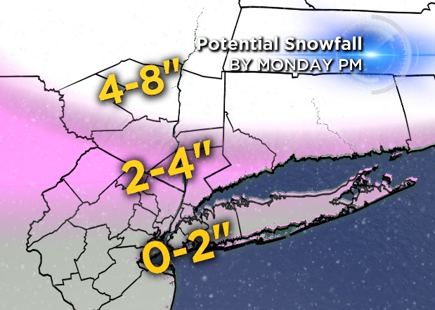
In terms of amounts (for the whole deal from Sunday through Monday night), best chance for anything over 6" would be Sullivan/Ulster/Dutchess; 2-4" range for NW New Jersey to Westchester/Fairfield and 0-2" for everyone else. Not a tremendous storm, but the ice threat appears to occur at the worst time. Tuesday features sunny skies and temps hitting 37 in NYC. Stay tuned for more updates on the wintry weather ahead!