8/30 CBS2 Tuesday Morning Weather Headlines
By Matt DeLucia
CBS2 Meteorologist/Weather Producer
*Put "Wake Up" graphic up top*
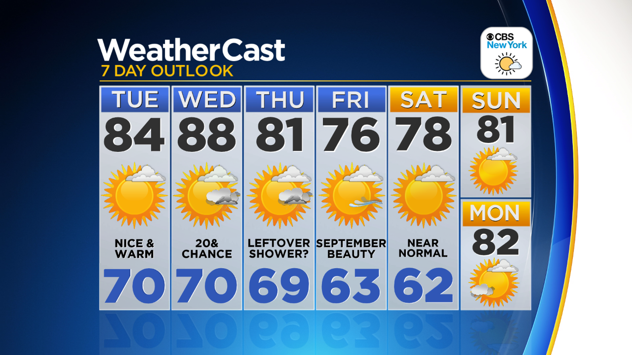
Good morning, folks! It's looking like another beauty out there today with cooler temps than yesterday. Humidity will down as well thanks to yesterday's cold front passing through. Highs will be in the low to mid 80s with plenty of sunshine. If you're headed to the beaches, the big concern is the continuing risk for dangerous rip currents. That's thanks to an onshore flow and Hurricane Gaston far out in the Atlantic. Be sure to swim where lifeguards are present!
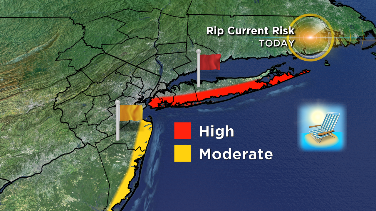
Wednesday is still looking like a pretty decent day, but we'll introduce more clouds and a shower/storm chance as our next front approaches, especially for those of you in the NW suburbs. It'll feel a bit more muggy with highs in the mid to upper 80s. The high rip current risk is expected to continue as well.
Thursday may see a lingering shower early with temps back down in the low 80s. Then it looks like a much cooler feel to start off Labor Day weekend with highs in the upper 70s. As of now it's looking dry to start, but be sure to stay tuned for any updates!
Have a good one!