Winter Storm Hammers Tri-State Area; Widespread Outages Reported
Updated at 12:15 a.m., Feb. 9, 2013
NEW YORK (CBSNewYork) -- A power-packed blizzard was continuing to pummel eastern Long Island and Connecticut late Friday night, while leaving in its wake a significant impact on New York City and parts of New Jersey.
Widespread power outages were affecting parts of the area, especially customers in Connecticut and Long Island.
LINKS: Con Edison | NYSEG | Long Island Power Authority | PSE&G | Jersey Central Power & Light | Atlantic City Electric | Orange & Rockland | Connecticut Light & Power | United Illuminated
As of Friday night, more than 25,000 Connecticut Light & Power customers were without power while more than 10,000 outages were being reported for Long Island Power Authority customers.
Before the storm is finished, New York City could see as much as a foot of snow. The likelihood of that is greatest in the Bronx and upper Queens, AccuWeather meteorologist Dave Bowers reported.
The heaviest precipitation continued to fall Friday night on Long Island and in Connecticut, where a foot and a half of snow is possible.
And the storm's impact was not only in the form of snow, but also strong winds. In fact, CBS 2's Lonnie Quinn said there was a verified reading of an 81 mph wind gust in Montauk.
A State of Emergency was earlier declared in both New York and Connecticut.
Quinn highlighted some parts of the area expected to see high snow totals. They include:
Ho-Ho-Kus, New Jersey: 10 inches
Andover, New Jersey: 12 inches
Central Park: 8 inches
Stony Brook, Long Island: 15 inches
Danbury, Connecticut: 16 inches
Snow accumulations on Saturday morning are expected to range from 10 to 14 inches north of the city, Quinn said. The bulk of the city is expected to get about 7 to 10 inches. On Long Island, 10-15 inches is expected.
Areas west and south of New York City are expected to get 3 to 6 inches.
"Maybe it's going to back off a little bit, maybe an inch or two less than what I was thinking yesterday," Quinn said.
Boston will be hardest hit, with totals expected to eclipse 2 feet.
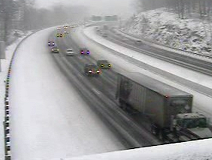
The strongest winds and heaviest snow will occur Friday evening into Saturday morning, the National Weather Service said. White-out conditions are expected to hit much of the area Friday night, making travel extremely dangerous.
Another big concern is flooding along the coast, especially for residents still cleaning up from Superstorm Sandy. A coastal flood watch will also be in effect Friday night through Saturday morning.
EMERGENCY DECLARED IN CONN.
Connecticut Gov. Dan Malloy issued a motor vehicle travel ban on limited access highways. The ban went into effect at 4 p.m. and will remain in effect until further notice, Malloy said.
"As the weather gets worse over the next few hours, we need to keep the roads clear so that emergency-related personnel and utility crews can reach those that may need our help," Malloy said in a statement. "By traveling in these conditions, you are not only putting yourself in danger, but you are potentially risking the lives of first responders, utility workers and other residents. Please be safe."
Malloy had earlier declared a state of emergency and deployed National Guard troops around the state to help with any rescues and other emergencies during a potentially historic winter storm.
For more information on how Connecticut is handling the storm, click here.
NEW YORK STATE
New York Gov. Andrew Cuomo activated the state's Emergency Operations Center at noon Friday to monitor the storm's impact and coordinate response efforts.
NYS To Activate Emergency Command Center
The governor said late Friday afternoon that the storm won't be nearly as bad as Superstorm Sandy, while adding his emergency declaration will allow the government more flexibility in dealing with the snow and ice.
"We've been through worse than what we're talking about. So it's all relative at the end of the day," Cuomo said.
STORM IMPACTS TRAVEL
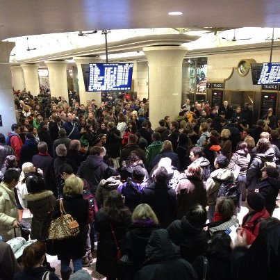
Transit officials took heed of the blizzard warning. Across the rail systems, officials took a variety of measures to keep the trains running as best they can.
MTA President Thomas Prendergast said subway service was running normally and that the agency had plenty of snow-fighting equipment to take care of the subways and commuter railroads.
"We expect to be able to get through the storm, but if you take care and travel early, it will be better for you," Prendergast said.
The MTA said it had no plans to shut down subway service but suburban schedules were affected, with several lines adding trains for the afternoon rush and reducing service Friday night.
For more information on how the storm is impacting the MTA, LIRR, NJ TRANSIT and more, click here.
UTILITIES
Power companies took every precaution to try to prevent widespread outages.
The embattled Long Island Power Authority turned over control to subcontractor National Grid for the first time in its history after facing criticism for its response during Sandy, when 90 percent of homes serviced by the utility lost power for days.
National Grid secured hundreds of extra crews and support personnel, saying the storm could result in a significant number of potentially prolonged electrical outages.
Con Edison crews said it would give priority to restoring service lines that will provide power to the most customers as quickly as possible. They'll then move on to restore smaller groups and individual customers who are without power.
In New Jersey, PSE&G is advising customers to have emergency supplies, including flashlights and batteries, on hand.
For more detailed information on how area utilities are responding to the storm, click here.
NEW JERSEY
New Jersey Gov. Chris Christie said officials were prepared for outages, flooding and anything else the winter storm may bring.
Christie said that the state's emergency operation center was activated Friday morning and that transportation agencies were fully mobilized.
A blizzard warning remains in effect for Hudson, eastern Bergen, eastern Essex and eastern Union counties. Forecasters said as much as 14 inches of snow are possible.
"This is a complex storm," Christie said Friday. "Just generally be smart and be careful and if you can be off the roads, that would be more helpful."
A winter storm warning for up to 10 inches covers the central and northern Jersey regions; 2 to 5 inches is possible in south Jersey.
The coast could see wave heights of 12 feet and moderate flooding.
NEW YORK CITY
"Stay off the city streets. Stay out of your cars. Stay in your homes when the worst of the storm is upon us," Mayor Michael Bloomberg said. "Cook a meal, stay home, read a good book, watch a movie, just take it easy."
Bloomberg urged New Yorkers to "use 911 wisely," only for actual emergencies during the storm. New Yorkers are urged to call 311 to report downed trees, blocked driveways, and other on-life threatening situations. Downed power lines that are not sparking should be reported via 311.
The Department of Sanitation has declared a snow alert and crews are on standby to work around the clock using 365 plows and spreaders to clear out 6,300 miles of city streets.
For more detailed information about how New York City is responding to the storm, click here.