Heavy Rains, Flooding Soak Parts Of Tri-State
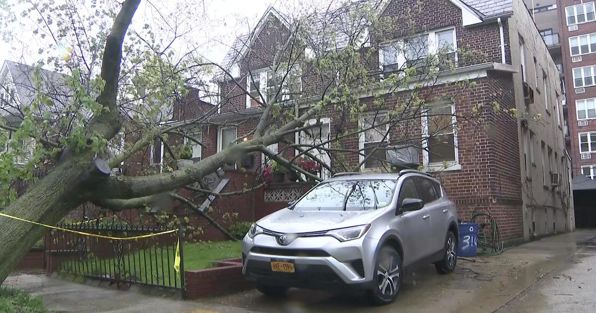
NEW YORK (CBSNewYork) -- Just days after remnants from Tropical Storm Andrea soaked the Tri-State Area, more storms brought heavy rain to much of the region.
A tornado watch was in effect for much of the day in southern New Jersey, along with southeast Pennsylvania and much of Maryland as the storm system moved its way north. The watch expired at 10 p.m. Monday, but tornado warnings were issued in parts of Maryland and there were reports that a tornado touched down in Woodbine, Md.
A tornado watch indicates several tornadoes are likely, along with damaging wind gusts up to 70 mph.
A flood watch was also in effect until Tuesday morning for southern Connecticut, northeast New Jersey and parts of New York, including New York City, Westchester, Suffolk, Nassau and Rockland counties.
Impressive rainfall totals were seen across the area. CBS 2's Lonnie Quinn reported Sea Girt, N.J., and Hampton Bays on Long Island each saw 2.95 inches of rain; Patchogue saw 2.28 inches; Hillsborough, N.J., 1.6 inches; and Central Park 1.2 inches.
Considering the heavy rain Friday that fell on Friday, the ground is saturated, Quinn reported.
CHECK: Radar | Forecast & Alerts | Traffic & Transit
The worst of the rain was expected to move out of the area by 5 a.m. Tuesday, though a second batch of lighter rain was possible for the morning commute, Quinn reported.
Spotty storm systems were nipping away at the southern tip of Manhattan on Monday night and moving off to the northeast. Yet another band of storms was also expected to move north from Delaware, where another tornado warning was in effect Monday night.
Stronger storms could also hit the region by late afternoon Tuesday, Quinn reported.
ON TRACK FOR WETTEST JUNE EVER?
Just 10 days into the month, this is already the ninth-wettest June in New York City history, Quinn reported. Already, more than 7 inches of rain has fallen in Central Park this month. The average for the entire month of June is about 4.4 inches, Quinn said.
Just 3.1 more inches of rain this month would bump 2013 to the rainiest June in history, Quinn added.
FLOODING CREATES HEADACHE FOR N.J. DRIVERS
The Garden State Parkway was closed in both directions around noon Monday near Brick and Wall Township due to flooding.
In Neptune in Monmouth County, N.J., many roads flooded earlier in the day because the storm drains were still overwhelmed from last week's flash flooding.
As CBS 2's Amy Dardashtian reported, traffic backed up for miles on the Garden State Parkway. Cars crawled just a few inches in an hour after flooding shut down parts of the Parkway north of Exit 90.
"Once you got up around 82, it starts backing up again and I understand it's even worse further up," driver Stewart Gladstone of Brick told Dardashtian.
Fed up drivers who were able to exit the Parkway spilled onto side roads clogging major routes like County Road 549 in Brick.
"There was nowhere to go. Just bumper to bumper traffic, horrible," driver Pete Faruolo told Dardashtian.
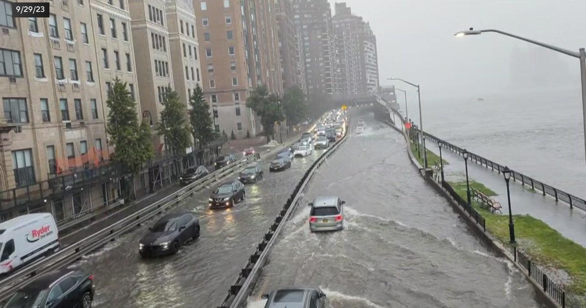
On residential side streets in Lakewood, cars trudged through waves of water.
"The water, it's like a lake in the middle of the road. You can't get by it. It's like four inches of water it looks like," Jackson resident Mark Llewellyn told Dardashtian.
Flood waters became road blocks. A wave of water trapped delivery man Peter Digiovanni's car. He told Dardashtian he has no insurance.
"You struggle to make ends meet and just when you get a little ahead something throws you back. I can't afford to lose my car," he said.
The heavy rain may cause flooding on local roads and highways as well as low-lying and poor-drainage areas.
The National Weather Service advised those living in flood-prone areas to be prepared to take action should flooding develop.
LONG ISLAND COPES WITH ANOTHER RAIN-SOAKED COMMUTE
As CBS 2's Jennifer McLogan reported, even with intermittent rain, flash flooding was a concern in Suffolk County. Low-lying areas were already dealing with flooding.
Reporting from the side of the Long Island Expressway in Melville, McLogan said traffic was moving at a snail's pace all day Monday.
Numerous weather-related accidents were reported on the L.I.E. as authorities were urging motorists to slow down.
"We're tired of this rain, too much rain! I think we're flooded out by now," Medford resident Carmello Palumbo told McLogan.
He and other weary drivers pulled off the L.I.E. and into an Islip shopping center to take refuge from the slick roads Monday afternoon.
"The rain's horrendous. It makes driving conditions horrible. It's hard to get home, it's depressing, people are just aggravated," Joseph Borja told McLogan.
Warnings flashed along the Wantagh Parkway as heavy rain fell on and off during the day.
For a time, Hempstead Turnpike in Nassau was barely navigable in spots, McLogan reported.
In Lindenhurst, there were worries of sudden flash flooding as some neighborhood streets turned treacherous.
This is the second recent commute complicated by rain. On Friday, the remnants of what was Andrea created dangerous flooding across Long Island.
"Last Friday, you guys saw the torrential rains we had and the weather men were pretty accurate with that," Melville commuter Joseph Ferrara told McLogan. "It just took us about an hour to get back from Manhattan doing 15, 20 mph all the way from the Midtown Tunnel."
WET WEATHER STILL CAUSING AIRPORT DELAYS
As of 11 p.m., John F. Kennedy International Airport was seeing delays of up to 1 hour and 15 minutes for departures due to low visibility.
Taxi delays of up to 30 minutes were also seen at Newark Liberty International Airport.
It is recommended you check with your airline before heading to the airport for the most accurate delay information.
Check Out These Other Stories From CBSNewYork.com:


