1/25: CBS2 Sunday Evening Weather Headlines
By Mark McIntyre Jr, CBS2 Meteorologist/Weather Producer
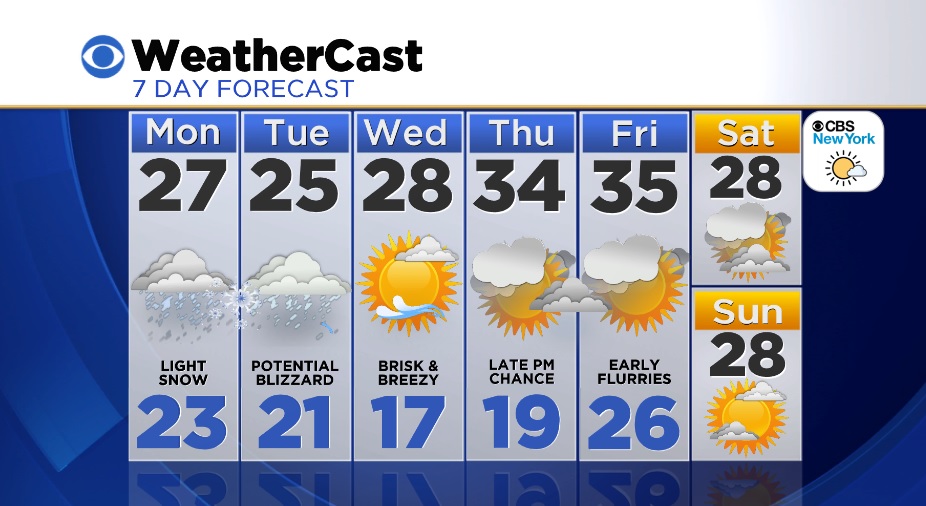
It appears our luck this winter is about to run out - in a big way. One more quiet evening ahead with increasing clouds and a few flurries after midnight as temps bottom out in the low 20s around town. Light snow expected Monday, perhaps 1-3", but this is an appetizer for the main course Monday night/Tuesday. If you need to go out and run any errands, do it tonight or tomorrow morning.
A storm will explode off the coast Monday PM. On the other side of midnight lasting through the day Tuesday is when the heaviest snow falls. Some folks in LI/CT may end up with close to 3 feet of snow - yes, 3 FEET. Closer to the city, perhaps closer to 16-20". Again, we'll have to fine tune the exact amounts as the storm is going on. It's going to be a tremendous storm any way ya slice it.
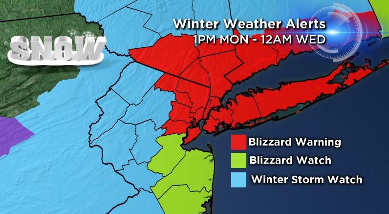
Winds will be another major concern, with 35-40 mph sustained winds out of the northeast and gusts of 55-65 mph (especially LI) during the height of the storm. Whiteout conditions, power outages, and impossible driving conditions are guaranteed. The winds could also cause moderate coastal flooding during the high tide cycle early Tuesday morning as well as beach erosion. Wednesday we're dry and sunny, but we have a brutal breeze. Temps peak in the mid/upper 20s, feeling like teens. Thursday starts off with sunshine with clouds by PM as temps "warm up" to the low/mid 30s.
Stay tuned for the very latest on this major storm heading our way.