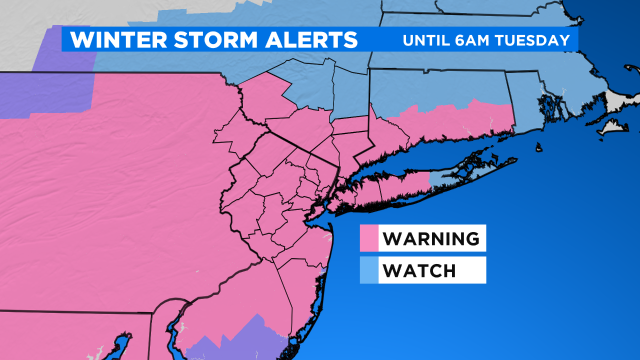
CBS2 Weather Headlines: Winter Storm Warning Takes Effect Later Today
By Matt DeLucia, CBS2 Meteorologist/Weather Producer
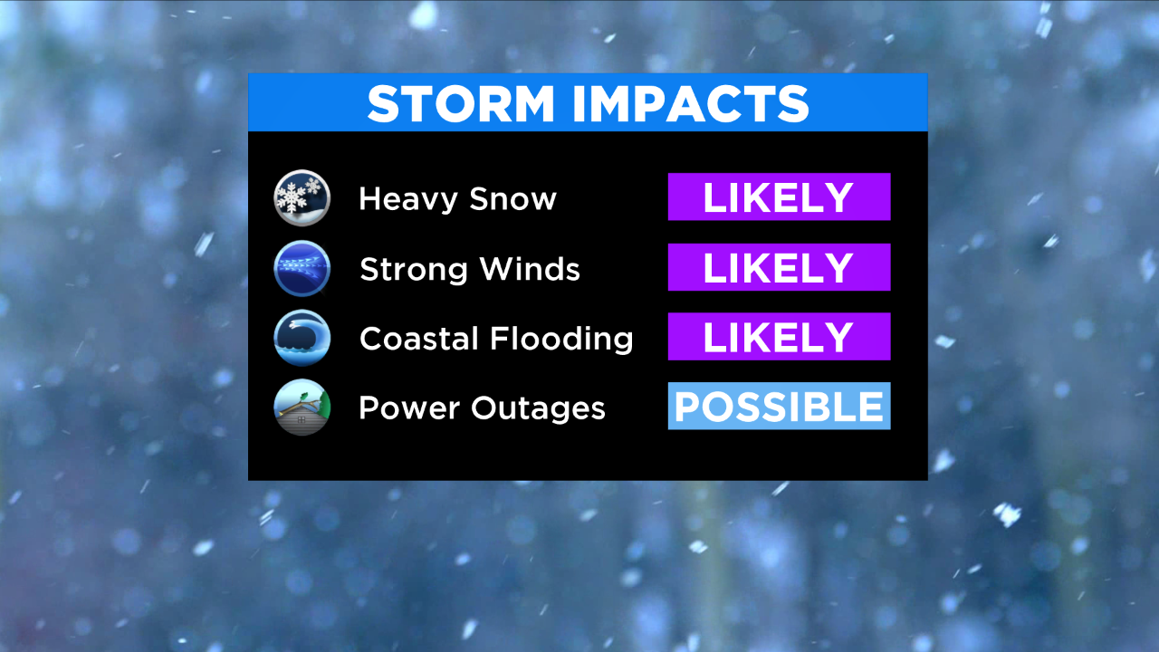
Ready for snow? Well ready or not, it's knocking on our door! A Winter Storm Warning will go into effect later today for most of the region.
Flakes will begin moving into the southwest suburbs this afternoon, gradually working northward. Some snow showers are possible in the city by sunset, but the steadiest holds off until later in the evening. Temps today are cold in the upper 20s.
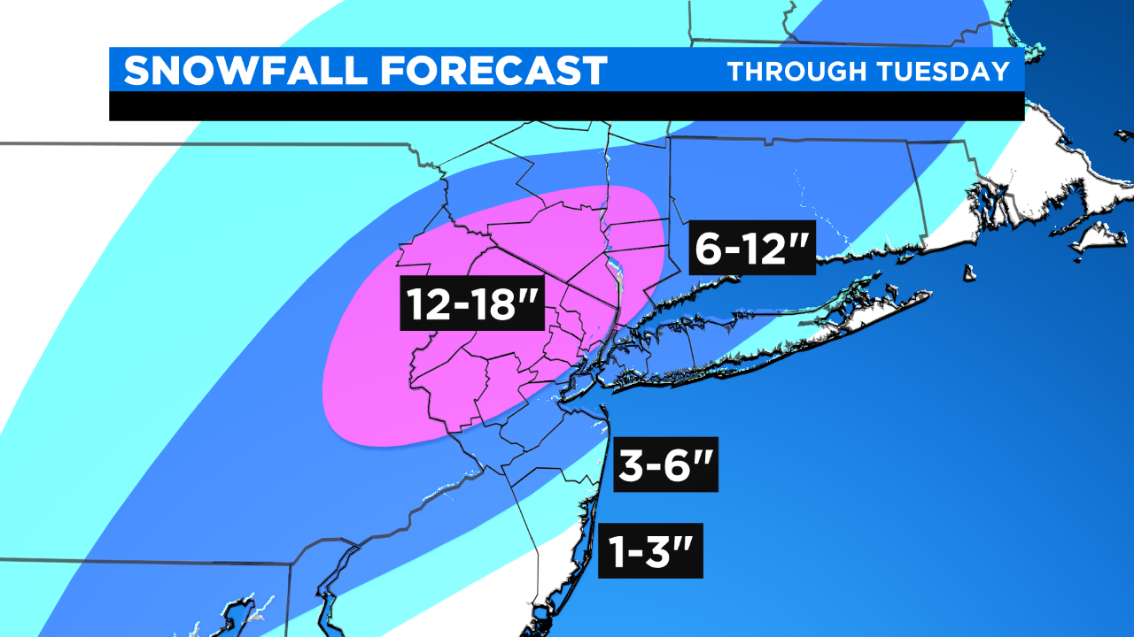
SNOW TIMELINE: 6" To 12" For Most Of Tri-State, 18" Possible Northwest Of NYC
Snow fills in overnight as our coastal storm takes shape. The brunt is still through the day on Monday with heavy snow rates of 1" to 2" per hour at times, especially in the afternoon and evening. We're watching the rain/snow line to the S&E, and there remains some uncertainty as to how far the milder air can penetrate.
The "jackpot" zone still appears to be just NW of the city, where 12" to 18" are possible by the time things wrap up on Tuesday. For now, NYC is right on the edge, likely around a foot or so. Closer to the coast, totals are lower where rain becomes a factor.
Winds will be gusting tomorrow 40-45 mph in NYC to 50+ mph along the coasts. Near whiteout conditions are definitely possible at times and the roads are not where you want to be as things crank up Monday... Stay home if you can!
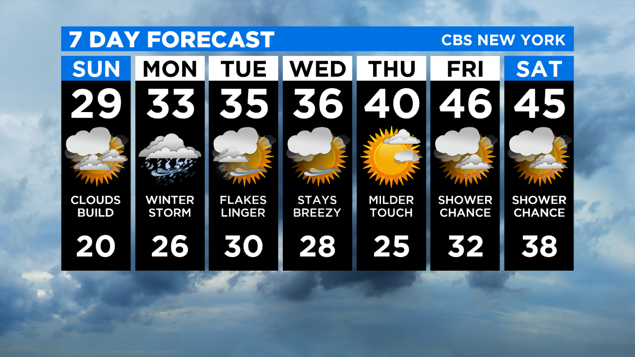
Snow showers gradually taper off through the day on Tuesday as our nor'easter pulls away. We'll be making tweaks as more data comes in, so be sure to check back for the latest. Stay safe!
MORE FROM CBS NEW YORK: