New York Weather: CBS2's 2/5 Friday Afternoon Forecast
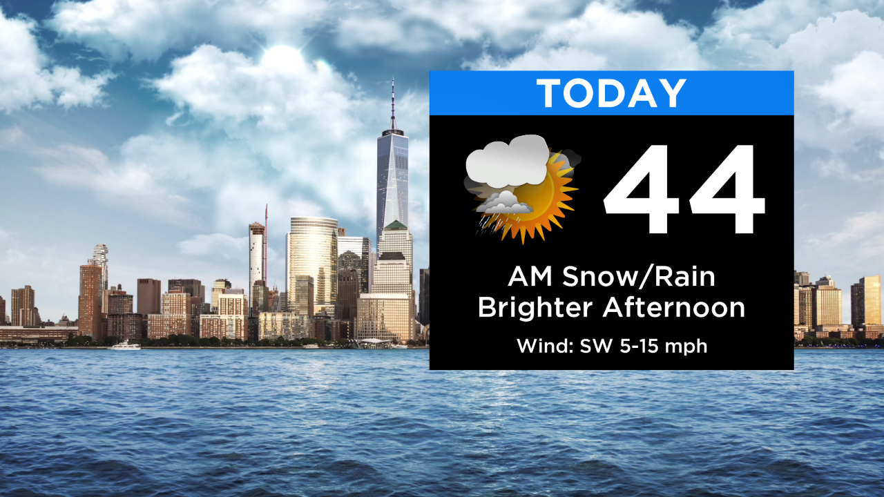
Rain/showers move through this morning with a mix of snow/rain N&W; snow accumulations will generally be a trace to 1+" N&W. Things should wrap up around midday with highs above normal in the low to mid 40s.
Tonight shapes up with partly cloudy to mostly clear skies. Temps will fall into the 30s and 20s.
Tomorrow looks good with mostly sunny to partly cloudy skies. Expect highs in the low 40s.
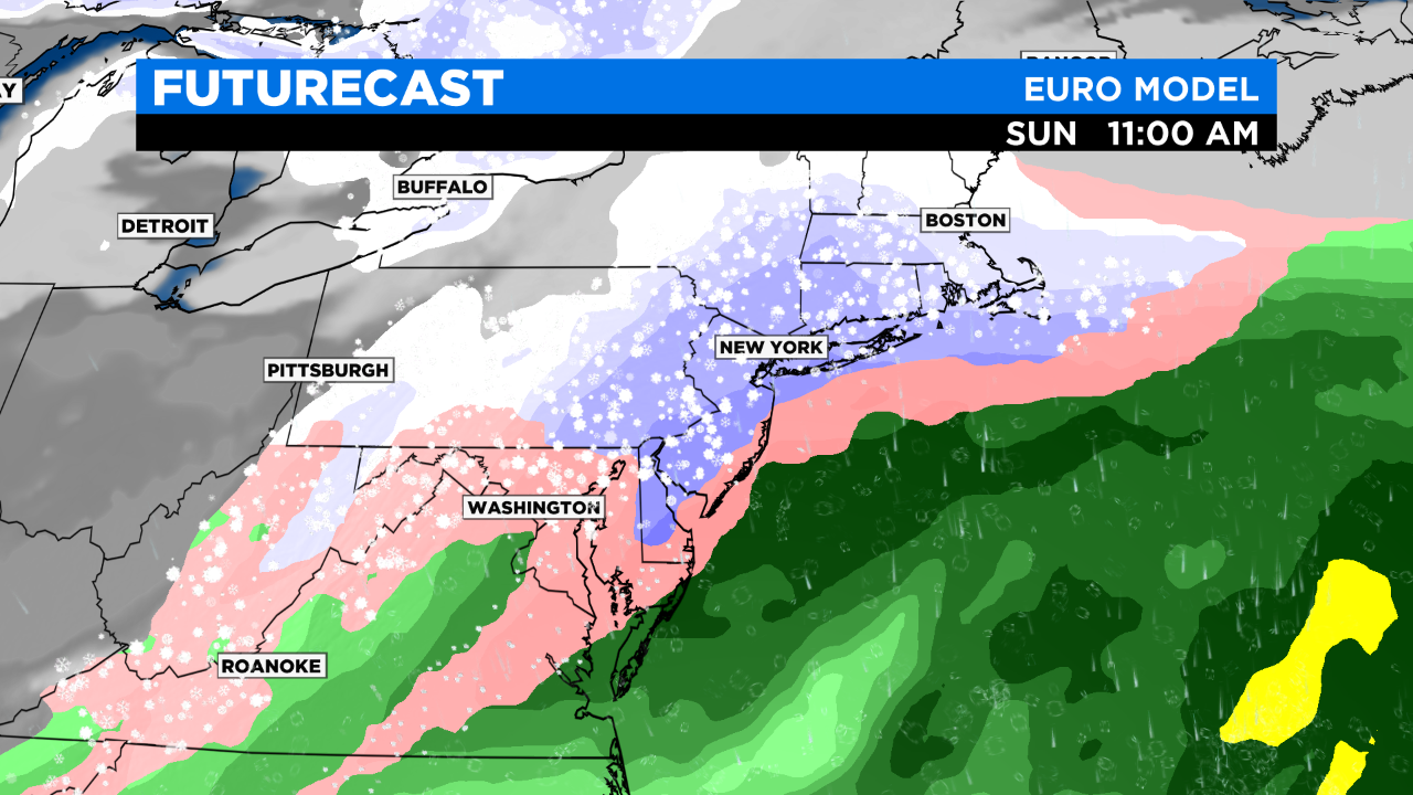
Some bad news and good news regarding Sunday. The bad news is the models have flipped again and show a better chance of snow (mixing along the coast?) around the area. The good news is, as of now, there's widespread agreement that it's a fast mover: starts Sunday morning and ends midday/early afternoon. Also, there's decent agreement that the storm doesn't come quite as close as the European model was projecting a few days ago. This would help to keep the winds and snow totals down.
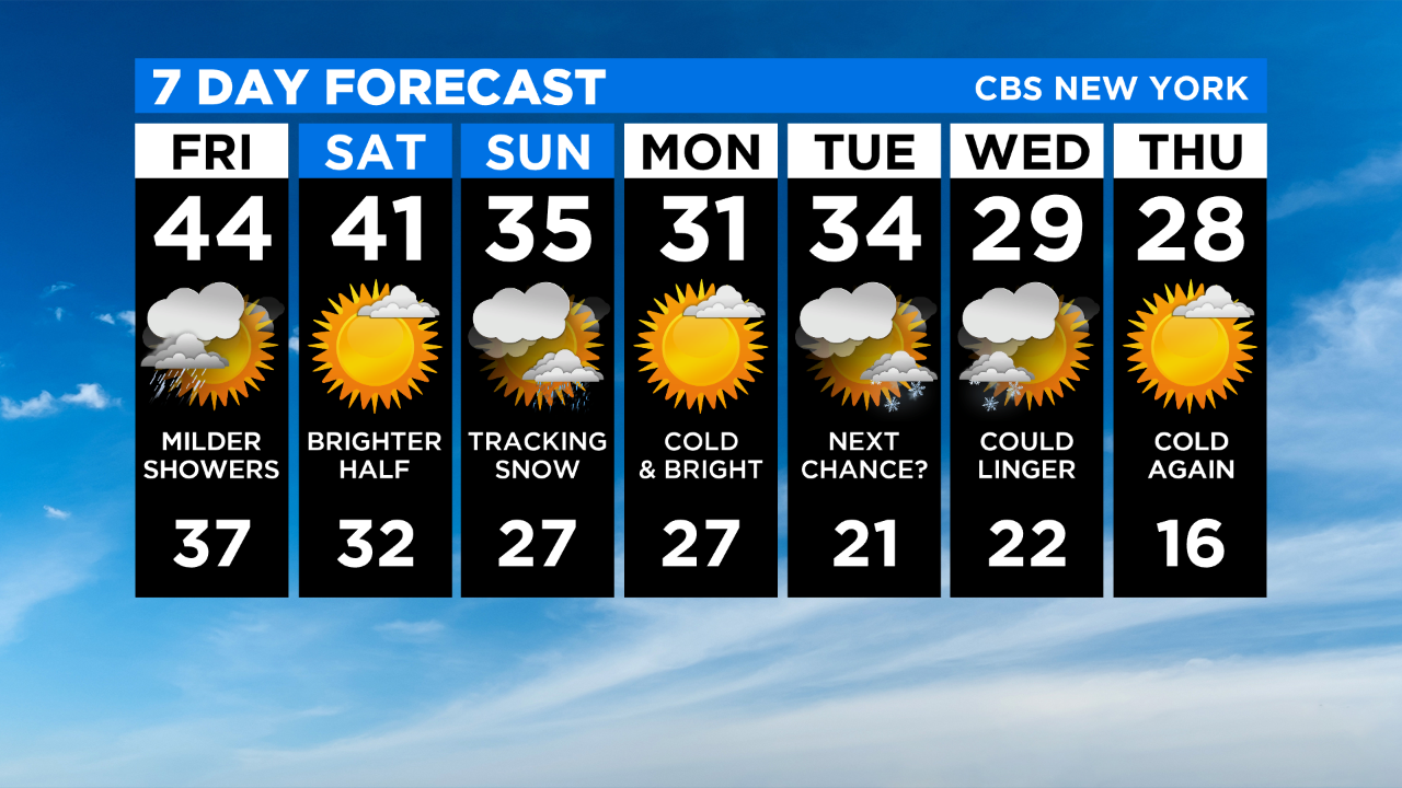
More to come over the weekend on our potential snowmaker...