New York Weather: Another Complex System Expected To Bring Snow Back Into Tri-State Area Starting Thursday Morning
By Giorgio Panetta, CBS2 Chief Meteorologist/Weather Producer
Winter Storm Watches were posted Tuesday afternoon in anticipation for our next storm. We are looking at yet another complex system passing offshore in just the right spot to spill snow back into the Tri-State Area.
We will be fighting a rain and snow line, as well as dry slotting this time, but the latest runs are keeping it south, so much of the area sees plowable snow.
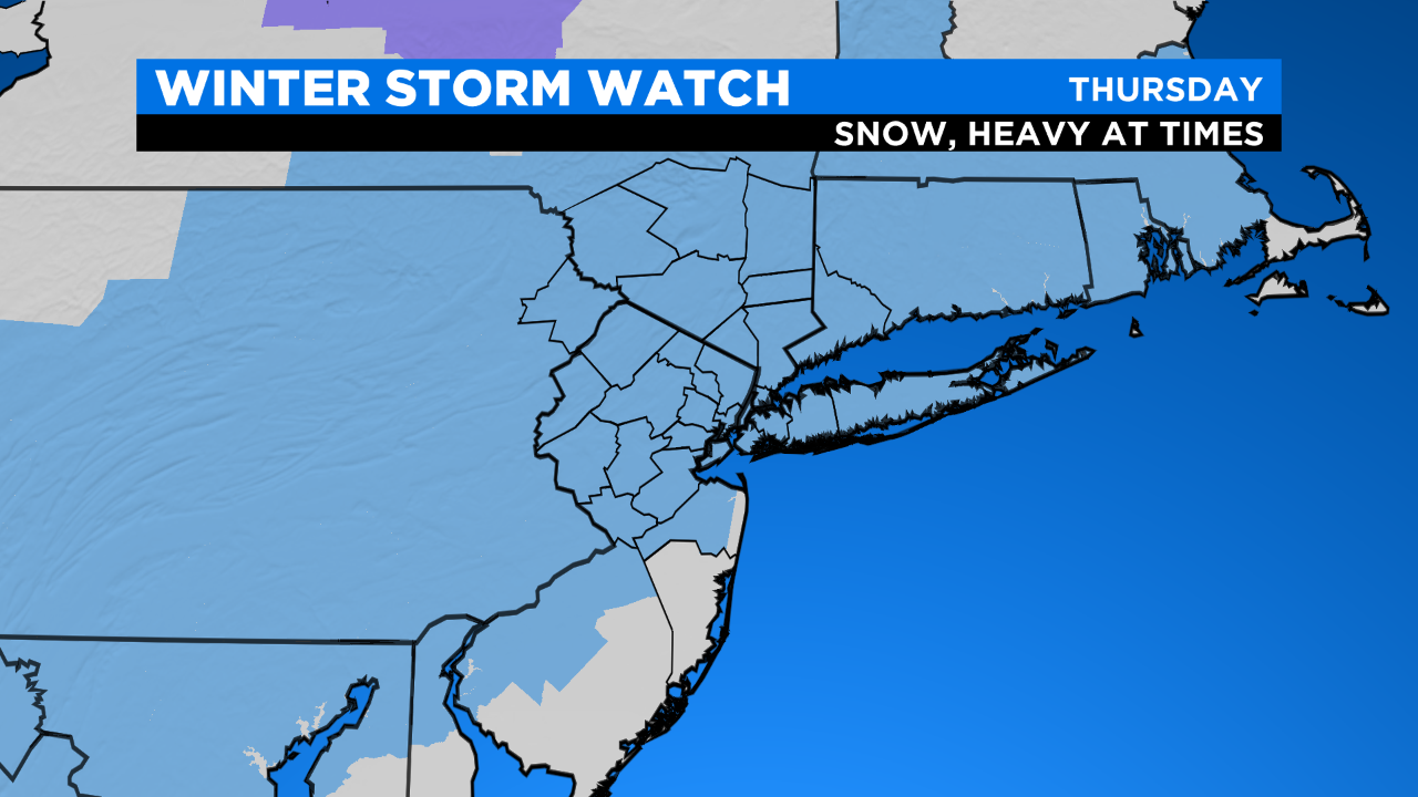
When? Starting Thursday morning, snow noses in from the southwest. It overtakes the area by the mid-morning and a good thump of snow will start to fall. Overnight, some mixing and rain will push it, but the damage is done, and it doesn't look like the rain will be washing away the totals with this track.
The storm will now last longer on Friday, with the bulk of heavier snow falling Thursday afternoon.
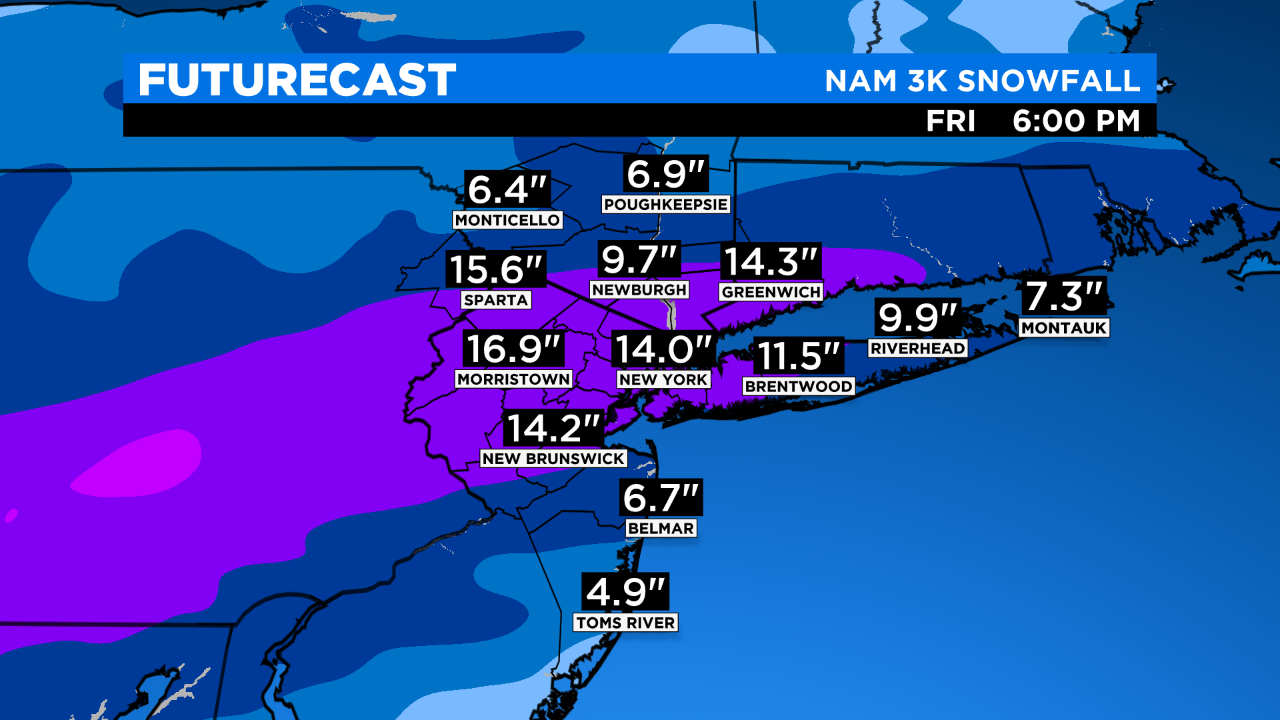
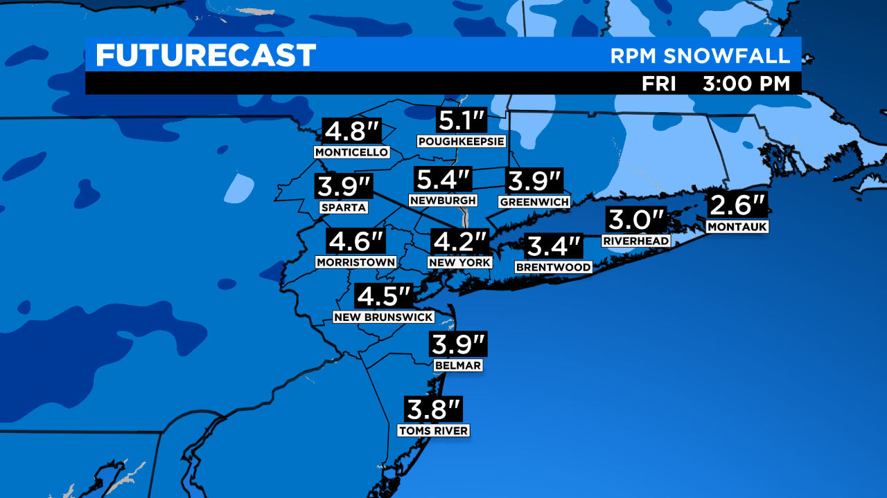
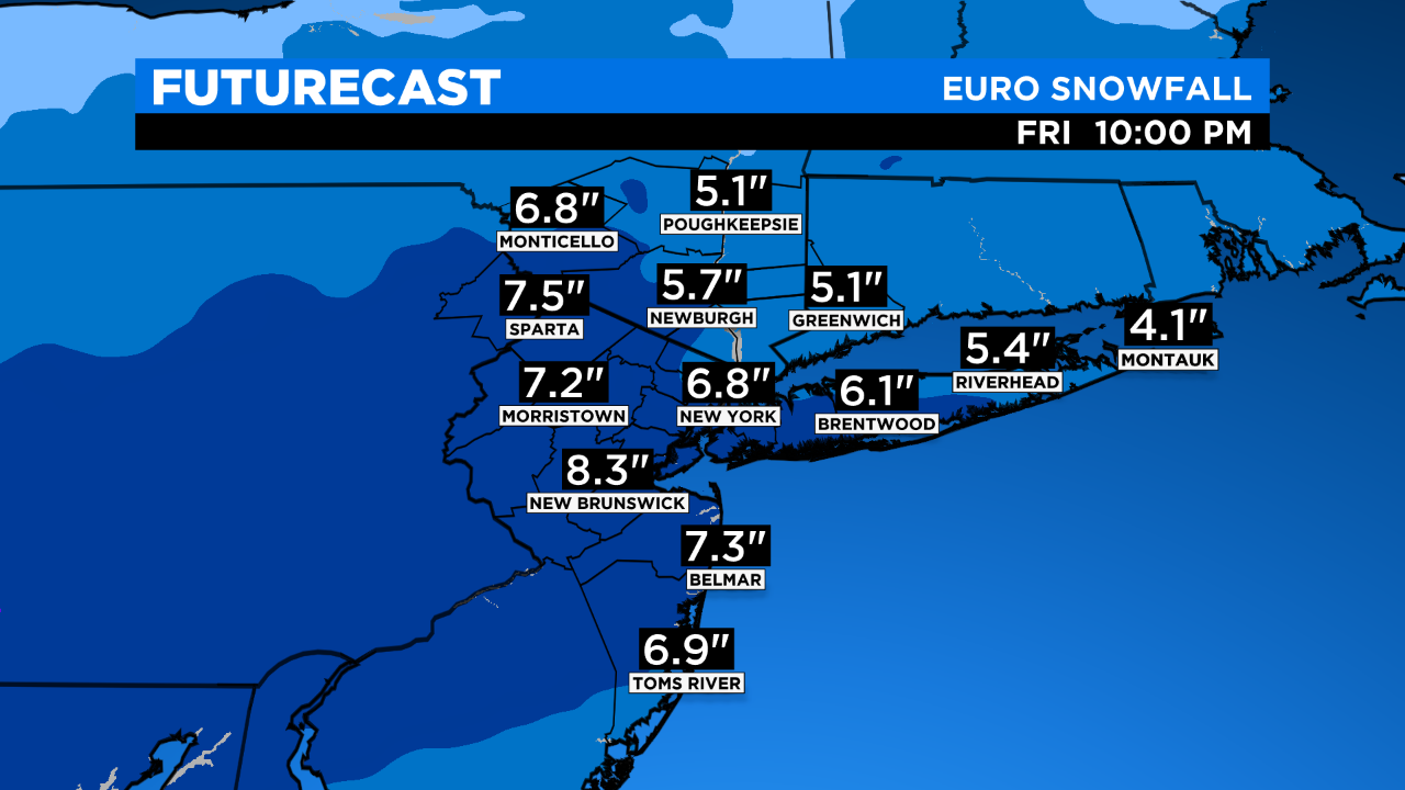
Intensity? Our biggest unknown. The NAM is forecasting a foot plus for much of northwest New Jersey and including New York City, but a sharp cutoff of 5 inches or less down the New Jersey shore. Not ruling it out, especially since they've been great this year, but we need a little more agreement before we bump our numbers up to a foot, but we're not far off!
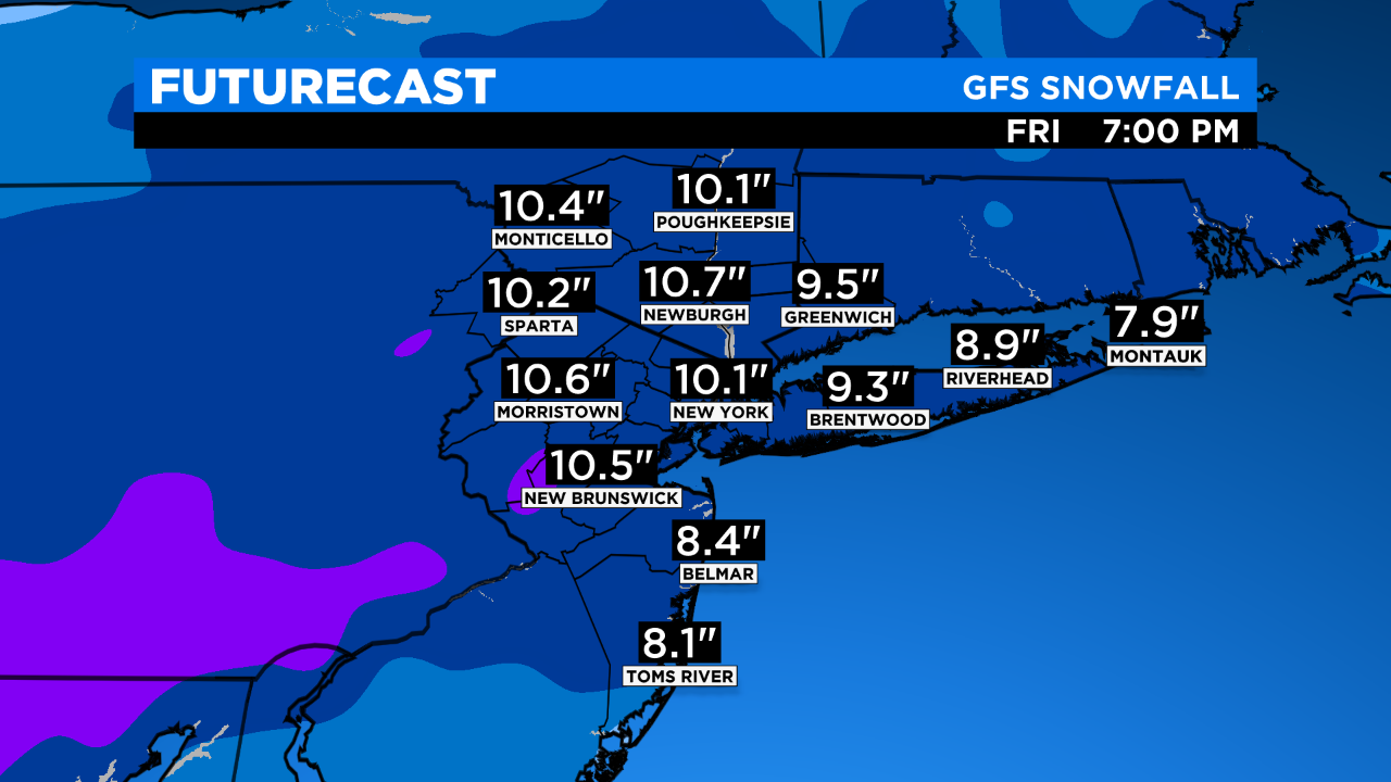
Otherwise, a widespread 4-8 inches plus is forecast most of the area, and that's a plowable storm that will slow things down.
Wind & Coastal Effects? Minor.
Stay tuned for the latest on our very active season!
MORE FROM CBS NEW YORK