Tracking Henri: Timeline Of Storm Bringing First Hurricane Watch To Our Area Since 2011
NEW YORK (CBSNewYork) - For the first time in 10 years, we have a hurricane watch up for parts of Long Island.
The last time one was issued in our area? August 2011, for Irene.
What about Sandy, in 2012? Back then, tropical advisories weren't issued for post-tropical systems, which Sandy was by the time it reached our waters. That has since changed.
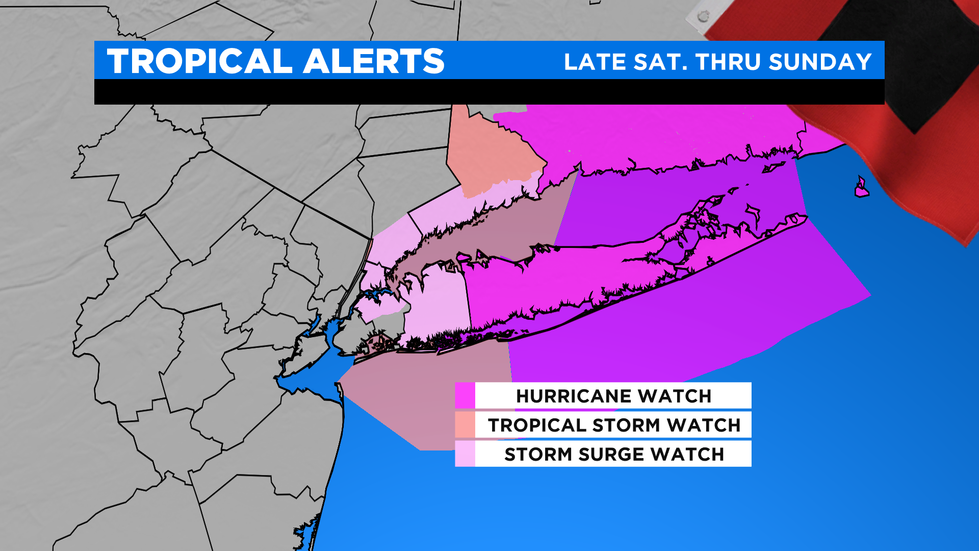
As of midday Friday in the Tri-State Area, a hurricane watch is in effect for Suffolk County. A tropical storm watch is in effect for Nassau, as well as coastal Westchester and coastal Fairfield. This means that tropical storm or hurricane conditions are possible in these areas within 48 hours.
There's still much uncertainty on the exact track of Henri, which will ultimately determine any impacts.
In addition, a storm surge watch is in effect for the same locations, plus parts of the Bronx and Queens. Again, a watch means these conditions are possible, not guaranteed.
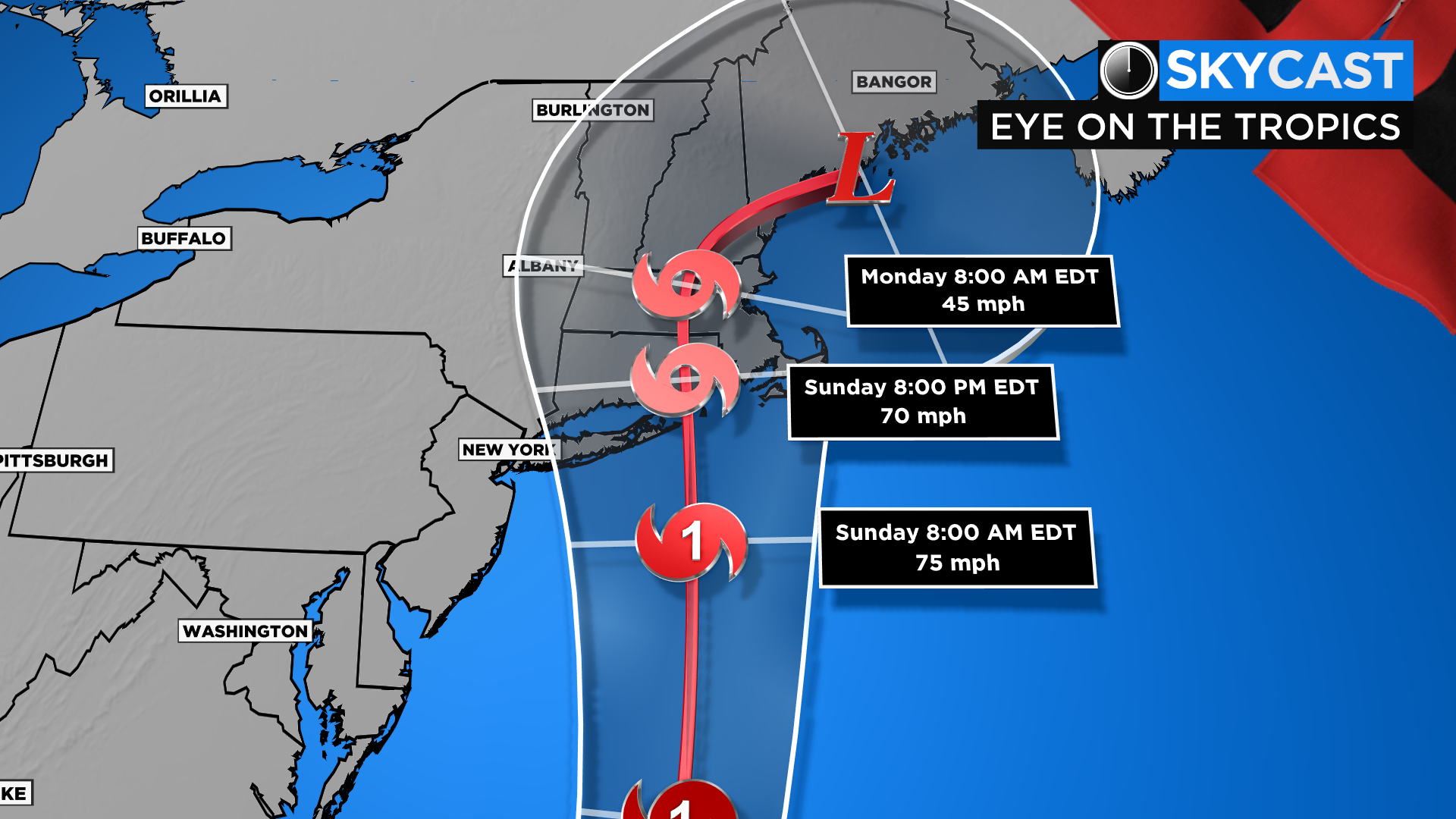
Friday afternoon, Henri is currently maintaining tropical storm status about 345 miles SSE of Cape Hatteras, NC and 745 miles south of Montauk, well off the southeast coast. It's moving to the NW at 7 mph and is expected to turn more northerly later Friday, accelerating toward our area Saturday. Any impacts in our area, especially for Long Island, would be on Sunday into early Monday. That's the timeframe to keep a close eye on.
As far as the track, most of the model guidance trended westward overnight. Why the shift? The hurricane hunters are now flying recon missions into Henri, feeding more data into the models. Unlike a couple days ago, the chance of Henri remaining completely offshore now appears to be extremely low. Anywhere from Long Island into New England faces the risk of a tropical landfall Sunday into Monday.
New York City needs to watch closely as any wiggle farther west would mean bigger impacts - more rain and strong winds - into the city, and even northeastern New Jersey. The next 24 hours or so will bring a much better picture.
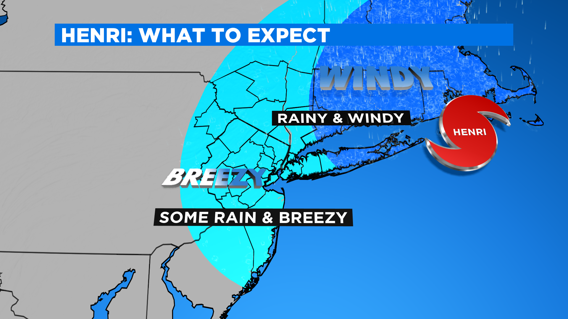
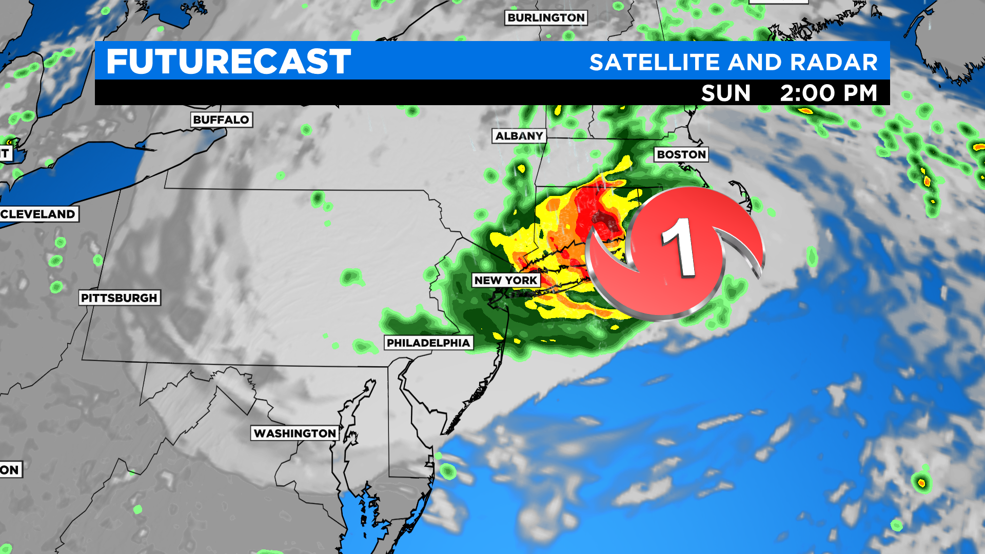
For timing and what you can expect, you'll want to stay tuned Friday and Saturday as things become clearer. For now, expect deteriorating conditions mid-morning Sunday that continues through Sunday evening for Long Island. This is where the heaviest rain bands and strongest wind gusts - 60+ mph - are possible, as well as the highest risk of power outages.
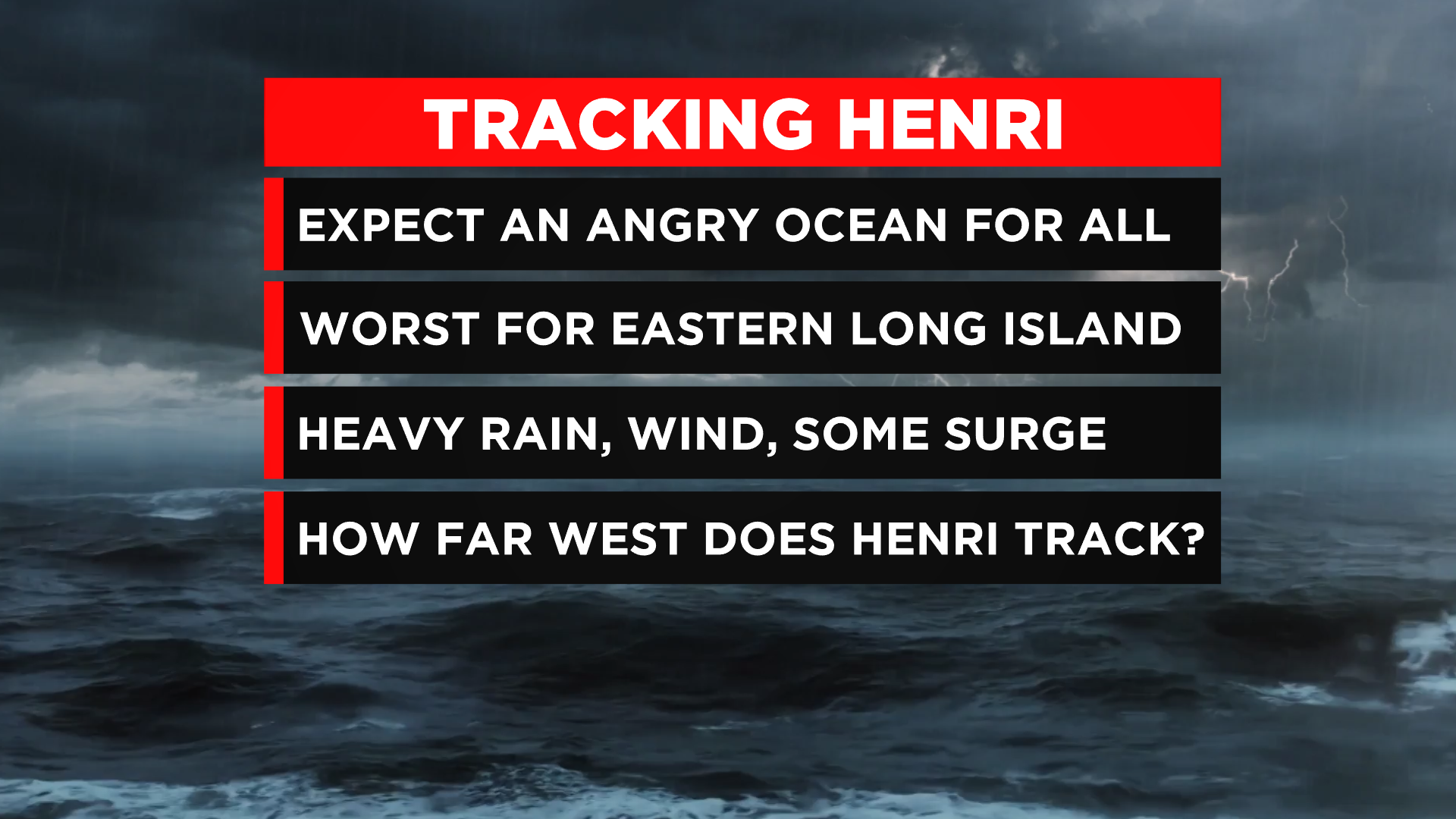
Closer to the city, expect some rain and breezy conditions. Again, this is all dependent on the exact track Henri takes. The farther west it goes, the farther west the main impacts come. If it stays farther east, the biggest impacts would be Suffolk County. We can't go into much more detail until we nail that down over the next 24 hours. For everyone, expect a very angry ocean!
CLICK HERE to get the latest forecast.
CBS2 meteorologist/weather producer Matthew DeLucia contributed to this report.