Henri's Impact Lingers: CBS2's 8/23 Monday Afternoon Forecast
By Matt DeLucia, CBS2 Meteorologist/Weather Producer
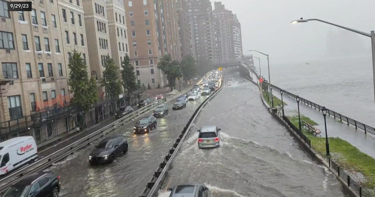
Now Tropical Depression Henri is sitting about 60 miles north of NYC and continues to weaken. After stalling overnight, it gradually moves off to the northeast through the day, eventually taking what's left of the rain with it. As the biggest impacts are now behind us, today will be a transition day as we deal with lingering wrap-around showers and residual flooding in spots.
Unlike the widespread heavy rain yesterday, today will be more scattered, especially heading into the afternoon. It'll be on/off showers moving through at any time and since we're still in this tropical airmass, heavy downpours remain possible. The good news these will be moving and not sitting over the same areas for hours at a time. As we get some daytime heating, a few scattered thunderstorms may develop as well.
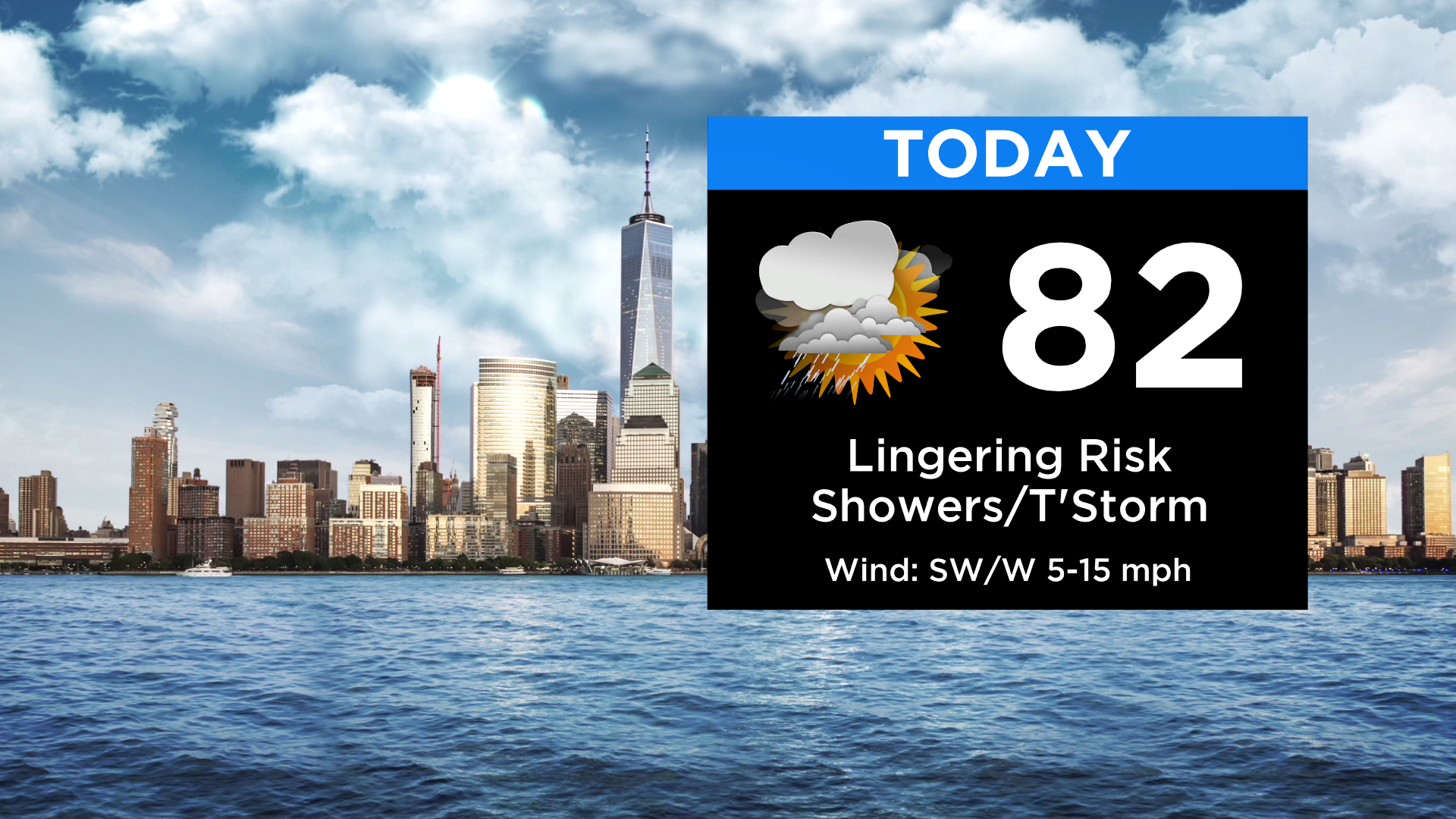
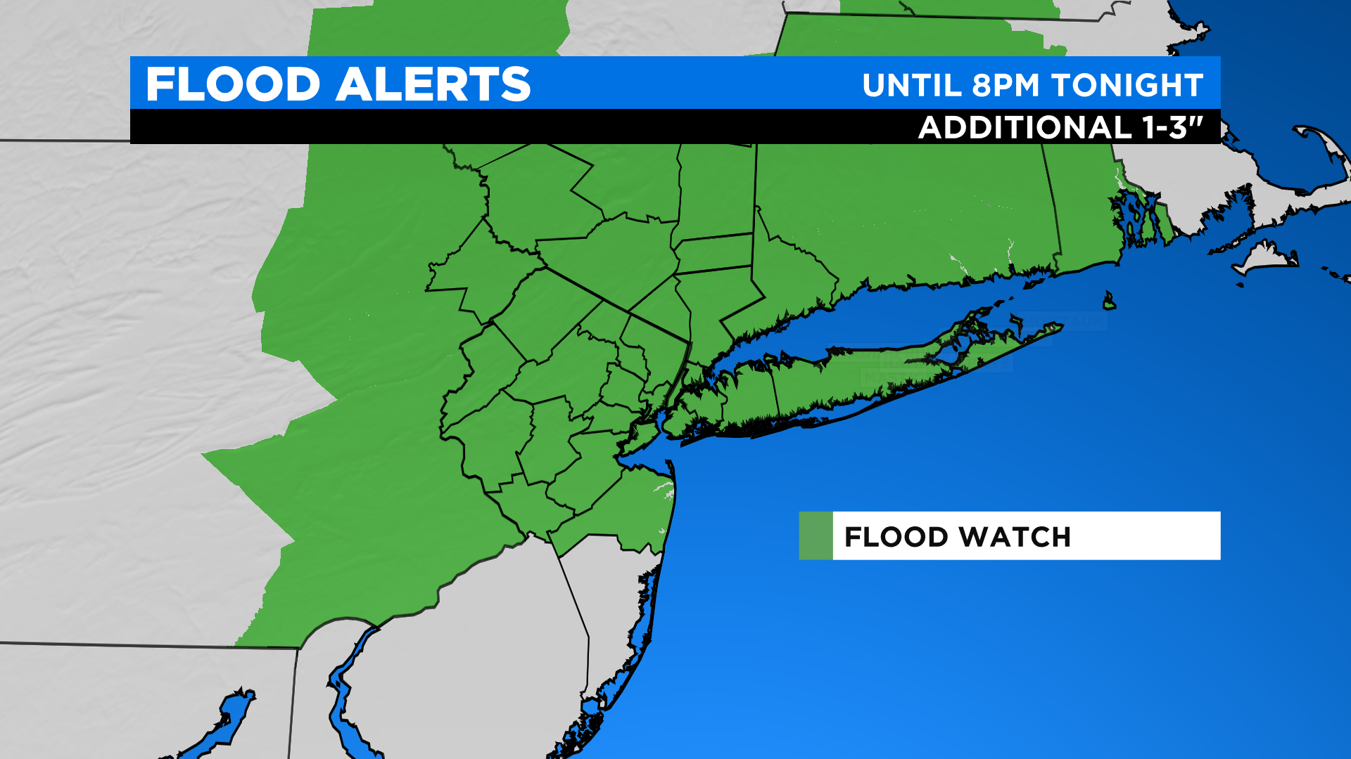
A Flash Flood Watch remains in effect until 8pm tonight. Even though there won't be extended periods of heavy rain today, the ground and streams just can't take anymore! In between any showers, it'll be mostly cloudy and muggy today with highs in the low 80s. There will even be some late breaks of sun, especially to the south and west.
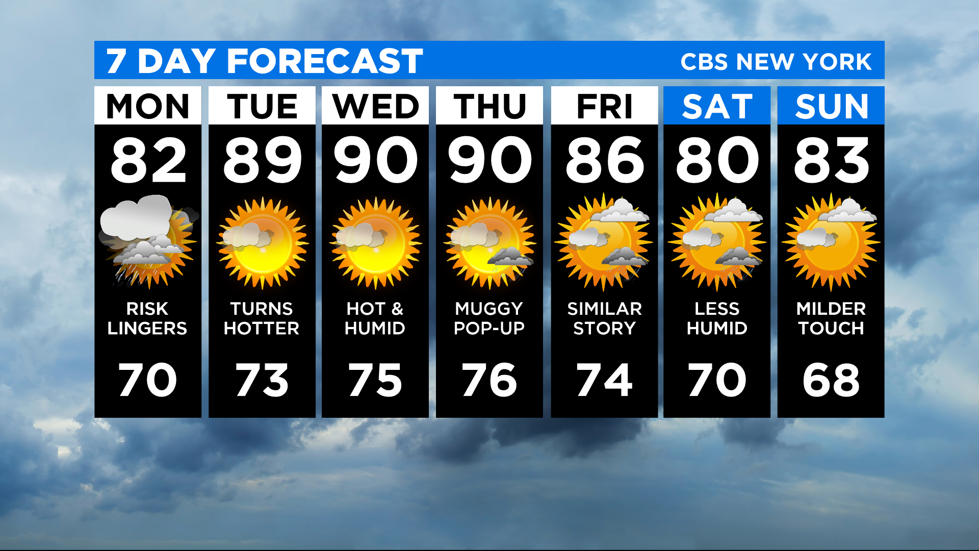
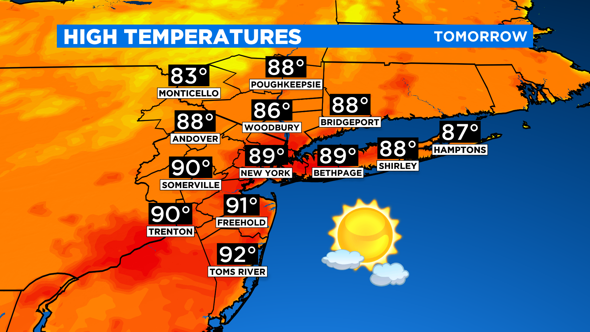
Any lingering shower activity will end heading into the evening and skies finally clear out overnight. Lows will be in the 60s and low 70s. It's the return of summer heat starting tomorrow as we finally enjoy some dry days. Temps will approach 90, feeling like the mid 90s. We'll be flirting with a heat wave through Thursday.