Tracking Ida: Heavy Rain, Severe Weather Arrive In Tri-State Area Wednesday
By Giorgio Panetta, CBS2 Chief Meteorologist/Weather Producer
Tropical Depression Ida will make for a very rough Wednesday afternoon and early Thursday morning.
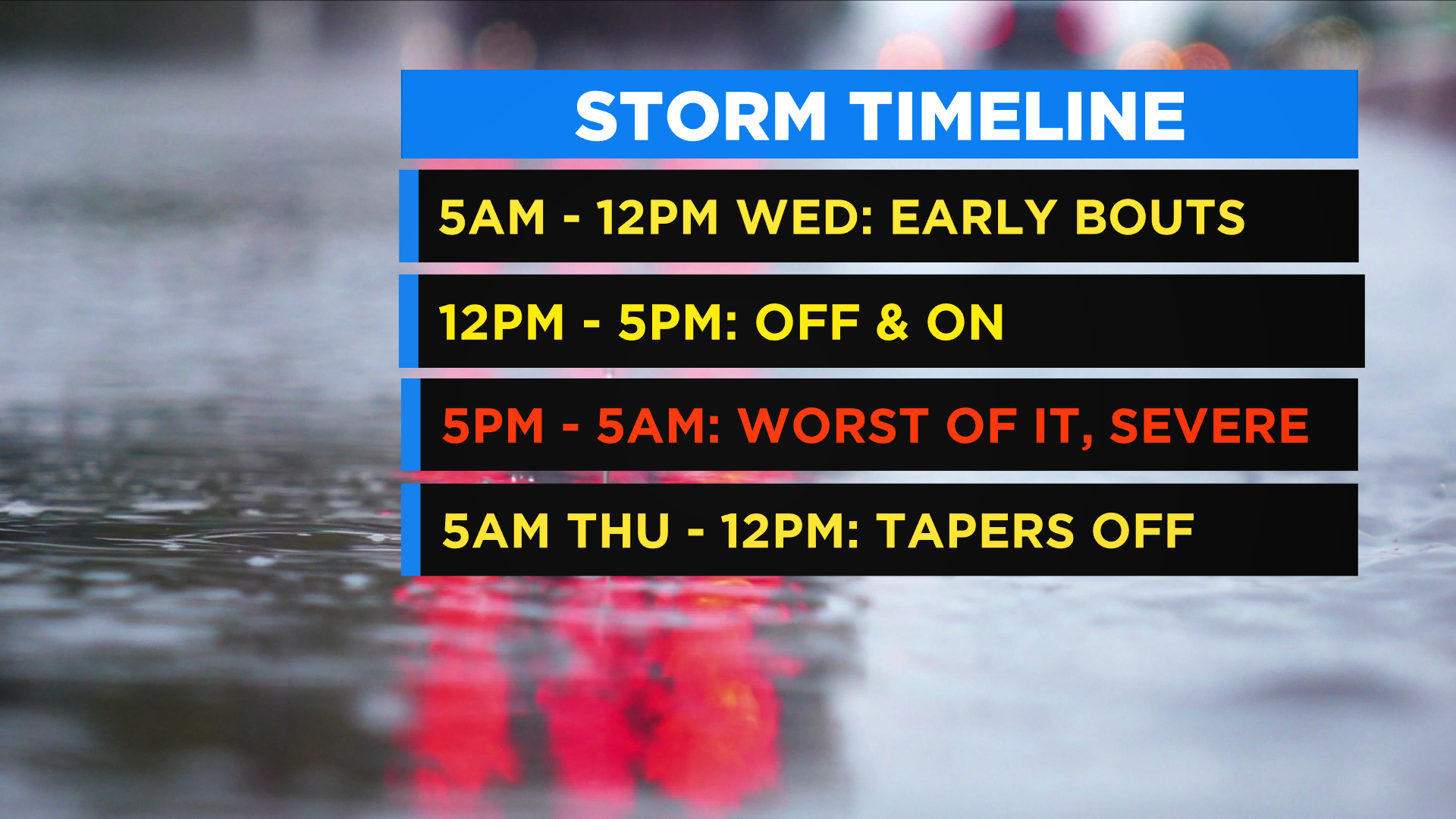
This storm should not be taken lightly. A handful of atmospheric phenomena are aiding this storm's power. We will get heavy bouts of rain for several hours starting after 5 p.m. Wednesday and continuing until about 5 a.m. Thursday with the heaviest and steadiest rain likely in Northern New Jersey.
Wednesday's morning commute will have some showers. Many are still dry, and the wetter weather looks to solidify north of NYC, in the lower Hudson Valley.
During the daytime, expect a dry period with some showers coming in waves. It's not a washout until the real heavy rain arrives as Ida moves in and taps into the moisture feed of the Atlantic Ocean. The storm is taking a track a little closer to shore, allowing for a risk of severe weather.
After 5 p.m., the storm ramps up and will be drenching the area in heavy waves of rain.
From 8 p.m. - 1 a.m. Thursday, heavy rain pounds the area, with the steadiest and heaviest rain passing over NYC.
The heaviest waves push east after 2 a.m. Thursday and pound Long Island overnight into the early morning.
Good news -- by 10 a.m. Thursday, the storm rapidly exits, and sunshine could be peeking through in NYC. Tranquil and fall-like weather follows.
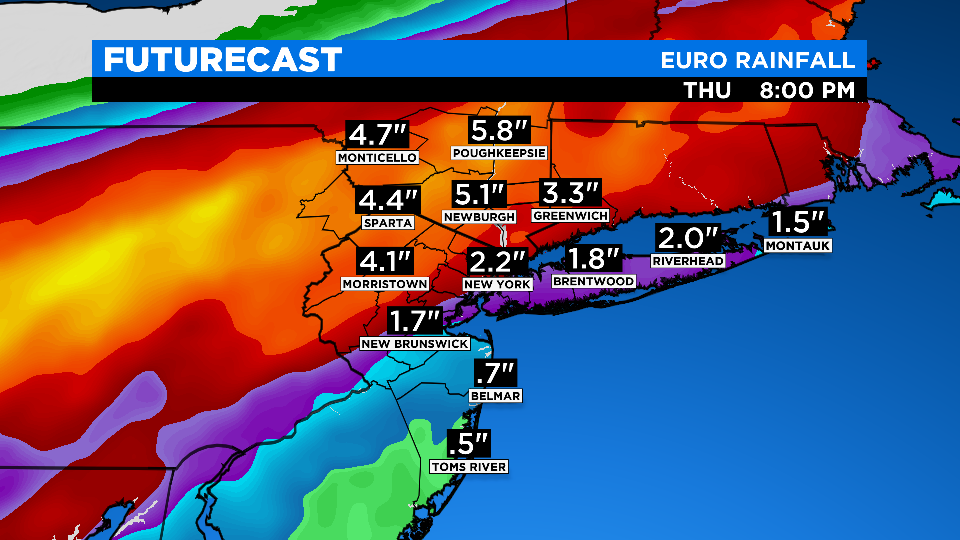
The models agree for heavy rain just north and west of NYC. We are expecting a widespread 2-5 inches with plenty of readings over 6 inches. Some models are indicating totals over 8 inches.
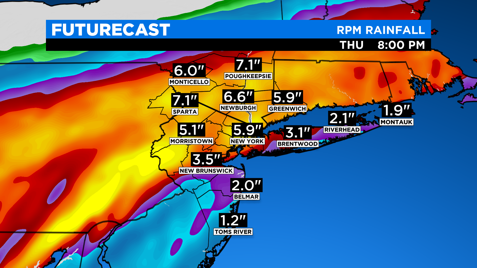
A Flash Flood Watch is in effective for the entire area. Flooding is a major concern. This is going to flood a lot of basements, especially in northern New Jersey. Many of the rivers are at action stage, meaning only a little rain will cause flooding. We are expecting over 3-5-inch rainfall totals in that area.
Severe weather is now also in play, mainly to the south. We cannot rule out a tornado Wednesday (again, more likely south of Monmouth County). The risk is extremely high just south of Philly over to Atlantic City.
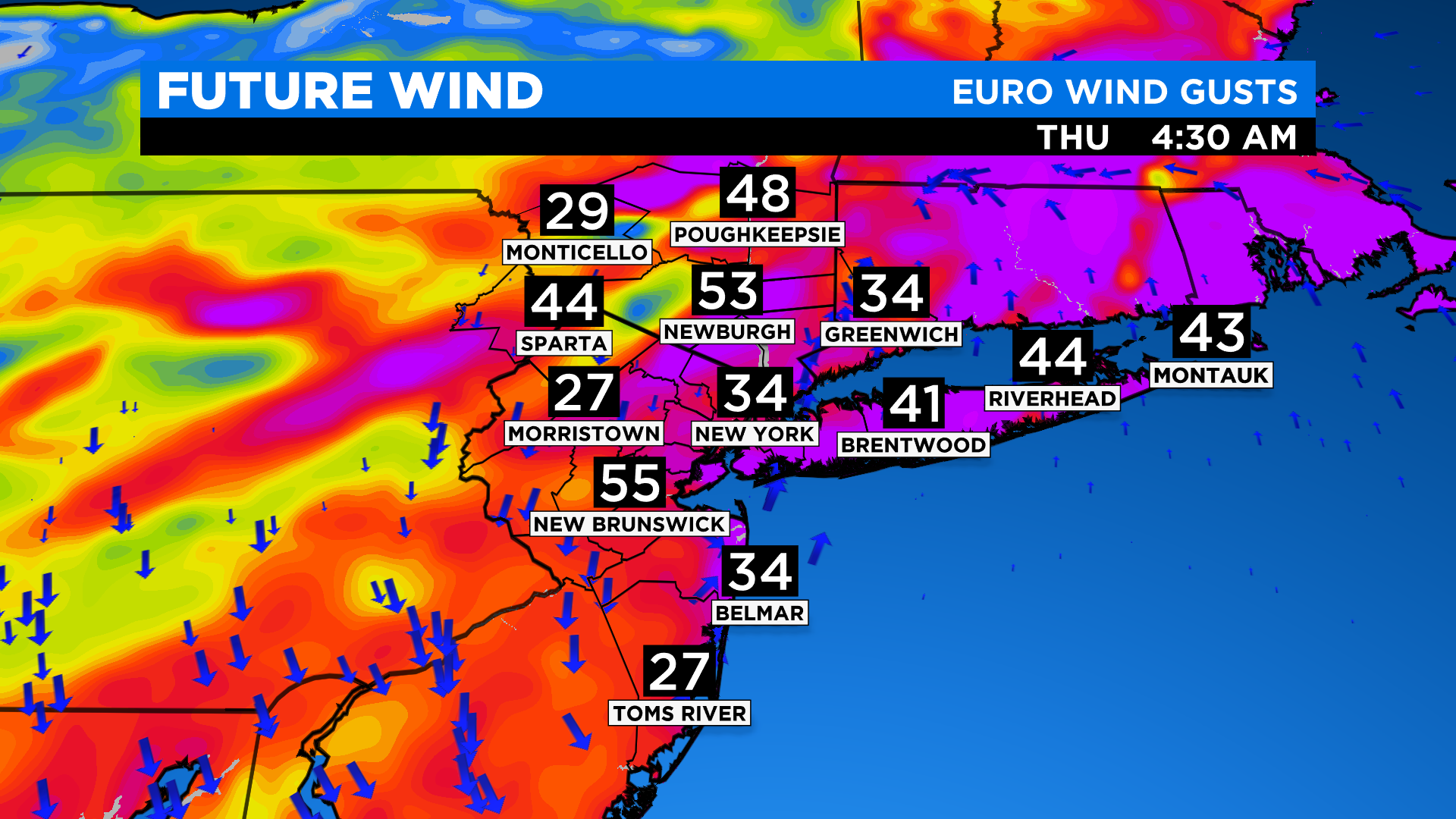
Winds will not be the biggest, but gusts over 35 mph are likely, with a stronger gust possible. EURO is indicating a gust to 50 mph.