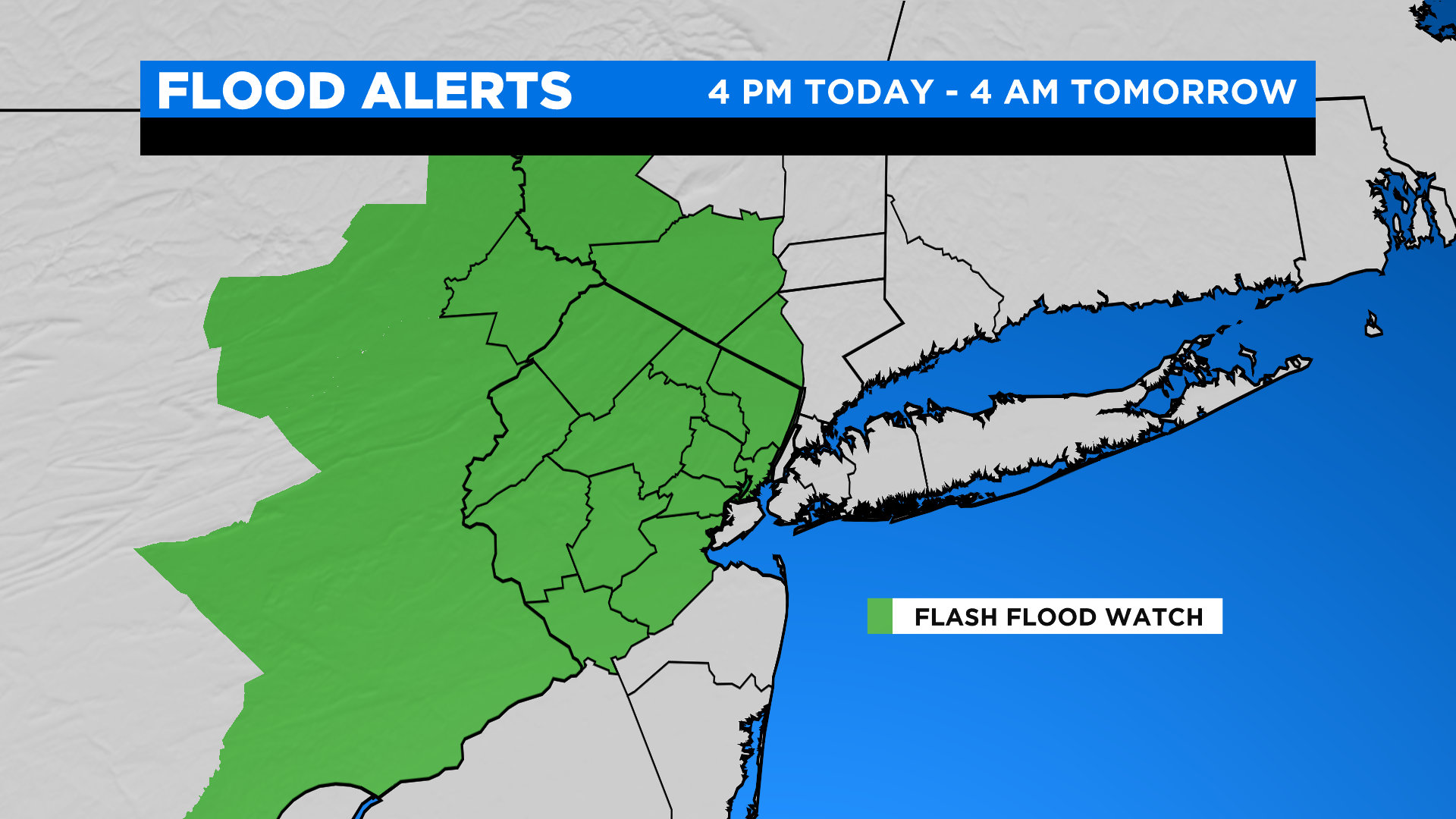
TIMELINE: Flash Flood Watch Scheduled Wednesday As Another Round Of Rain Approaches
The better part of this afternoon looks to be uneventful with perhaps some added cloud cover and isolated showers or rumbles of thunder.
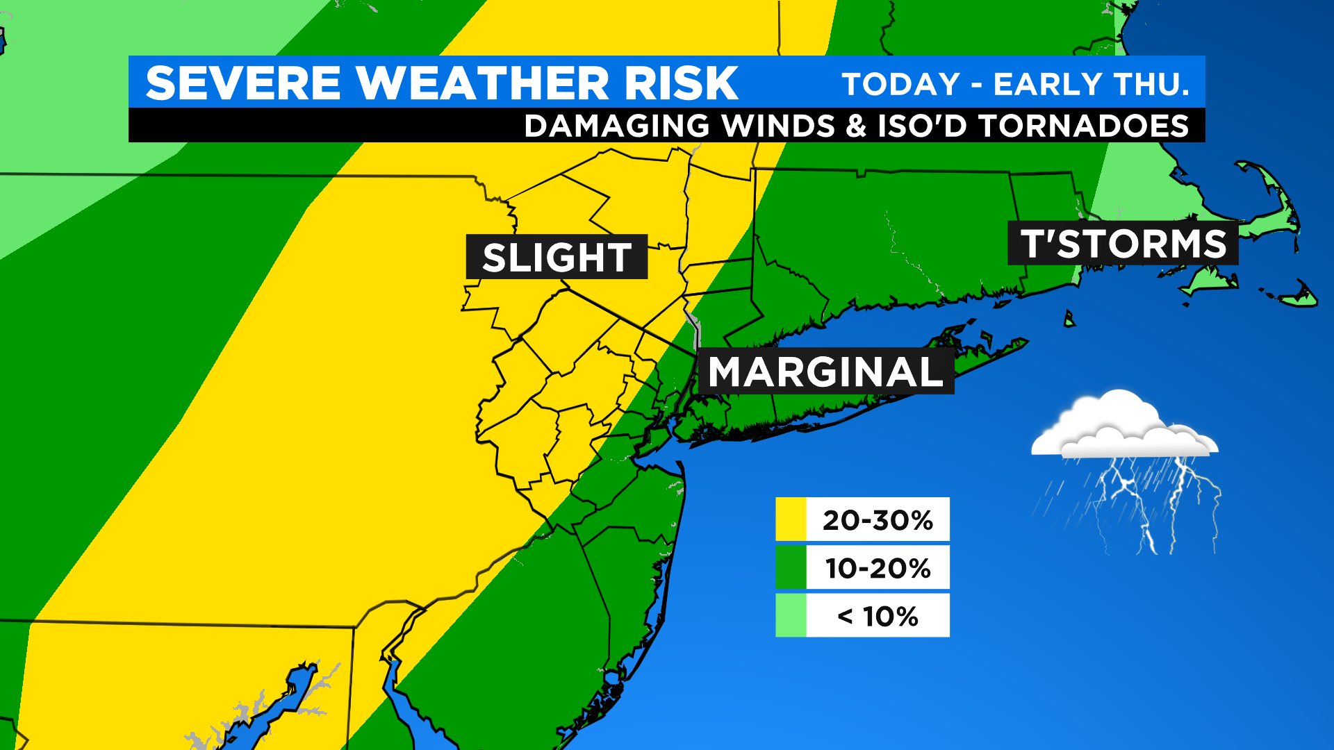
It's really this evening -- mainly after 8 PM -- where we'll start to see showers and strong storms fill in N&W and work their way towards the city. These storms will have the ability to produce torrential downpours, damaging winds and even an isolated tornado or two. The greatest risk of flash flooding looks to be across northern New Jersey and parts of the Hudson Valley where up to 2" (locally) could fall.
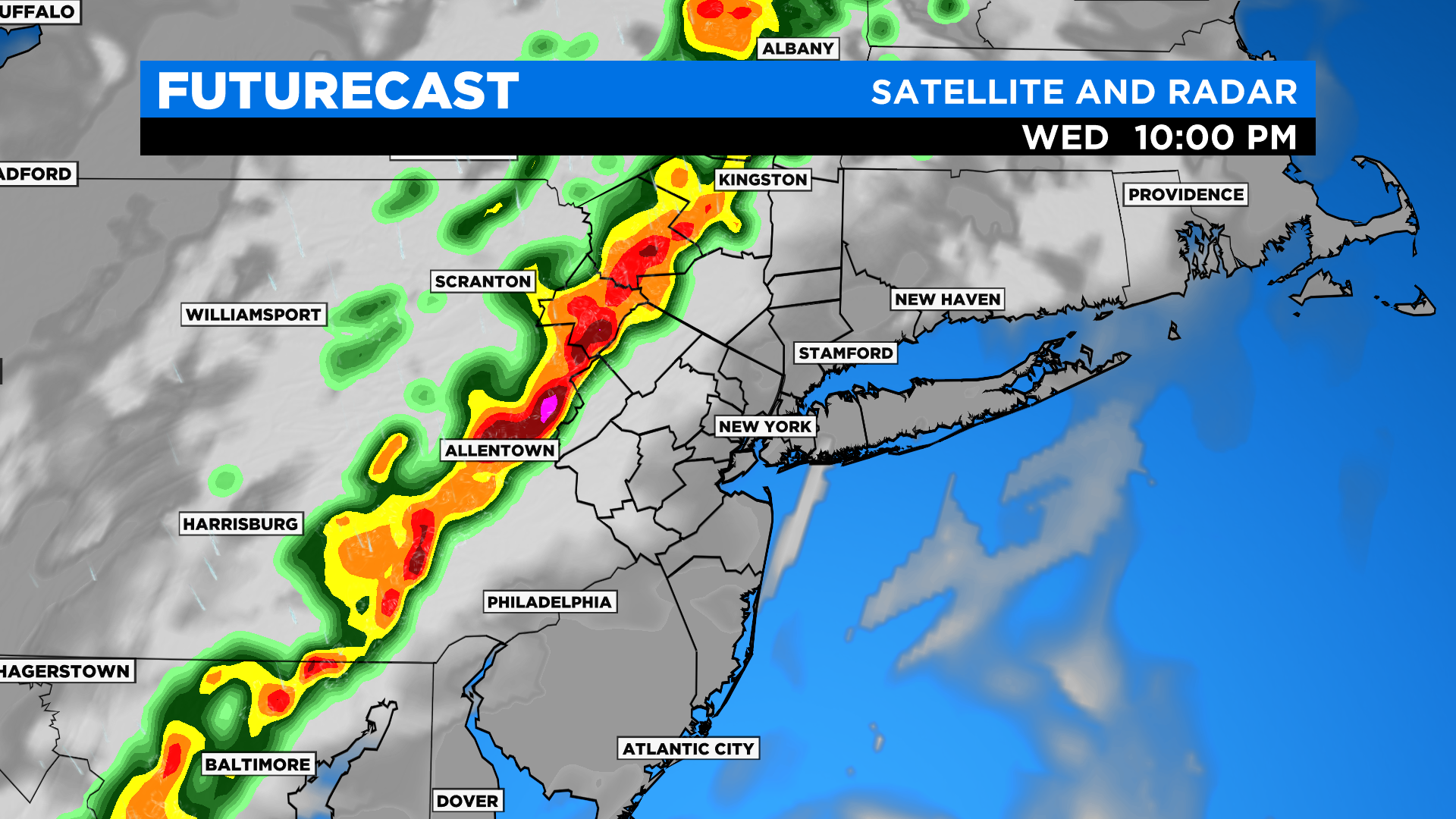
The storms will then push through the city and nearby suburbs late in the evening and into the early overnight hours. Downpours and perhaps some isolated severe storms will still be a possibility at this point, though as they progress eastward across Long Island into the overnight hours the risk of severe weather should go down.
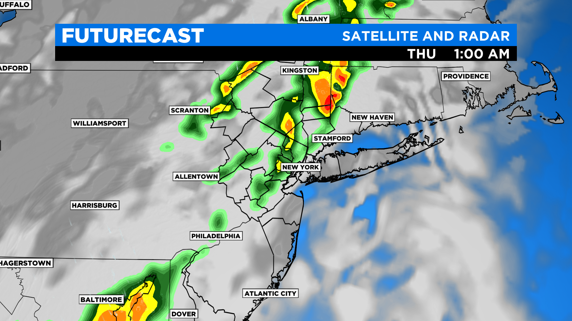
Even into tomorrow we'll be dealing with showers and some downpours, though the focus of the activity looks to be east of the city.
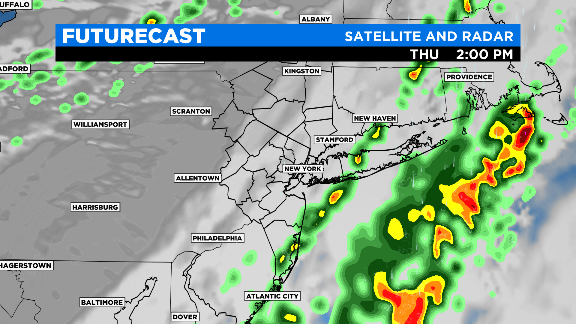
The showers should wrap up across Long Island late in the afternoon and evening.