New York Weather: CBS2's 9/15 Wednesday Morning Forecast
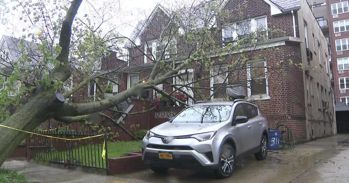
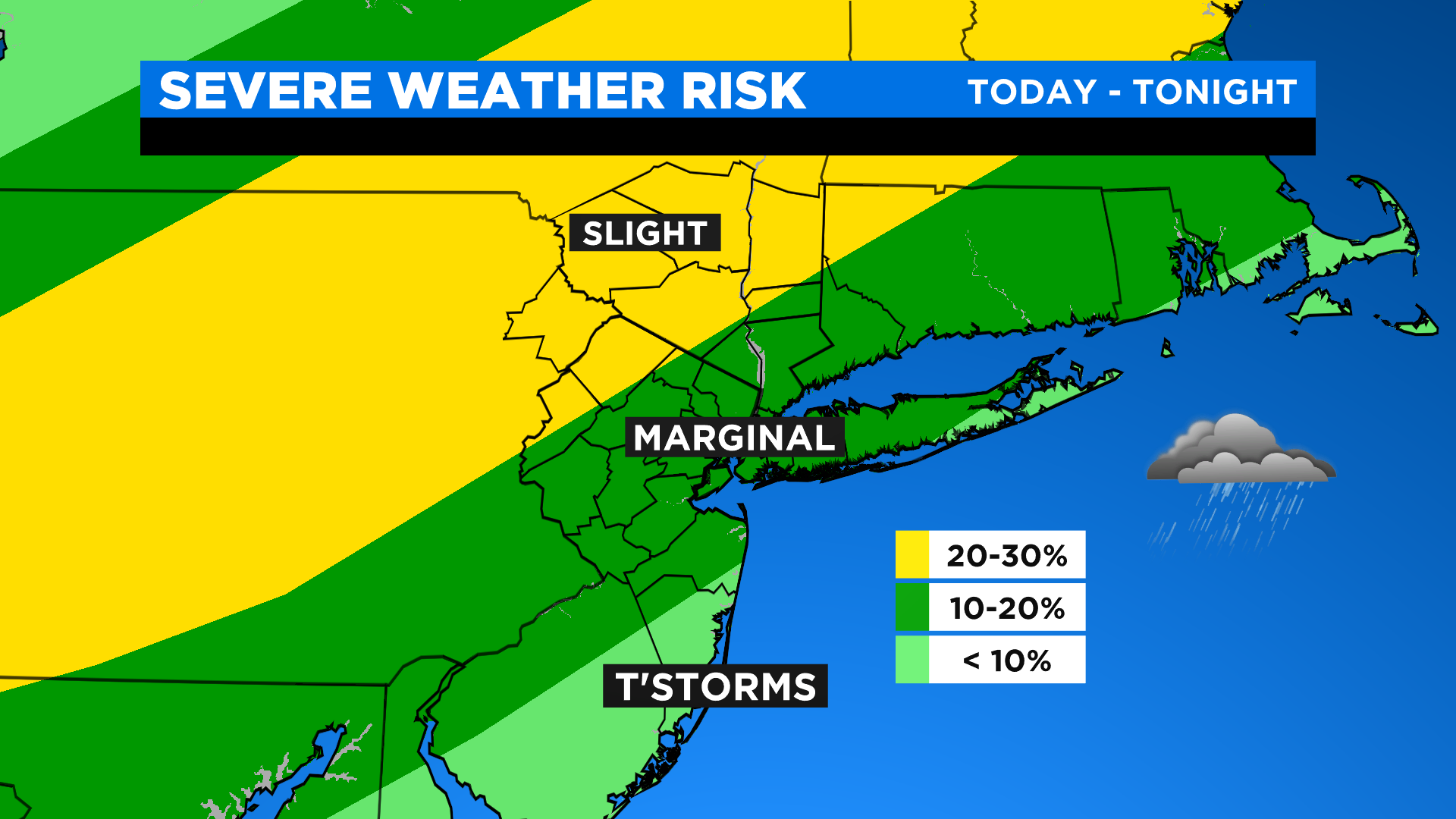
Today will be hot and sticky with a chance of t'storms this afternoon (mainly N&W) with a better chance in the city this evening. There is the potential for isolated severe storms, as well, with the best chance N&W of the city. The main threats with these storms will be locally damaging winds and hail, but an iso'd tornado can't be ruled out across our more distant northwest suburbs.
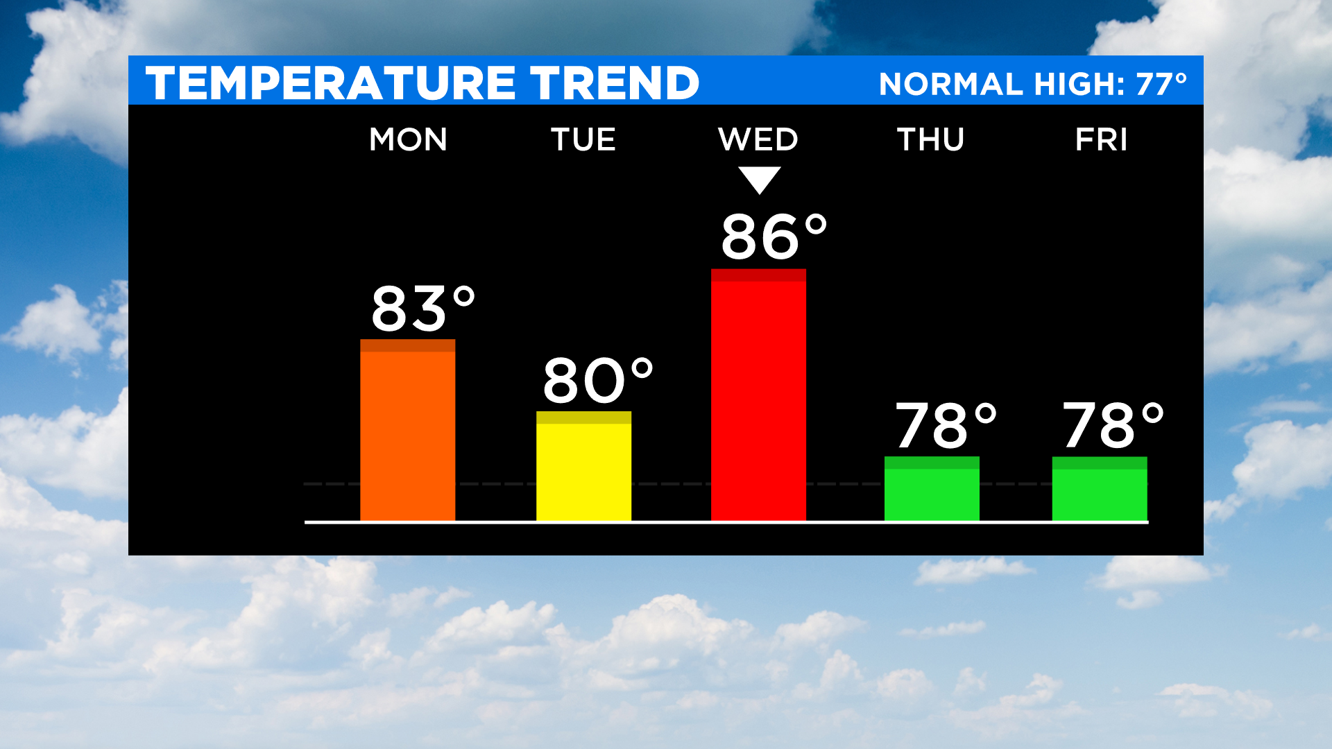
For the better part of today though, expect mostly sunny to partly cloudy skies with highs in the mid 80s with feels like temps in the upper 80s to near 90. Also worth mentioning: high risk of rip currents at the south shore beaches today.
Tomorrow will remain unsettled with sct'd showers/rumbles and even some downpours. And given this activity will be slow moving, it looks like whatever develops has the potential to produce some localized flooding. Outside of all that, it will be partly sunny to mostly cloudy and a touch cooler with highs only in the 70s.
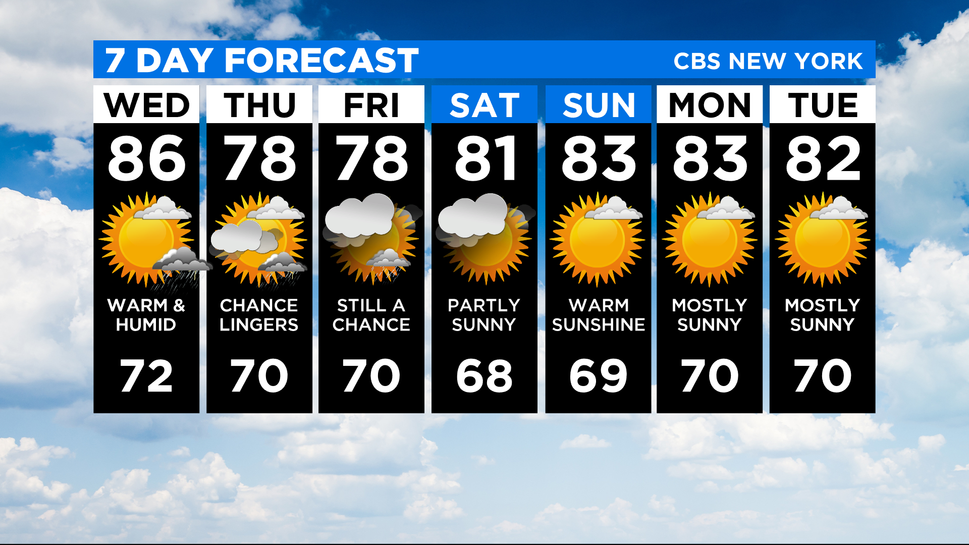
Friday there's about a 30% chance of showers with highs in the upper 70s.