New York Weather: CBS2's 10/27 Wednesday Morning Forecast
By Giorgio Panetta, CBS2 Chief Meteorologist/Weather Producer
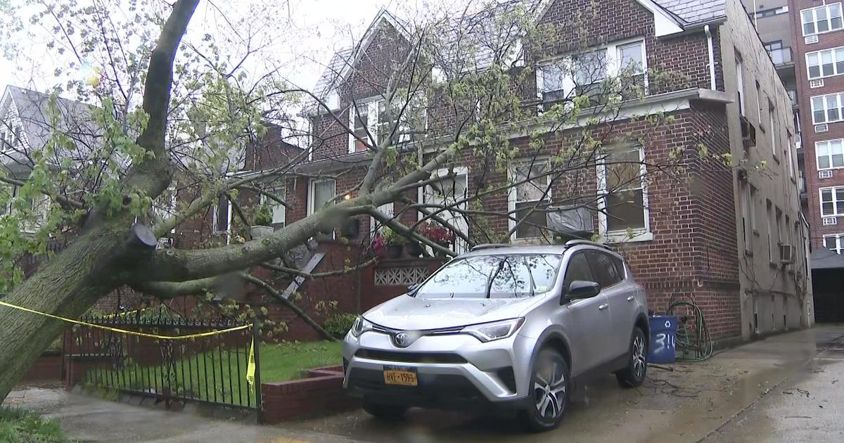
The last band of heavier rain pushed through the area, and it's still raining for most of us. We can expect an additional .5-.75" or so by Wednesday morning.
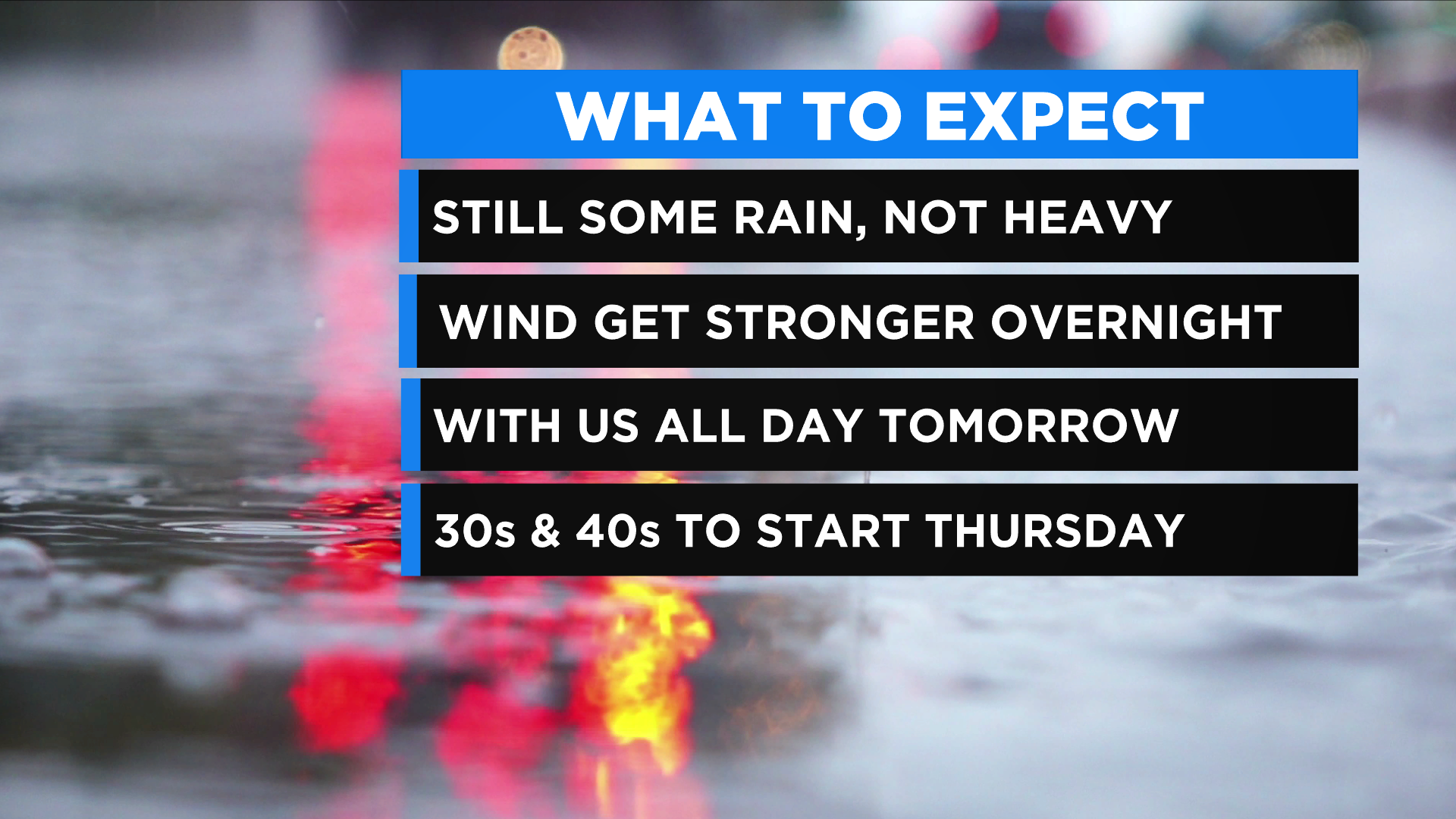
The winds start to crank up overnight, and they get stronger the farther east you go. A Wind Advisory is in effect for Nassau and Suffolk counties on Long Island, with a High Wind Warning in effect for the south shore until 2 p.m. Wednesday. Gusts are possible up to 60 mph.
Expect some leftover showers early Wednesday morning, then dry conditions take over throughout the day. Breezes are consistent especially on Long Island. Gusts to 35 mph are expected for the rest of the area.
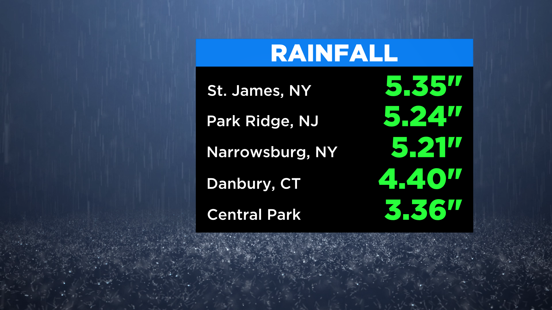
Rainfall totals have been racking up!
- St. James, N.Y. -- 5.35"
- Park Ridge, N.J. -- 5.24"
- Narrowsburg, N.Y. -- 5.21"
- Danbury, Conn. -- 4.40"
Central Park received 3.36 inches of rain. A total monthly rainfall is normally 3.60 inches.
We will have final totals Wednesday morning.
Once the winds die down, the temps drop for a chilly start Thursday morning. Waking up in the upper 40s, and the 30s in the Hudson Valley.
Overall, it was not as bad as Ida (thankfully) but a significant rainfall, and we will see what these winds do Wednesday.
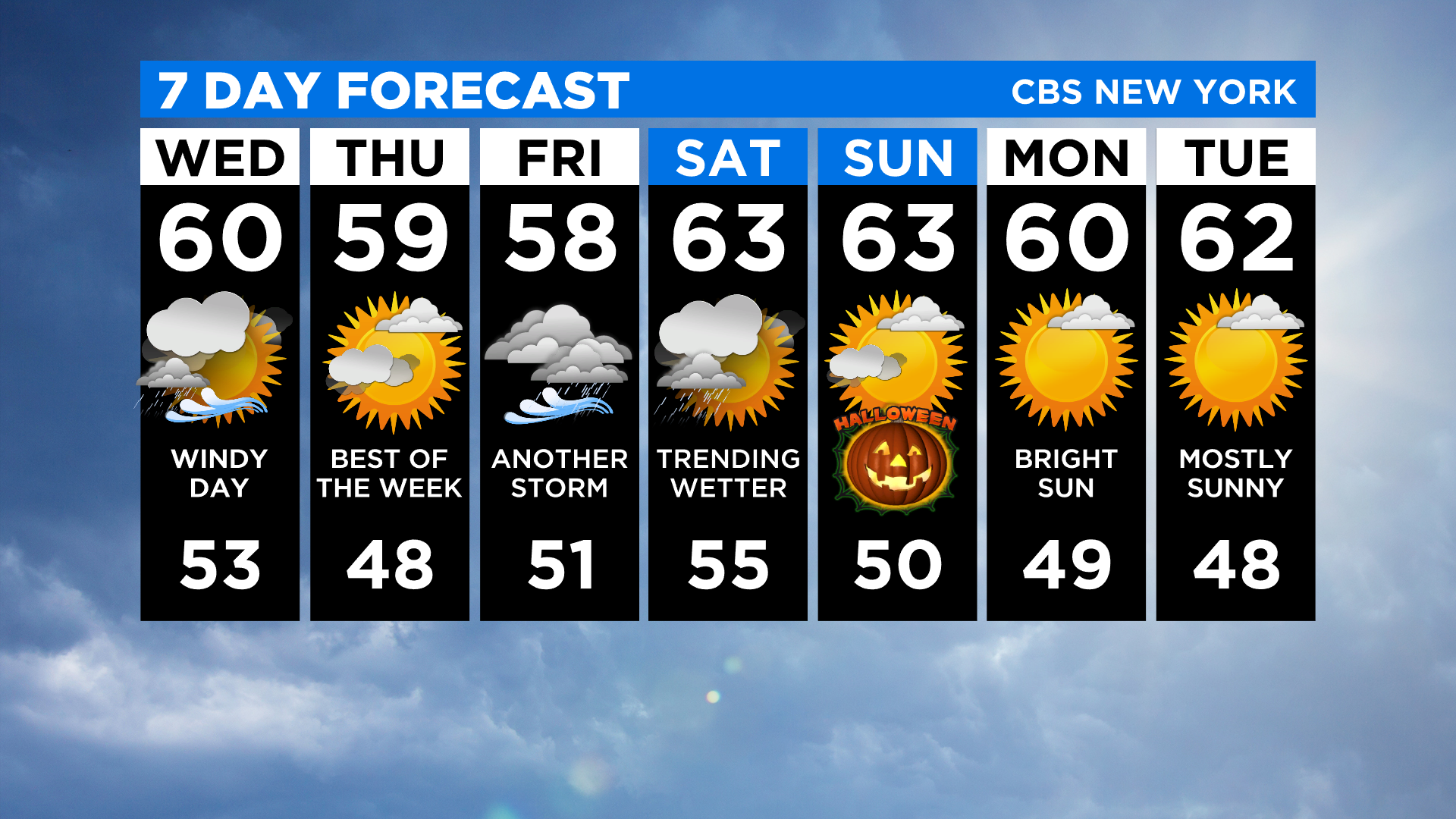
We have another system approaching for Friday that will bring more rain into the weekend. Not a nor'easter, but a decent low-pressure system.
Saturday is trending wetter, but Halloween looks OK under partly sunny skies and temps around 60.