New York Weather: CBS2's 12/11 Saturday Morning Forecast
By Giorgio Panetta, CBS2 Chief Meteorologist/Weather Producer
We can expect a fairly dramatic day today. We will likely tie or break a record from 1879, then drop 20 degrees by Sunday morning, and the chance for some rare December severe weather is possible in between.
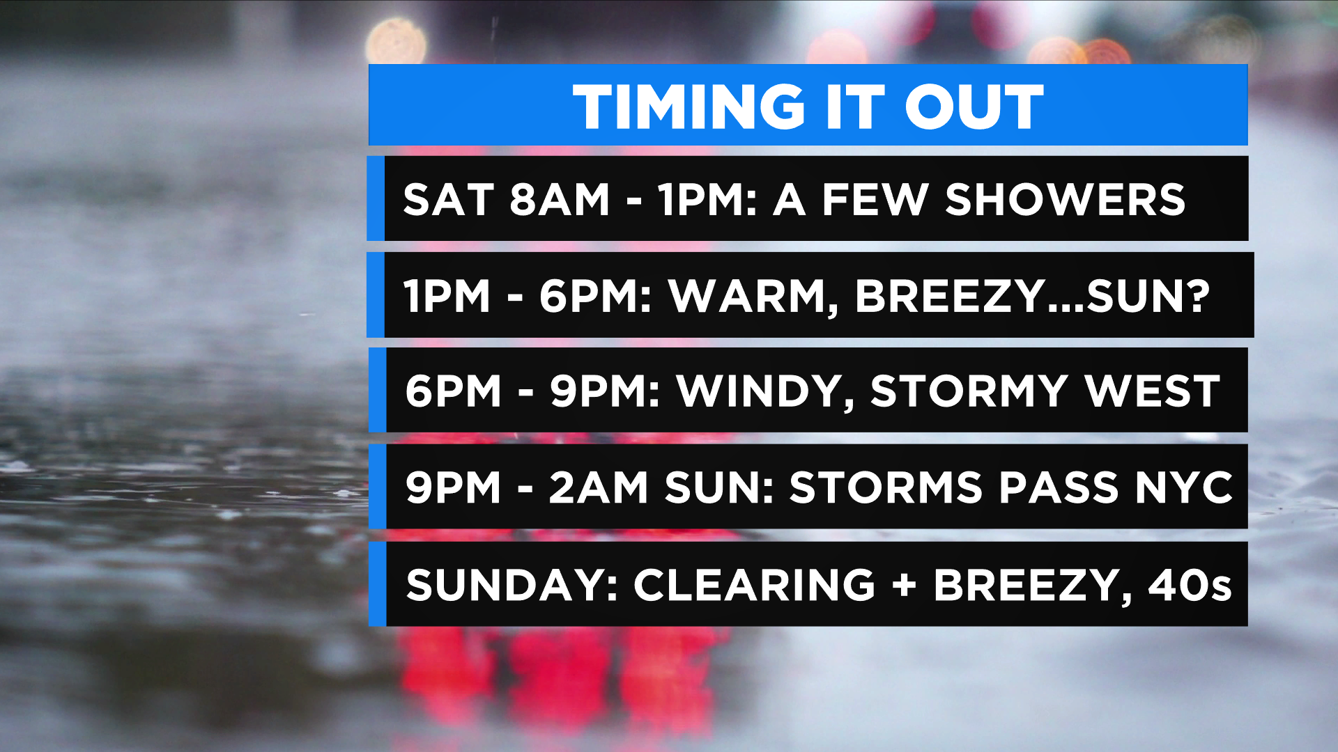
The first half of the day will be breezy and mild with some intermittent showers. If we see some peeks of sun, we will likely get into the upper 60s, maybe the 70s inland. So it's a mild afternoon ahead of the squall line.
The actual skinny line of storms has been timing out to approach western New Jersey around 6-7 p.m. The line marches across New York between 8-10 p.m., then leaves Long Island around 1 a.m. Sunday.
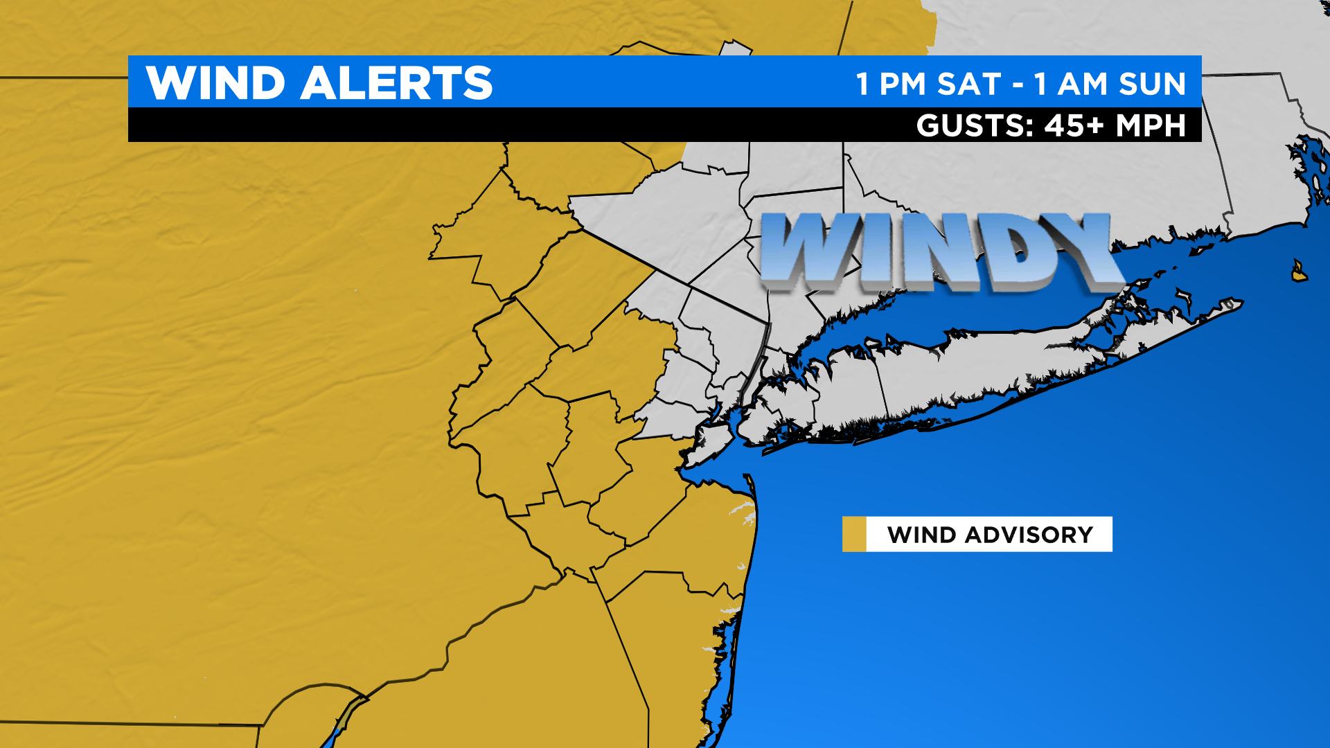
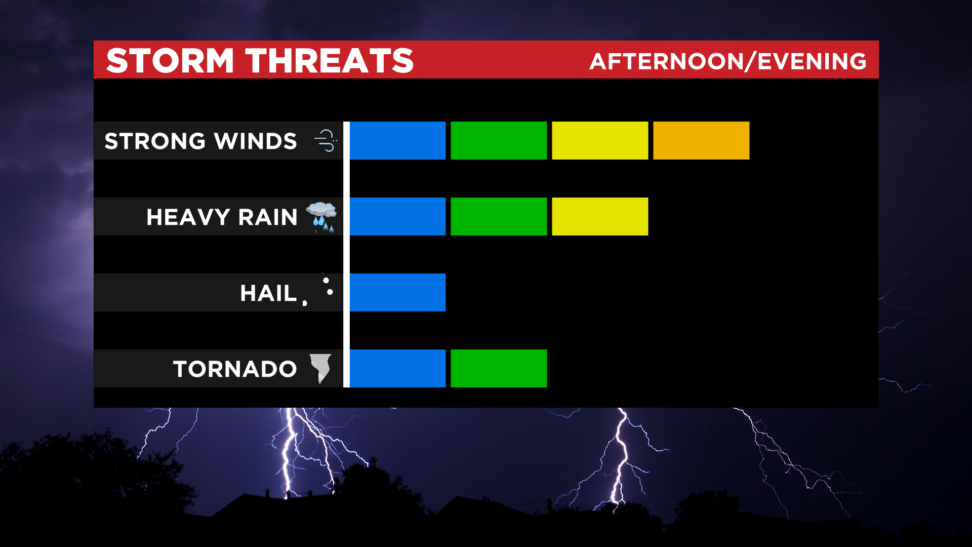
A Wind Advisory goes into effect from 1 p.m. Saturday until 1 a.m. Sunday. The better likelihood for categorically severe storms is just to our south, but it's too close for comfort to discount a breakaway severe cell around New York City or Long Island.
There is a very slight tornado chance. It's an anomaly to have the risk in December. Plus, the tornado watches happening from St. Louis to Little Rock are letting us know the storms are not to be taken lightly.
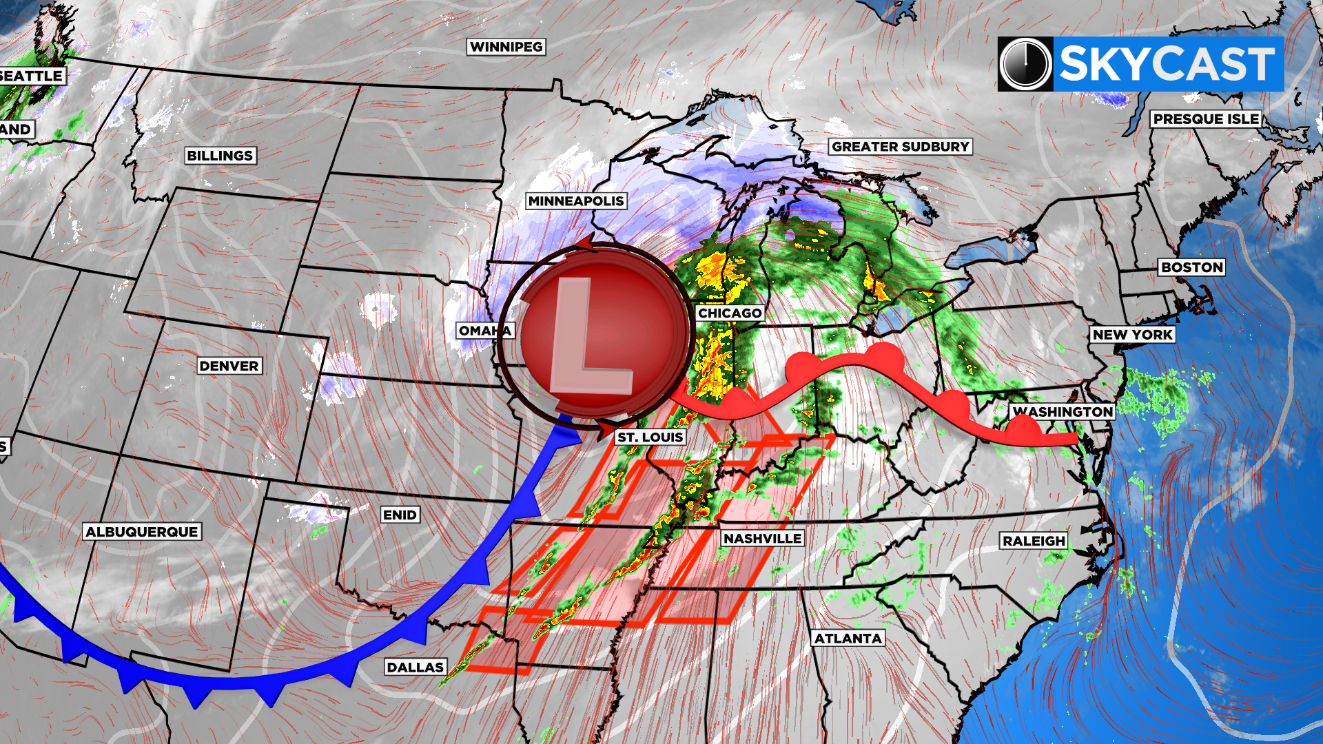
A little silver lining: because the storm is such a fast mover, we're not expecting any widespread flooding and the rain totals are generally .25 -.75 inches, more in isolated strong downpours.
Temps drop after midnight down to the lower 40s. Sunday is bright and breezy with a high around 47.