SNOW TIMELINE: Worst Period Of Snowfall Expected Friday Morning With 2-5 Inches Expected For Much Of Tri-State Area
NEW YORK (CBSNewYork) -- The Tri-State Area is bracing for a messy morning commute Friday as snow moves into the area overnight.
Here's what to expect and when.
Thursday night
Snow is already falling in northern New Jersey. This is just about where we should be, but the snow is about 30 miles closer to the coast, and we are seeing the early bands clipping eastern Long Island, too.
Basically, the storm is overperforming slightly already. It dumped 8 inches in Nashville, with 9.5 inches so far in West Virginia. We're not looking at that much snow... Why? Because the storm is such a fast mover. It kicks offshore and explodes with energy, just clipping our area.... If it was moving slower, we'd be talking big numbers. But this provides confidence that we will likely get a widespread moderate snowfall.
CLICK HERE FOR THE LATEST FORECAST
Friday morning
Unfortunately, the timing continues to look tough for the morning commute with 4-7 a.m. looking like the worst of it.
The low will start to pull northeast after 8 a.m., and the storm wraps up fast with sunshine likely to return. By 11 a.m., the snow looks to head fully out to sea with a dry wind on its heels.
Friday afternoon
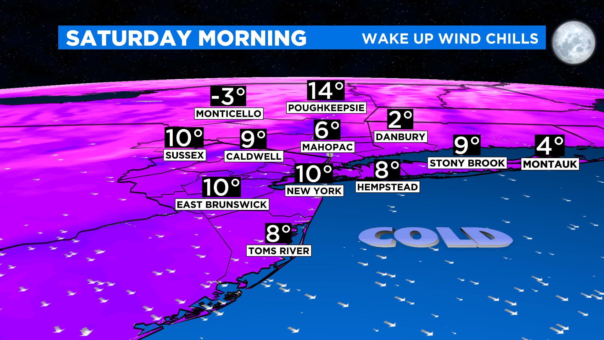
Brutally cold winds follow. By 3 p.m. Friday, some gusts will peak around 30mph, and that will drive the feels-like temp down into the single digits and sub-zero early Saturday morning. Yikes.
Expected Totals
New York City could get 3-5 inches. In fact, much of the area could see 2-5 inches.
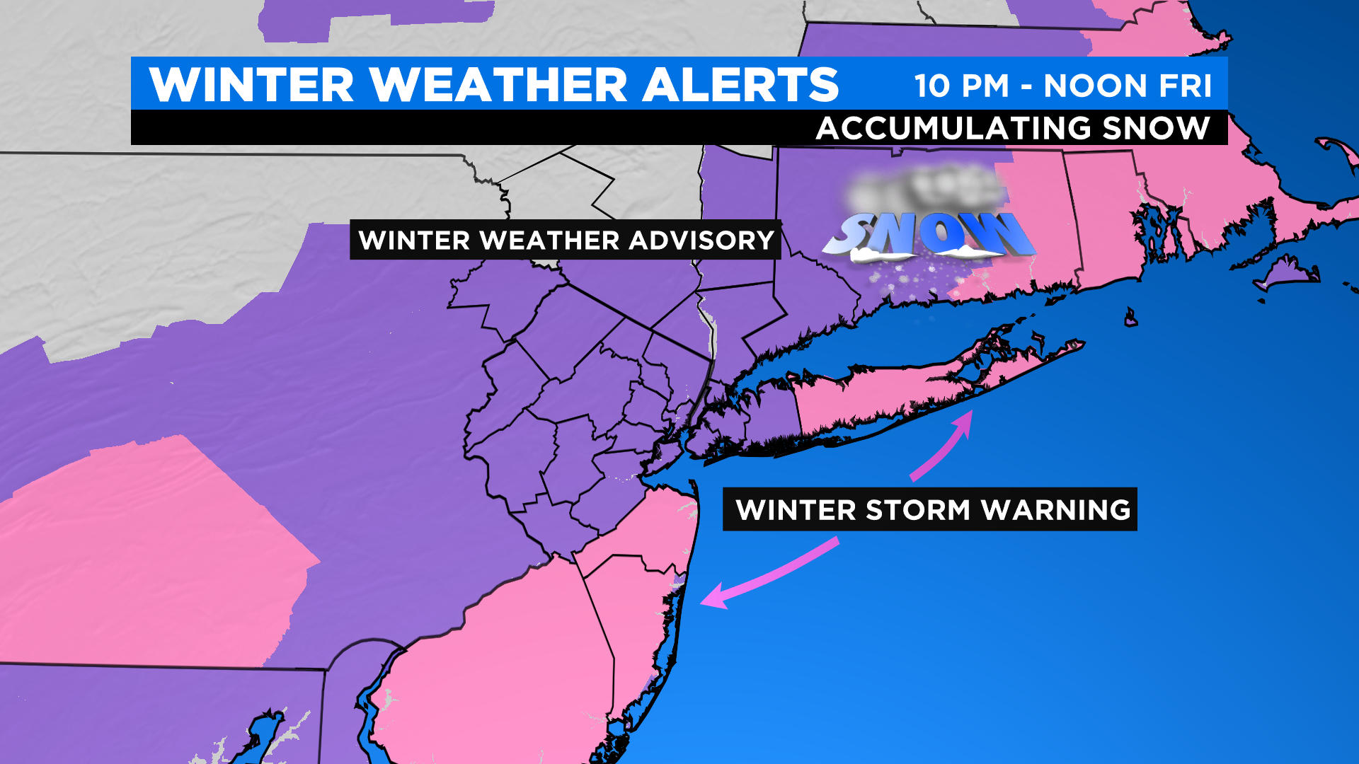
Greater snowfall totals (5-7 inches) are possible in Suffolk County and along the Jersey Shore. This is where the Winter Storm Warnings are in effect. Why? The storm will strengthen, and some banding is possible with snowfall rates up to 1.5 inches or so, and that stacks up quickly. Less is expected in the SUDS (1-3 inches)... a little too far away from the center of the storm.
What can change? A shift east overnight will lower totals overall, likely taking out the risk for 6 inches, but still a decent snowfall. Lots of 2-3 inch readings. If it hugs closer, the heavier bands could push inland, and more communities see the bigger numbers, lots of 5-plus-inch readings.
Not a huge storm, but very poor timing, and our first widespread significant snowfall of the season.
Meteorologist Giorgio Panetta contributed to this report.