TIMELINE: Nor'easter Dumping More Than A Foot Of Snow On Long Island & Jersey Shore; Up To 8 Inches On NYC
NEW YORK (CBSNewYork) -- A Nor'easter moved into the Tri-State Area on Friday night and brought some significant snowfall.
High winds and coastal flooding will also be a concern.
LINK: Check The Latest Forecast
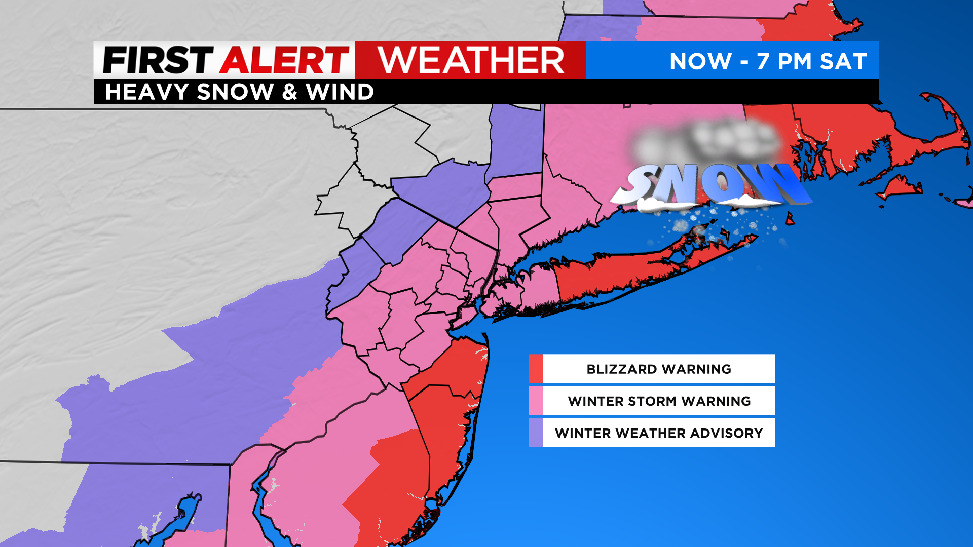
A winter storm warning has been issued for most of the area from 7 p.m. Friday through 7 p.m. Saturday.
A blizzard warning is also issued for the Jersey Shore and Suffolk County during the same timeframe.
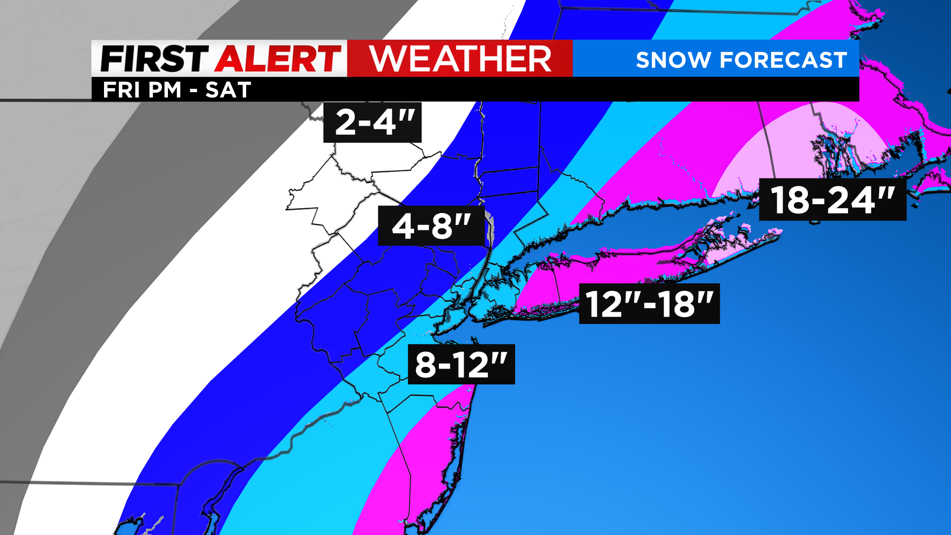
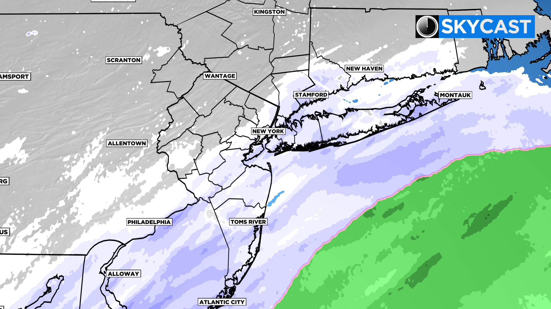
SNOW TOTALS
The Jersey Shore and Long Island will see the most accumulation, with 12 to 18 inches expected for most, and more than 18 inches possible for some.
New York City will likely see 4 to 8 inches, and areas north and west will see 2 to 4.
STORM TIMING
4-7 p.m.: Wrapping up across Long Island, frigid and blustery elsewhere.
7-10 p.m.: Final flakes out east.
LINK: Winter Storm Survival Guide
BLIZZARD IN NYC?
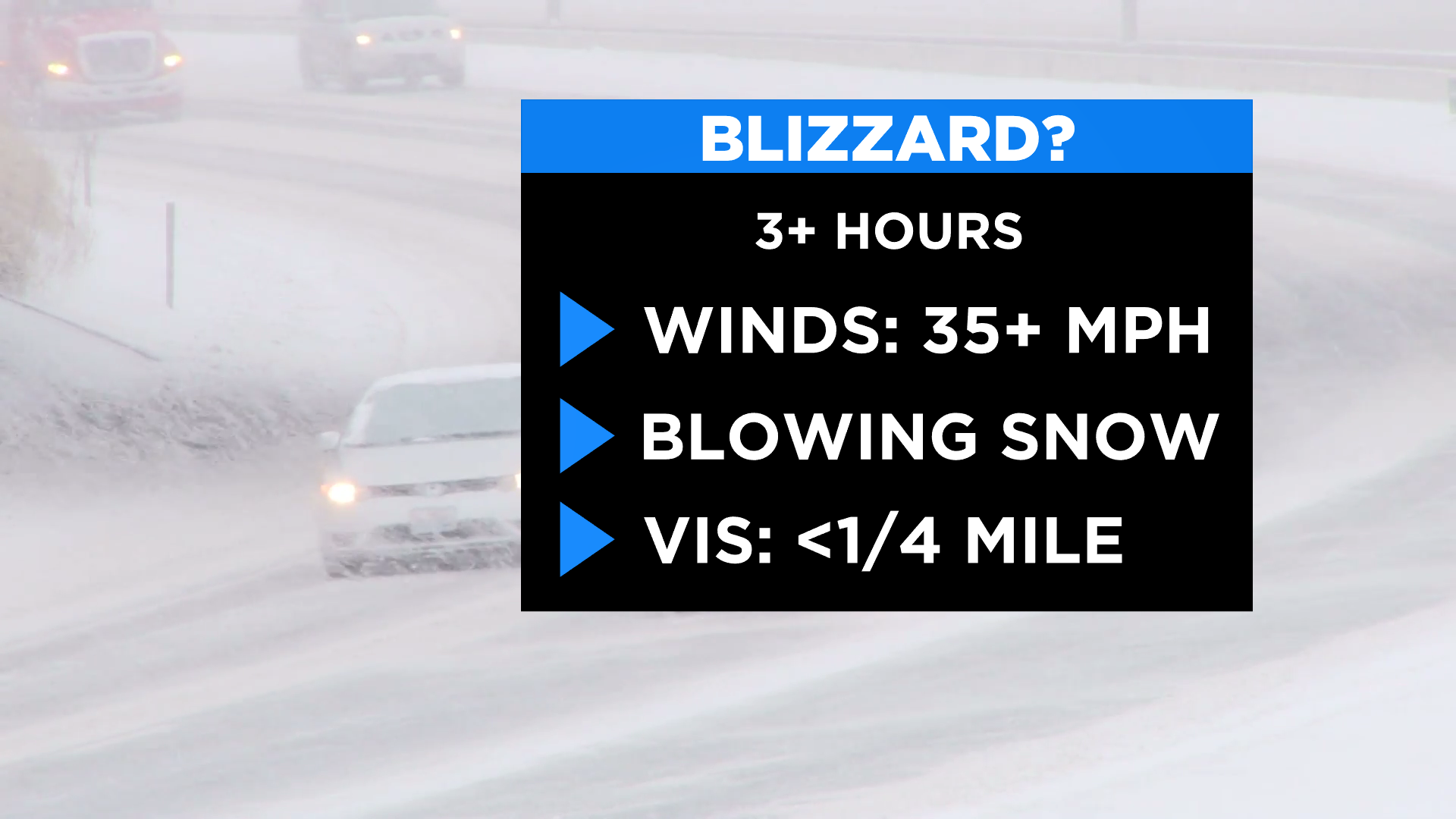
Although the city is not officially in the blizzard warnings, it will experience a taste of that volatility from time to time Saturday.
STORM SIGNATURE: FRIGID AIR
People will be trying to dig out in the afternoon under horrible conditions. This storm is a little different in the sense that we are under an arctic airmass while it's snowing. You will be shoveling in sub-zero wind chills! Exposed skin is very dangerous, and people should take caution. Cold air allows snow to stack quickly, and it is blown around easier, which lowers visibility dramatically.
Stick with CBS2, CBS News New York and CBSNewYork.com for the latest forecast and weather alerts.