3/1 CBS2 Sunday Evening Weather Headlines
By Mark McIntyre, CBS2 Meteorologist/Weather Producer
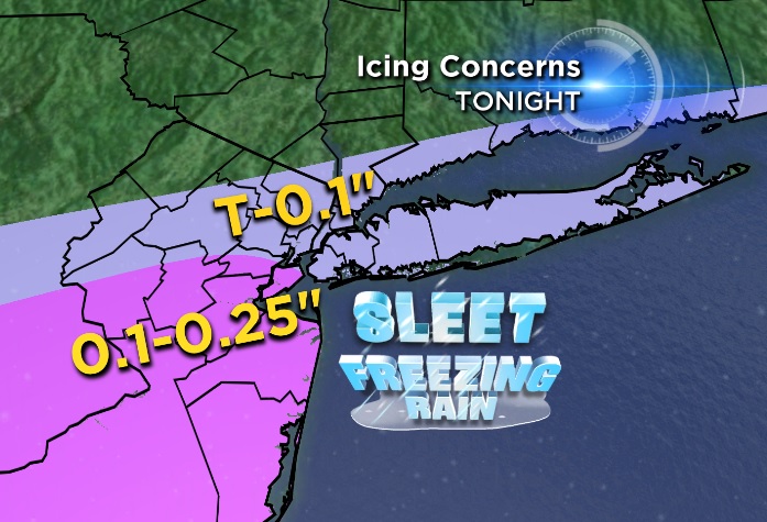
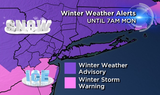
Good evening all! We're now seeing that wintry mix of snow, sleet, and ice making a push north. The biggest concerns for icy precip will be in central & southern NJ, from Middlesex/Somerset/Mercer and points south. Folks there look like they'll be dealing with potential of a quarter inch of ice, maybe even more!
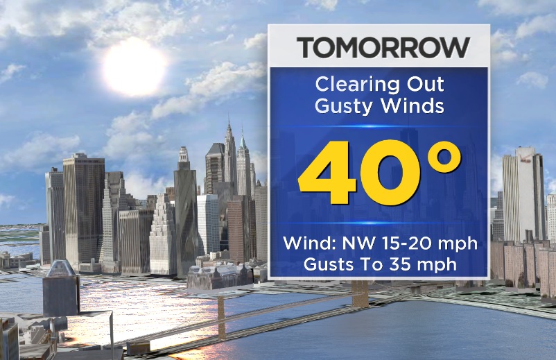
There are alerts still in effect until 7AM tomorrow morning. The precip will be done falling by then - thinking by around midnight - but there will be slick spots on area roadways. Expect gradual clearing through the day tomorrow with winds starting to pick up...Gusts up to 35 mph possible with temps reaching a high of 40 degrees.
Tuesday looks to be another interesting day with a cloudy start and possibly icy evening. Looks like as temps will be right around freezing here as precip moves in we'll be dealing with some sleet/freezing rain..but temps soar Wednesday to the 40s and 50 in spots! That will be enough to make it just plain ol' rain...then colder on Thursday.