5/10 CBS2 Sunday Evening Weather Headlines
By Mark McIntyre, CBS2 Meteorologist/Weather Producer
We hope you had a chance to enjoy this warm & summery Sunday while celebrating mothers and mother figures! After a day of 70s and 80s we'll have clouds and fog roll back in across the region tonight with temps bottoming out in the mid 60s. A few spots of drizzle are also possible overnight, so be mindful of that if you're going to be on the road.
Monday will be another warm day, albeit with more clouds...and there will also be some showers/thundershowers that could move through the area. The two culprits will be an approaching front and the remnants of what is now Tropical Depression Ana. We won't get a direct hit, but the moisture and energy from both systems will provide a chance for scattered showers.
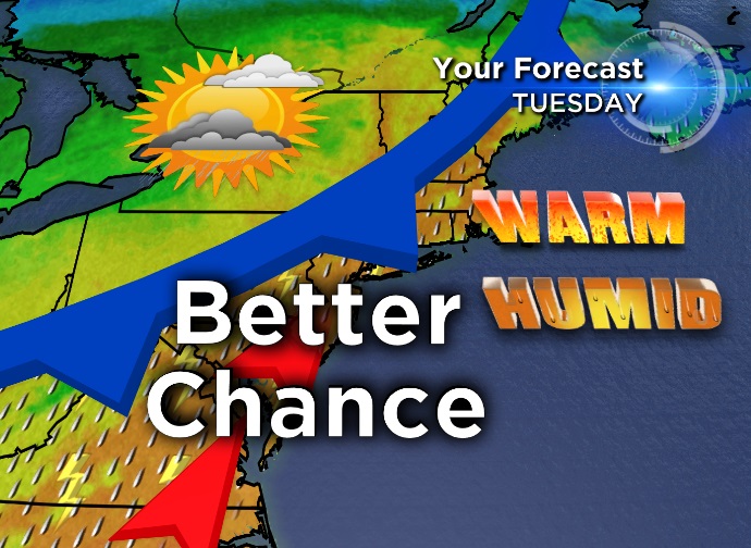
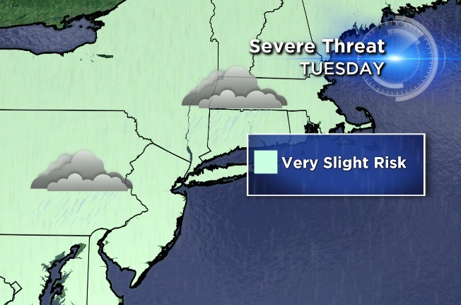
The warmest day of the week by far will be Tuesday with temps hitting 86 in NYC, and many folks in NJ finding 90! There will be a greater chance for storms due to higher temps, humidity, and energy levels...so the "oomph" could be there for a few very strong thunderstorms. We are in May, after all!
Wednesday will be a gem of a day with mostly sunny skies, a refreshing breeze, and cooler temps in the 70s.