Tri-State Area Dries Out, Thaws After Wintry Blast Blankets Region
NEW YORK (CBSNewYork/AP) -- Residents across the region have dug out from the first blast of winter this season.
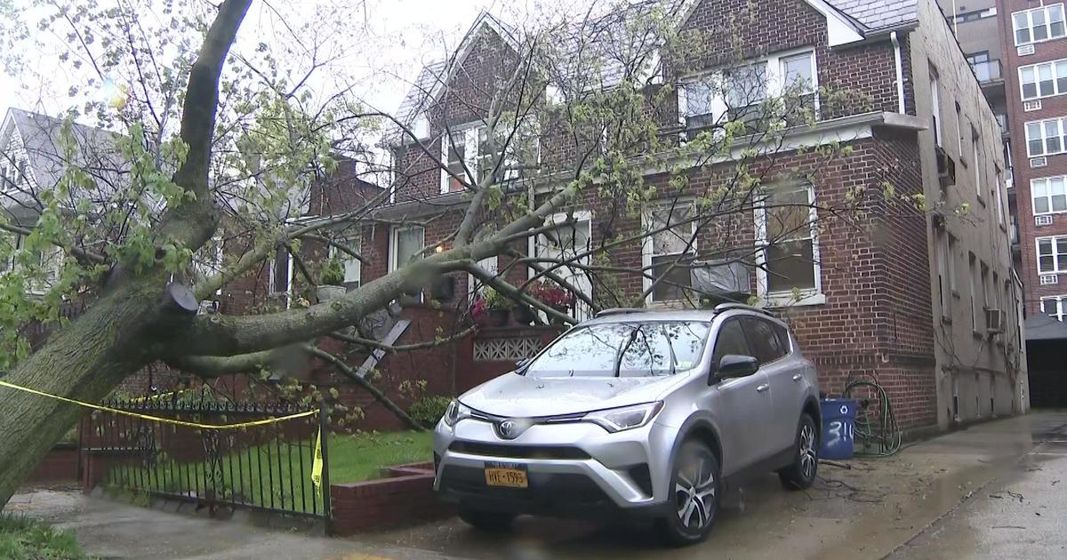
The winter storm that lashed parts of the Northeast brought heavy rain, high winds and snow to parts of the Tri-State area, knocking out power to thousands and making a mess of the roads.
The morning commute was slick and slippery for many and the snow and ice affected some subway service early.
But by afternoon, there were no major problems on the roadways. Subway, bus and rail service also was normal.
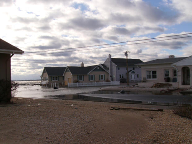
Portions of the Jersey shore that were hard hit by Superstorm Sandy took yet another blow from the latest storm, which began Wednesday and continued into Thursday morning, with hurricane-force wind gusts recorded overnight.
The Barnegat Bay spilled over its banks, turning streets along the Jersey Shore into rivers, WCBS 880's Jim Smith reported.
WCBS 880's Jim Smith reports from Berkeley Township
Podcast
More than six inches of water covered many roads, making them impassable for much of the morning and afternoon.
The water began receding by late afternoon, but the flooding may only serve to complicate the clean-up effort still going on from superstorm Sandy.
The area was battered during the storm and debris still litters the streets, Smith reported.
Sheet rock, air ducts and televisions line the roads and are again inundated with water.
Many homes appeared to be vacant in the community due to the after-effects from Sandy, Smith reported.
The windows are still open in some homes as residents try to dry their houses out.
In northern and western areas of New Jersey, some communities got more than six inches of snow, making for some dangerous conditions on the roads early.
On Long Island, streets turned into rivers and homes in Lindenhurst were again surrounded with the salty waters of the Great South Bay.
"Might be a 'for sale' sign on my house pretty soon. My wife can't deal with it, I can't deal with it. Something's gotta be done," homeowner Sean Logan told CBS 2's Carolyn Gusoff.
Most of the homes in Lindenhurst were wrecked by superstorm Sandy. There are still signs everywhere of the damage and the rebuilding effort is under way.
But less than two months later, the sight of newly flooded streets brings more headaches.
"Just another drawback. Just keep going," Lindenhurst resident Rob Bontempi told Gusoff. "What can you do? You got to deal what life gives you sometimes."
Many Lindenhurst residents said the overnight storm brought three feet of water onto land, higher than typical Nor'easters. They blame the damage Sandy did to the barrier beaches that protect Long Island's mainland.
"Something changed since Sandy because we never had it like this," Lindenhurst resident Bob Fischer said.
The latest round of flooding came and went so quickly that many homeowners may not yet know if their homes were affected because they have still not been unable to come home since Sandy.
GALLERY: User-Submitted Winter Storm Photos
The heavy rains caused flooding for many areas already hit hard by Superstorm Sandy.
Eight-foot sand dunes that failed to stop Sandy's flood waters were back up in Long Beach on Long Island to prevent more flooding. Flood waters from the winter storm also closed major roads along the Jersey Shore.
This storm took a toll on residents, who spent much of the day digging out from under the snow and ice.
Orange County was hit with at least five inches of snow and more in some parts.
But some residents said they were ready for the winter weather.
"We've taken trees down that we knew were old and were ready to go so we kind of planned for that," said Central Valley resident Robert Wersinger.
Some residents in the northern suburbs said they are already weather-weary and we haven't even hit January yet.
"The timing just couldn't be worse," one Orange County resident told CBS 2's Ann Mercogliano. "All sorts of problems and you add this on top of it."
Drivers complained of slick conditions throughout the day.
"Very slippery, very icy from all the sleet that was landing," a driver said.
But other residents enjoyed the winter wonderland as they plowed out.
"You have to take it and just be really optimistic about it. It's beautiful, it's cold. But you know what, it's great," Central Valley resident Roger Silverblatt told Mercogliano.
Snow, wind and ice took down power lines throughout the region, leaving thousands without electricity. As of late afternoon on Thursday, less than 3,500 homes were still in the dark.
CHECK OUTAGES IN YOUR AREA: Con Edison | NYSEG | Long Island Power Authority | Orange & Rockland | PSE&G | Jersey Central Power & Light | Atlantic City Electric | Connecticut Light & Power | United Illuminated
The highest snowfalls were recorded in Sussex County. Highland Lake and Wantage each received about six inches. Montague received about five and a half inches. Parts of Morris County got up to four inches.
The wintry mess stirred up some trouble for travelers. Dozens of arriving and departing flights were canceled early Thursday morning at Newark Liberty International Airport, CBS 2 reported. Minor delays were being reported at LaGuardia and John F. Kennedy International airports.
AIRPORT STATUS INFO: JFK | Newark Liberty | LaGuardia
Drier conditions are forecast for Friday.
(TM and Copyright 2012 CBS Radio Inc. and its relevant subsidiaries. CBS RADIO and EYE Logo TM and Copyright 2012 CBS Broadcasting Inc. Used under license. All Rights Reserved. This material may not be published, broadcast, rewritten, or redistributed. The Associated Press contributed to this report.)