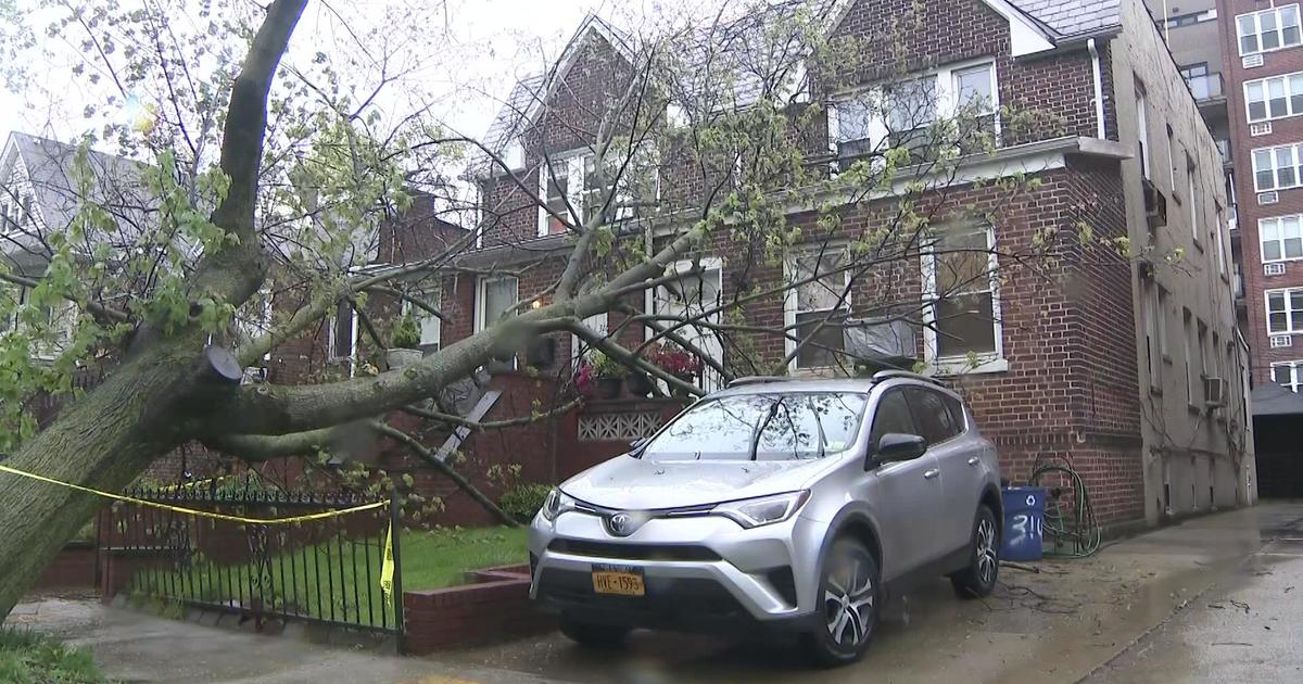
Winter Storm Packing Snow, Heavy Rain And Strong Winds Headed Our Way
SEA BRIGHT, N.J. (CBSNewYork/AP) -- It may be March, but winter isn't done with us yet.
A big winter storm has been making its way across the middle part of the country, dropping upwards of a foot of snow on some places as it tracks its way east.
The system will arrive Wednesday around midday, bringing heavy rain and snow that could disrupt travel and cause power problems throughout the Tri-State Area.
RELATED: Check The Forecast | Watches And Warnings
The biggest threat at this point is strong winds and rain that could also become wet snow. However, the storm's track is a work in progress.
The National Weather Service has issued a coastal flood watch for the entire Jersey Shore from Wednesday afternoon through Thursday evening. Forecasters said moderate tidal flooding is expected with pockets of major flooding possible.
Sea Bright Braces For Latest Winter Storm
A high wind warning also is in effect Wednesday through Thursday for coastal Ocean and eastern Monmouth counties.
The National Weather Service has also issued a wind advisory for New York City, Long Island and coastal portions of southern Connecticut and southern Westchester County from 4 p.m. Wednesday to 6 p.m. Thursday.
LONNIE QUINN'S FORECAST
CBS 2's Lonnie Quinn said in all, "this will be about a 45-hour event," because a second storm is expected to hit the area Thursday night into Friday.
During the day Wednesday, New York City will deal primarily with rain. But overnight, conditions will grow cold enough to see snow, Quinn said.
As of 11 p.m. Tuesday, Ocean County, N.J., was the only county close to New York City under a winter storm watch. But many areas farther west were under a winter storm warning, and watches and warnings were expected to hit the area Wednesday, Quinn reported.
Meanwhile, every county that has coastline is under either a flood warning or a flood watch. Beach erosion and flooding at the shoreline is going to be a big problem, Quinn said.
Wind advisories were also in effect for New York City, Westchester County, the entirety of Long Island, Fairfield County in Connecticut, and all Jersey Shore counties. Some shoreline areas in New Jersey were placed under a wind warning.
Quinn said the immediate NYC area wouldn't see more than a few inches by Thursday morning, but then the wrap-around effect would come into play later in the day with much heavier precipitation into Friday morning.
When all is said and done, New York City can expect about 3-6 inches of snow, while areas west, including parts of Westchester and Rockland counties, could see 6-12 inches of accumulation.
Quinn also warned that shore communities should expect multiple high tides, sand dune breaches, road closures and 15-foot waves off shore.
IMPACT ON JERSEY SHORE
Forecasters are calling for mainly rain in south Jersey and along the coast. However, inland areas could see a mix of rain and snow.
The mayor of Brick Township advised residents to evacuate.
"If they're on a low-lying area or a barrier island, we're asking them seek higher ground," said Brick Township Mayor Stephen Acropolis.
Homes in the area sustained severe damage from Superstorm Sandy. Dunes are now being built on the barrier island to protect homes from the 7- to 15-foot waves expected with the latest storm.
Voluntary evacuation notices also have been issued in Toms River.
Sea Bright Mayor Dina Long said she is also bracing for the storm.
"We are expecting, with a coastal flood watch, it's possible we'll have a water event of flooding in our downtown. It'll be the third time that we've had flooding since Sandy. So, we are definitely prepared," she told WCBS 880 reporter Sean Adams.
Belmar Mayor Matt Doherty is determined to prevent this storm from wrecking progress along the boardwalk.
"In no way, shape or form is anything going to slow us down from being up and running by Memorial Day," he told 1010 WINS' Steve Sandberg.
After Sandy, Jersey Shore Braces For Latest Winter Storm
In Brick, the Department of Public Works has built up the dunes -- measuring 20-feet-high by 30-feet-wide -- along the beachfront.
"We believe we're pretty well protected from the ocean, but obviously anything can happen with the storm," said Sgt. Keith Reinhard.
However, officials are urging residents on the barrier island section of town and those who live in areas prone to flooding to move to higher ground.
"Prior to Sandy, we would put out some of these warnings and many people would go, but because of what happened I think many people are more prepared," said Reinhard.
Weakened structures will have to be watched. So many homes are still scarred and vulnerable since Sandy.
Many shore towns have been fortifying their dunes, which might offer some protection.
HOW WILL STORM AFFECT LONG ISLAND?
On Long Island, wind and storm warnings are in effect from Wednesday morning through Thursday afternoon.
Heavy equipment is all along the waterfront in Long Beach in advance of the storm.
The machinery is moving sand and building barriers to protect the Sandy-battered community.
"They've done so much and they're still trying to recuperate from Sandy. Another storm coming in, a lot of people are still numb from it, it seems," a woman named Jennifer told WCBS 880's Ginny Kosola on Tuesday afternoon.
Long Beach Residents Weary Of Impending Storm
She was walking along what used to be the beach and the boardwalk with her husband and their young son.
"September 2011 he proposed to me right here on this beach. It was beautiful and to walk over here now, it's amazing to see the difference. It's scary,"
Other storm-weary residents said on the positive side, Wednesday is not a full moon so any flooding will not be made worse.
"There's nobody in Long Beach who didn't lose something, either an automobile or the first floor of the house -- everybody was affected," a long-time resident named Carl told Kosola.
The storm could span a couple high-tide cycles, CBS 2's Quinn reported Tuesday afternoon, but he added this storm will not be nearly as severe as Sandy.
TRANSPORTATION TO BE AFFECTED
Transportation both in the air and on land will be affected by the storm. In some cases, transportation already was affected Tuesday evening.
NJ TRANSIT will be cross-honoring tickets beginning Wednesday and 2 p.m., through Thursday.
Meanwhile, while no weather-related delays were reported for most flights at Tri-State Area airports Tuesday night, airlines did cancel more than 1,100 flights Tuesday at O'Hare and Midway international airports in Chicago.
Meanwhile, about 450 flights were already canceled for Wednesday at Dulles International and Reagan National airports in Washington, D.C., as the storm heads for the nation's capital.
How are you preparing for the storm? Let us know in the comments section below...
(TM and © Copyright 2013 CBS Radio Inc. and its relevant subsidiaries. CBS RADIO and EYE Logo TM and Copyright 2013 CBS Broadcasting Inc. Used under license. All Rights Reserved. This material may not be published, broadcast, rewritten, or redistributed. The Associated Press contributed to this report.)


