New York Weather: Thunderstorms Expected Tuesday Afternoon
A line of showers/t'storms currently over central NY state will weaken as they approach our area this morning. That said, showers and some rumbles of thunder could potentially move through our NW suburbs and maybe even make it the city before they completely fizzle out, but that's the extent of any morning activity. It's really this afternoon -- mainly after 3 PM -- where we'll see iso'd to sct'd thunderstorms develop N&W and push through the area through the early evening hours.
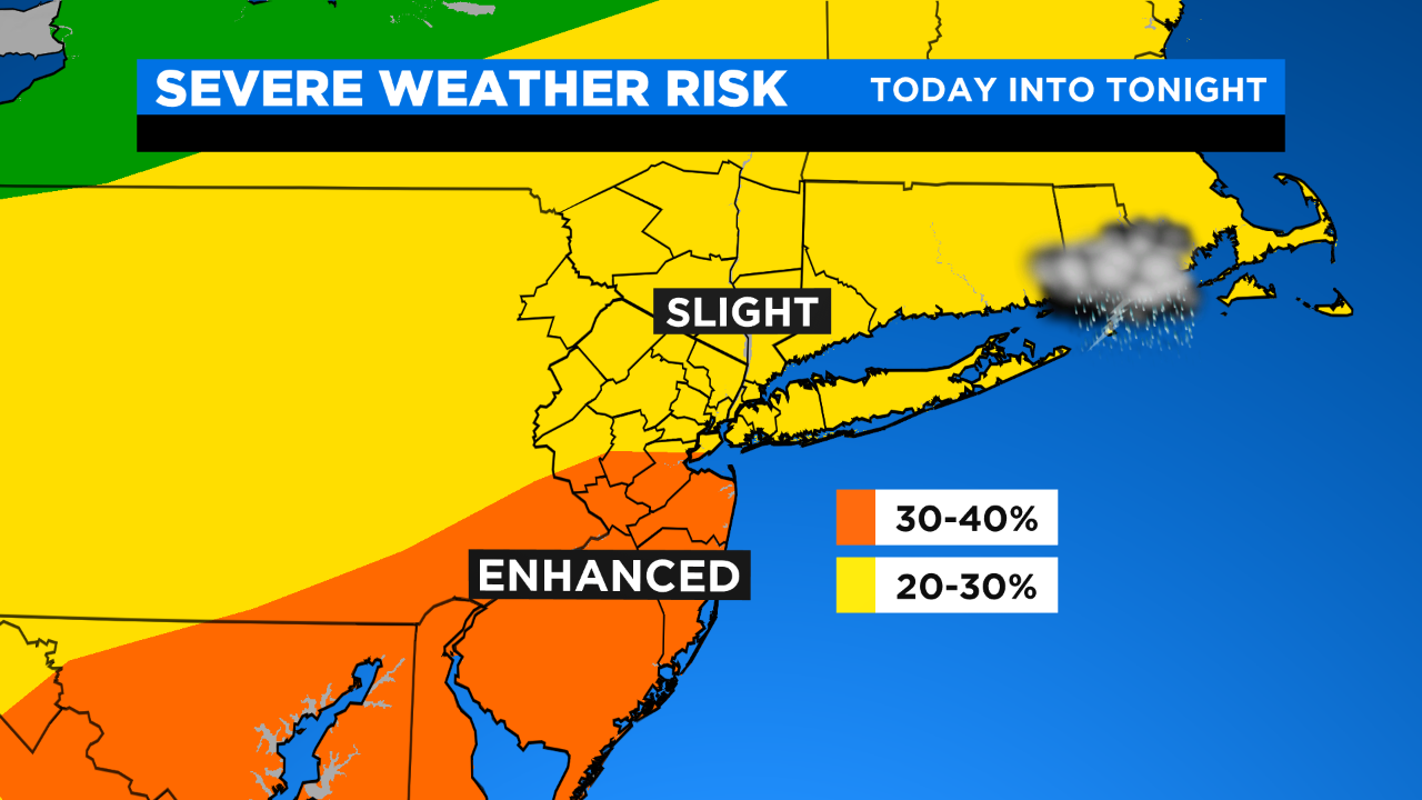
At the moment, the city is under a slight risk for severe t'storms; an enhanced/greater risk of severe t'storms lies just S&W of the city. The main concerns today will be strong/damaging wind gusts and hail. Outside of all that, expect mostly to partly sunny skies, hot and humid conditions with highs in the low 90s.
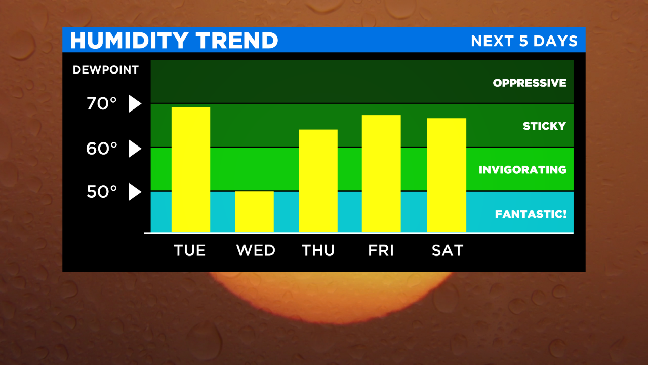
Any early evening shower/t'storm activity will exit S&E. For the remainder of the night we're expecting mostly clear skies, falling humidity and temps in the 60s and 50s (N&W).
Tomorrow's the pick of the week: lots of sunshine, low humidity and highs only around 80 (10+ degrees cooler than today).

A chance of showers/t'storms will return on Thursday. It will be mostly to partly sunny, warmer and more humid with highs in the upper 80s.