CBS2 Weather Headlines: Wintry Mix Possible Monday, Heavier Snow Wednesday
By Matt DeLucia, CBS2 Meteorologist/Weather Producer
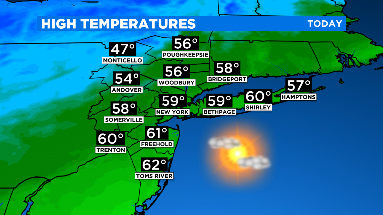
We're looking at a great finish to the weekend with temps climbing back into the upper 50s to around 60! After this morning's patchy, dense fog, skies will be mostly to partly sunny for this afternoon.
It's much colder tonight as temps drop into the 30s. Clouds will be on the increase ahead of our next system, which will be grazing us as it passes south and east tomorrow. The Monday morning commute looks find, but precip will be moving in shortly after and through the afternoon. Expect a mixed bag depending on location... S&E will be mainly rain with a few wet flakes mixed in. Around the city looks like a wintry mix, but not much (if any) accumulation on colder surfaces. N&W has the best bet at being mostly snow with light accumulations of 1-2" possible.
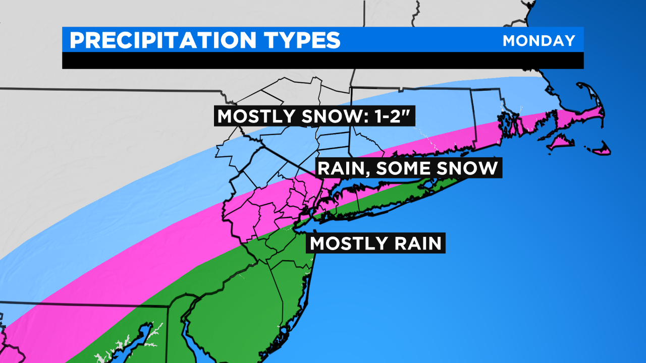
There's still a bit of uncertainty as to how far north and west the precip shield reaches, and a sharp cutoff is likely tomorrow. Either way, it's a minor event and quickly exits by evening. Temps will be around 40 for a high, 20 degrees or so colder than today.
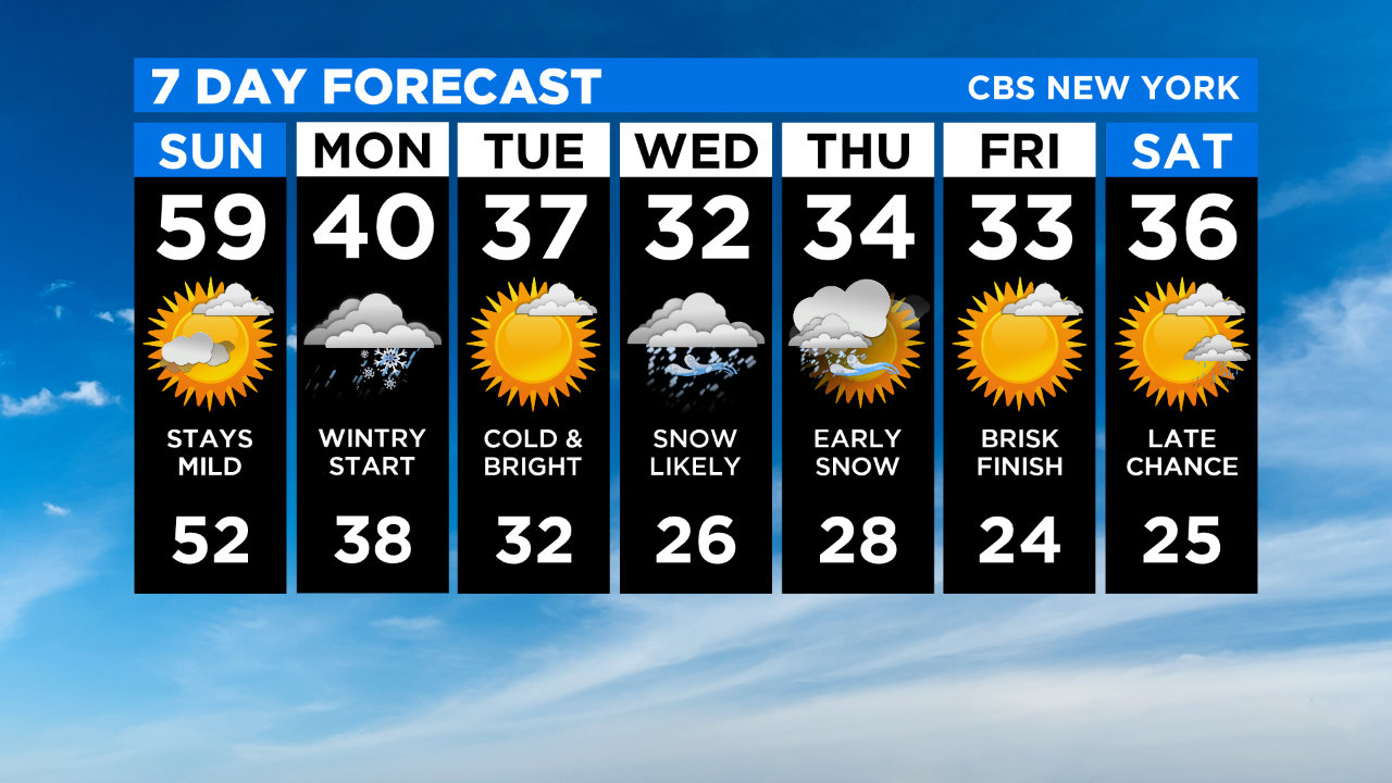
Tuesday looks cold and bright ahead of another coastal storm for midweek. That one we'll be watching closely as it may come with a significant snowfall for much of the region. Stay tuned as we get closer!
MORE FROM CBS NEW YORK: