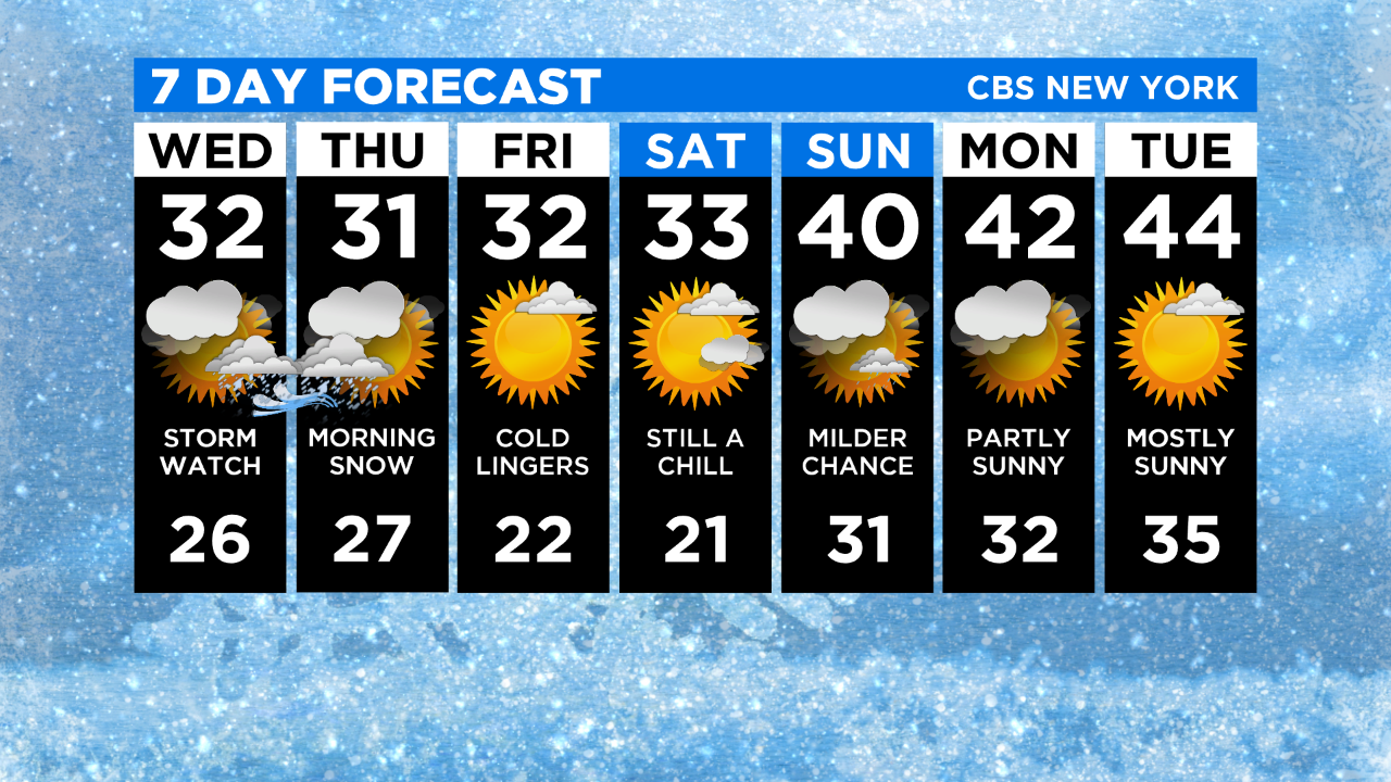
New York Weather: CBS2's 12/16 Wednesday Storm Forecast
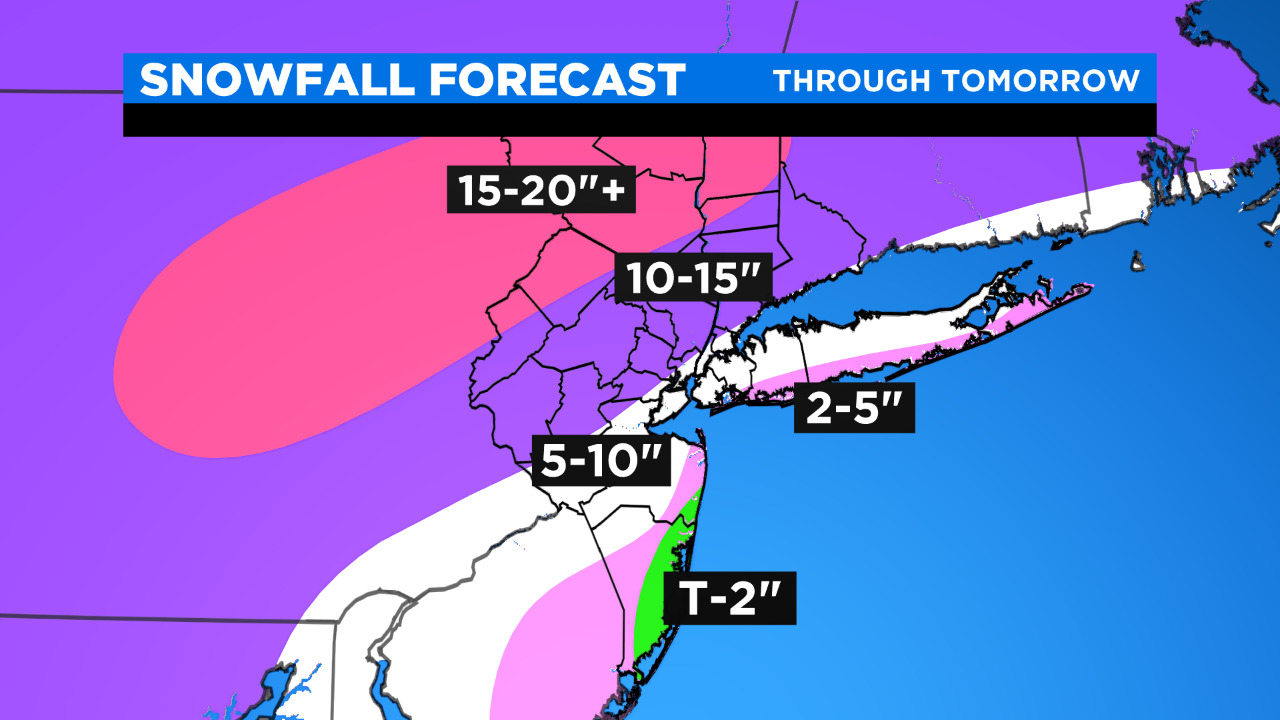
WINTER STORM UPDATE (WATCHES/WARNINGS GO INTO EFFECT THIS AFTERNOON): A little snow may work its way in the first half of the afternoon (especially S&W), but it mainly develops the second half of the afternoon (after 4 PM), intensifies into the night (most intense overnight: rates of 1-2+"/hour, blizzard conditions along coast), and tapers off through tomorrow morning with the final flakes falling early in the afternoon; a little mixing (mainly a rain event for Ocean county) is still possible S&E.
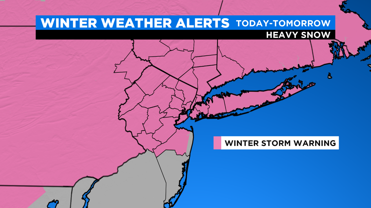
Significant snowfall (12+") is VERY LIKELY N&W with amounts generally decreasing as you head S&E/towards the coast. Gusty winds (35-45 mph; 50-60 mph S&E/coast) tonight into Thursday AM may lead to downed tree limbs and power outages. Minor to moderate coastal flooding is expected this evening into tomorrow afternoon.
AFTER THE STORM: The cold lingers for days, so we're not expecting rapid melting; and whatever does melt has the potential to refreeze.