CBS2 Weather Headlines: Cold Finish To Weekend; Wintry Mix, Icing Possible For Presidents Day
By Matt DeLucia, CBS2 Meteorologist/Weather Producer
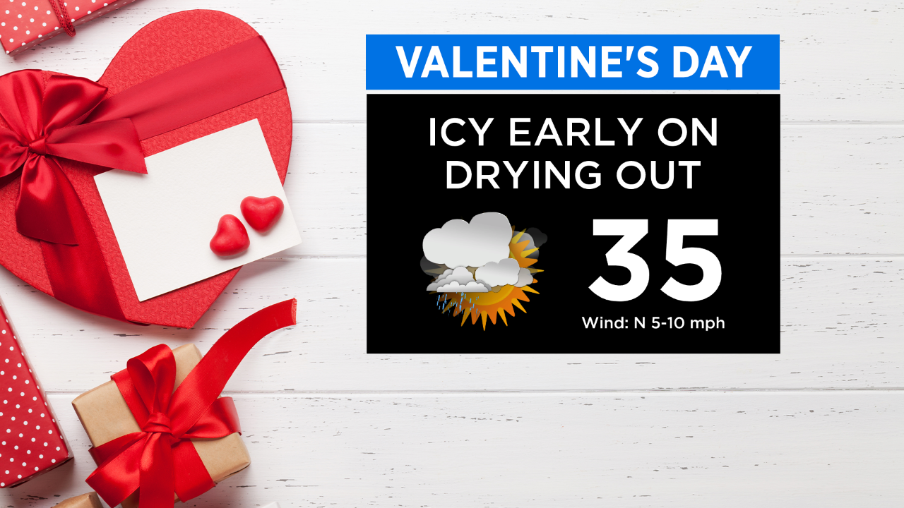
Happy Valentine's Day! After an icy start this morning with areas of freezing drizzle, we're looking at a better afternoon as temps rise above freezing.
Clouds will prevail through and it'll still be a cold finish to the weekend. Highs will reach the mid 30s.
It's mostly clouds and cold tonight with lows around 30 in NYC and 20s in the suburbs. A weak system will be passing to our south and if it gets close enough, we could have mixed precip move through south of the city toward daybreak.
Then, light on/off mixing is possible at any time tomorrow. Not a big deal during the daylight hours, but enough to cause slippery spots for Presidents Day.
The bigger event will occur Monday evening through at least Tuesday morning. The latest track wound bring a wintry mix to start, changing over to rain for points south and east of the city.
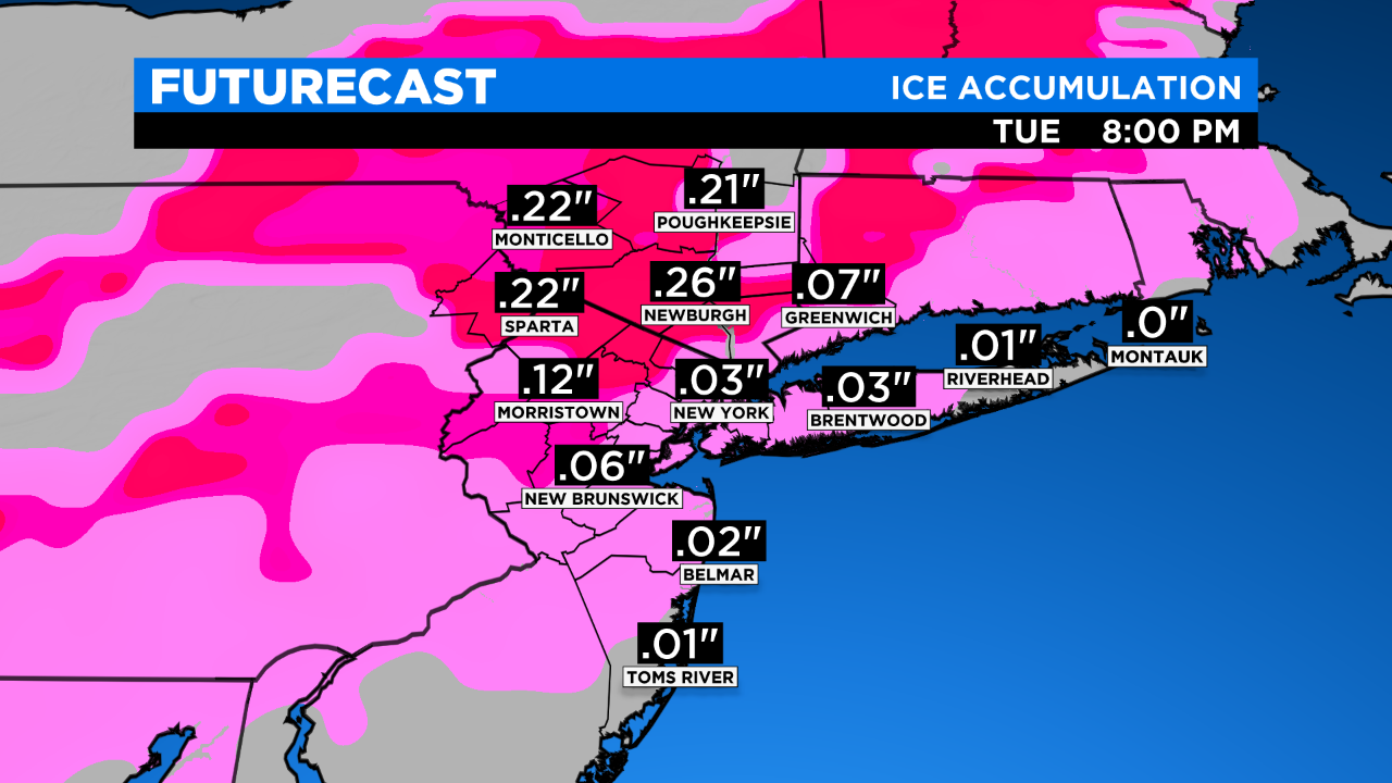
To the N&W, this has the potential of being a prolonged icing event. For these locations where temps remain marginal... more sleet and freezing rain will make for dangerous travel conditions overnight into Tuesday morning. It's not looking like a big snow maker for our area, with perhaps a few inches in the mountains.
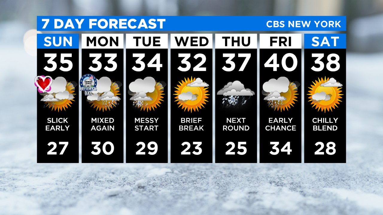
The storm should quickly pull away into Tuesday afternoon, and we get a midweek break before another round of wintry precip Thursday.
Enjoy the rest of your weekend and be sure to check back for updates!