Tracking Ida: Remnants Arrive In Tri-State, Heavy Rain Ahead
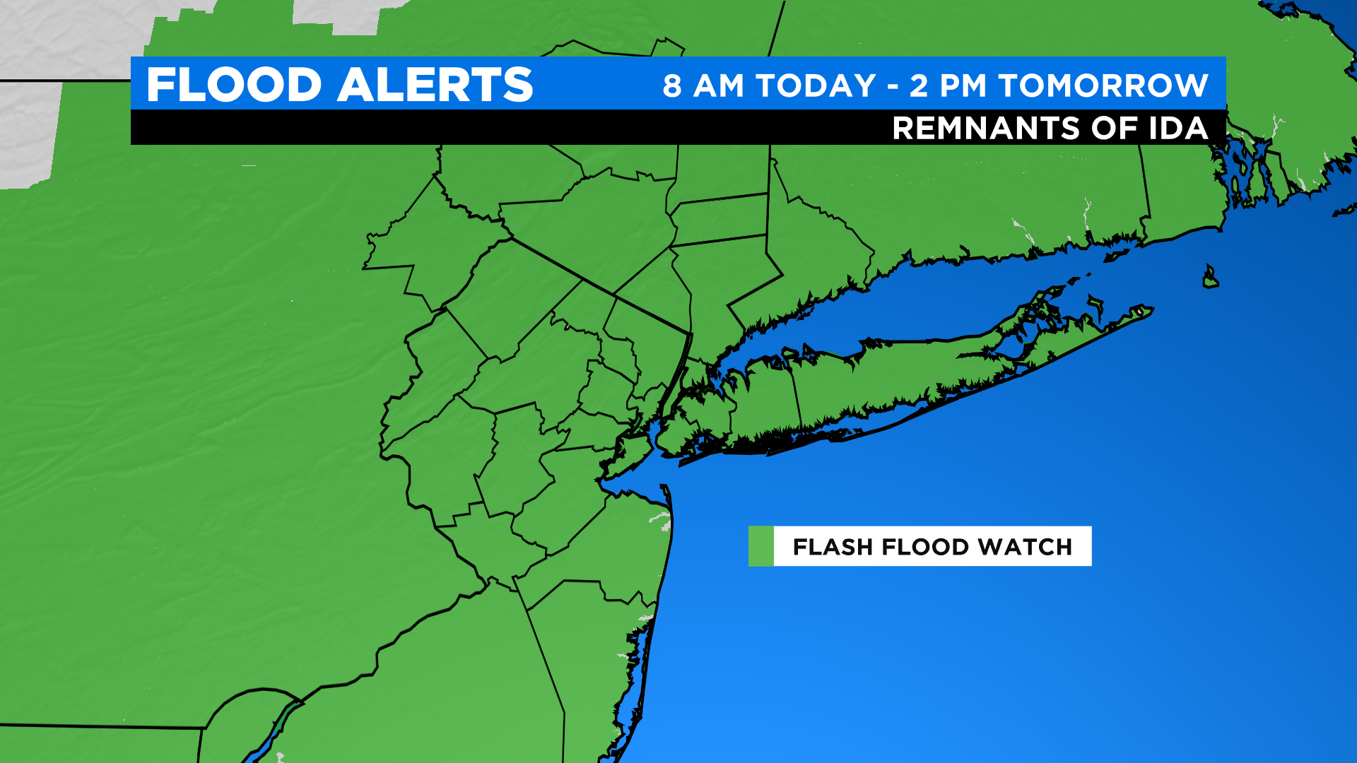
It's today into tonight that we'll be watching the remnants of Ida push through. A flash flood watch has already been issued and will go into effect at 8 AM today and remain in effect until 2 PM tomorrow. The main concerns are flooding along roadways and around creeks, streams and rivers.
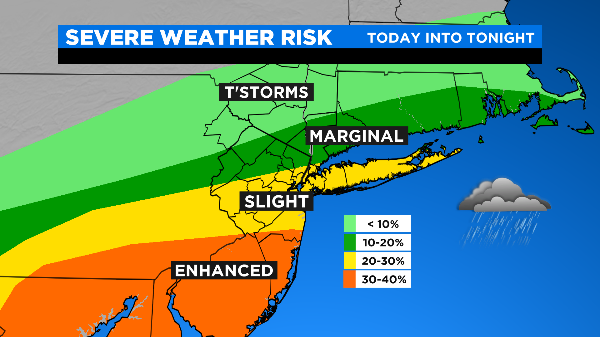
As far as the timeline goes, we're expecting off and on light to moderate rain during the day with heavier, steadier rain N&W. The heaviest rain for the city pushes through late this afternoon through early tomorrow morning with the potential for flash flooding and even some severe weather. The highest probability of the severe weather will be to our south with damaging winds and isolated tornadoes possible. The last of the rain should exit by early to mid-morning, and when all is said and done, 2-6" of rainfall is expected with up to 8" locally.
For the remainder of the day tomorrow, expect clouds to give way to sunshine, low humidity and breezy conditions with highs only in the mid 70s.

Friday will be another gem with mostly sunny skies, low humidity and highs in the mid 70s.