New York Weather: CBS2's 9/12 Sunday Morning Forecast
By Matt DeLucia, CBS2 Meteorologist/Weather Producer
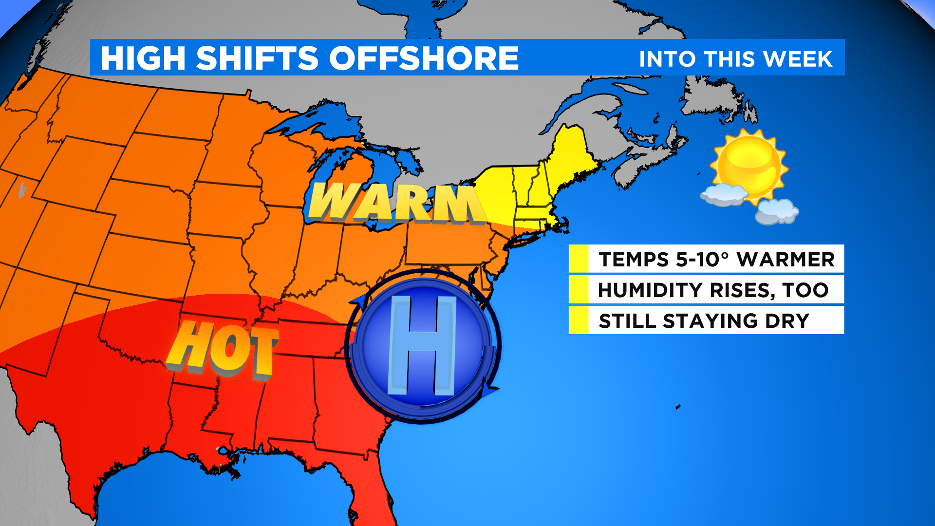
Good morning! We're not as chilly starting off today with temps mainly in the 60s. It's a bright start, and that'll continue for your Sunday. With high pressure now offshore and a southwest flow dominating, temps will be about 5-10 degrees warmer to finish out the weekend. We'll reach the mid 80s this afternoon, with upper 80s likely to the south. The humidity will be creeping up as well.
Despite plenty of sunshine, you may notice a bit of a hazy sky at times. As we've often seen this summer, some more smoke from the western wildfires will be moving overhead. It's in the upper levels though, so there are no health concerns or anything. Still a very nice day overall.
A cold front will be approaching from the northwest and knocking on our northern suburbs by sunset. There's about a 30% risk of a few showers or t'storms far north Sunday evening... we're talking Sullivan, Ulster, Dutchess. Elsewhere, it's dry into late evening. Overnight, the risk sinks a little farther south. They'll be weakening, but we can't rule out an isolated shower or storm after midnight closer to the city. Lows will be in the 60s to near 70.
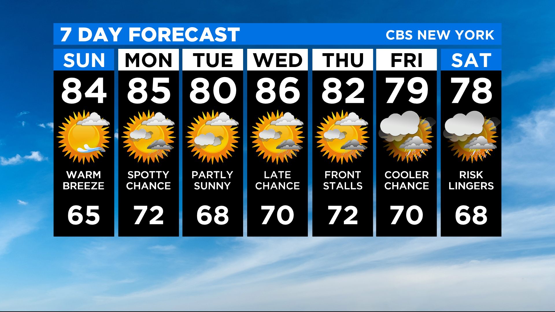
For the final full week of summer, it'll certainly be feeling like it! Highs will stay in the mid to upper 80s for Monday with the chance of a pop-up storm. Humidity levels won't be oppressive, but you'll feel the difference compared to the past couple of days.
Enjoy the rest of your weekend!