Storm Watch: 1-3" Of Snow Expected, Winter Weather Advisories In Effect Through 1PM
By Giorgio Panetta, CBS2 Chief Meteorologist/Weather Producer
We're on track for a light snowfall accumulation Thursday morning.
A narrow band of snow will form after a brief period of rain overnight as a strong cold front passes the region. Winter Weather Advisories are in effect from 5 a.m. through 1 p.m. Not a big event, but a poorly timed event.
Timing has pushed back a touch, with more legitimate snowfall now presenting after 6 a.m. The back end of the storm is trending a bit later, too. Expect decent snowfall through 10-11 a.m. as the storm heads east. I-95 will be slick.
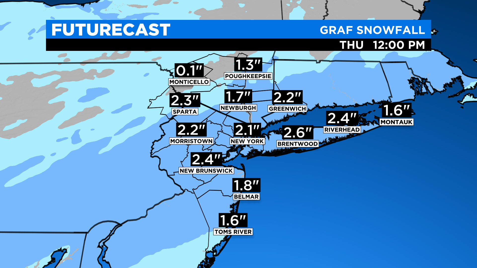
Much of the area will see 1-3 inches, but some isolated areas with 4 inches are not out of the question. A trace to 1 inch is expected north and west in the typical spots that achieve bigger totals.
Snow showers taper off after noon and dissipate offshore.
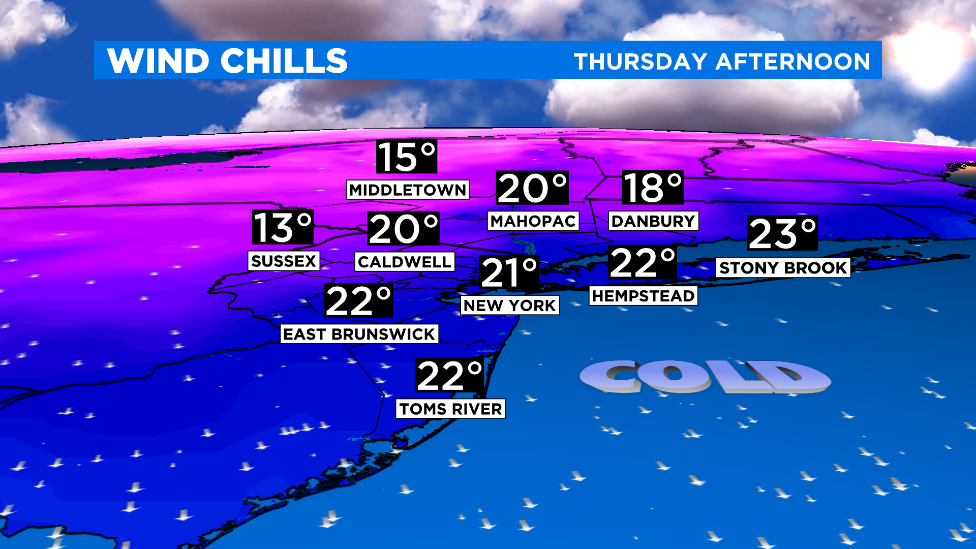
Unfortunately, the winter weather continues as the snow ends. Arctic air is right on its heels, driving the real feel temps down to the teens by Thursday evening.
We will be about 32 degrees around 6 p.m. Thursday, feeling like 16 degrees.
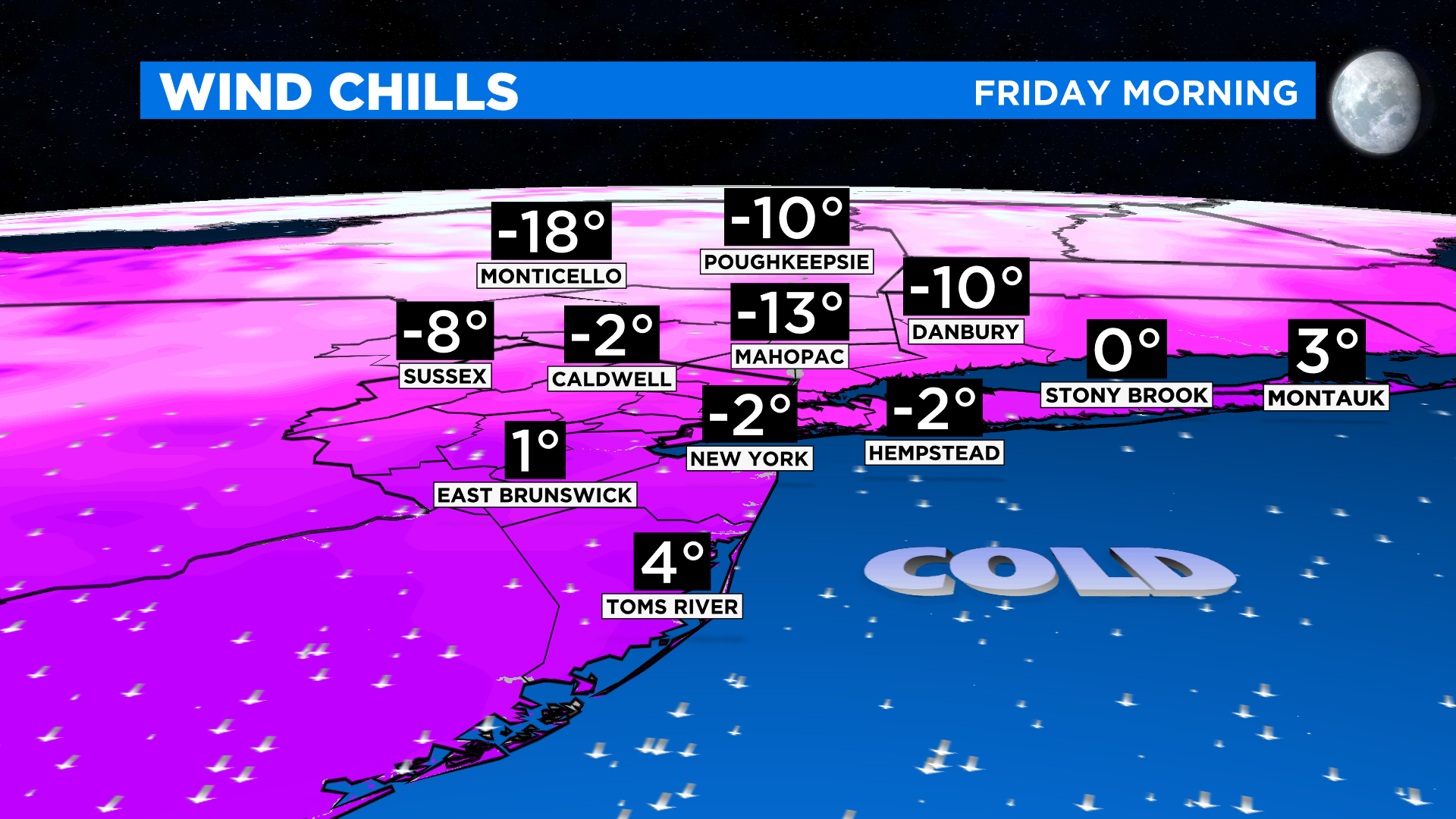
Waking up Friday morning the real feel temp will be SUBZERO for a good portion of the area. This is bottoming out cold, and the most widespread deep freeze we've seen so far.