First Alert Forecast: CBS2's 2/13 Sunday Morning Update
By Matthew Villafane, CBS2 Meteorologist/Weather Assistant
Last night was a much different story than the mild weather experienced Saturday afternoon, as clouds moved in and temperatures started to crash.
A round of light snow, which will initially start as rain, moved in overnight, likely accumulating on unpaved surfaces first as the ground will take longer to cool after yesterday's warmth.
Accumulations for the overnight hours are expected to be around an inch. Low 30.
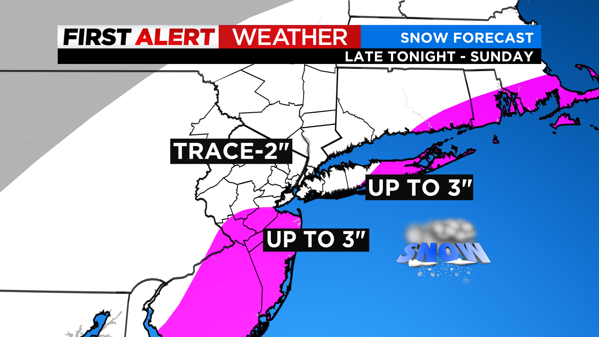
Snow will continue through the morning hours of Sunday, ending around 1 p.m., with light flurries continuing for a few hours afterwards. The snow will linger longer for the Jersey Shore and Eastern Long Island, not completely ending till around 4 p.m. for those locales.

Total storm accumulations look to be around 1-2 inches for the city and immediate surrounding areas, while further north and west, lighter amounts on the order of a trace - 2 inches are likely. Eastern and southern portions of the region are likely to see the highest totals, especially in counties such as Ocean and Suffolk, where up to 3 inches cannot be ruled out.
Skies will remain mostly cloudy. High 34.
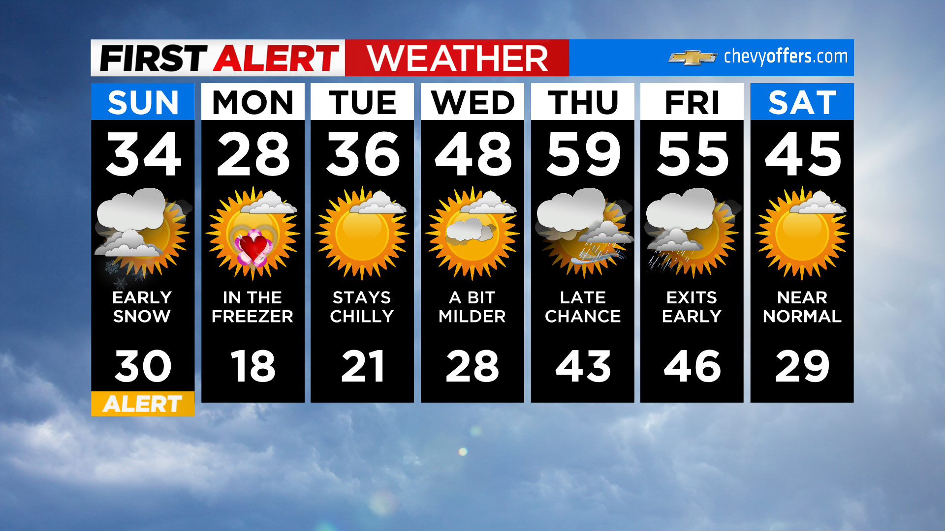
Skies will remain mostly cloudy for Sunday night, with partial clearing late. Otherwise, it will be a bit breezy and very cold, with wind chill values in the teens and single digits. Low 19.


