New York Weather: CBS2's 11/14 Sunday Morning Forecast
By Matt DeLucia, CBS2 Meteorologist/Weather Producer
Good morning! How about yesterday's wild weather?! Gusty winds, widespread hail, possible tornadoes... and the big temp drop! The mild air is long gone and we're starting off much colder today... in the 30s and even some 20s across the area. Grab the winter coats!
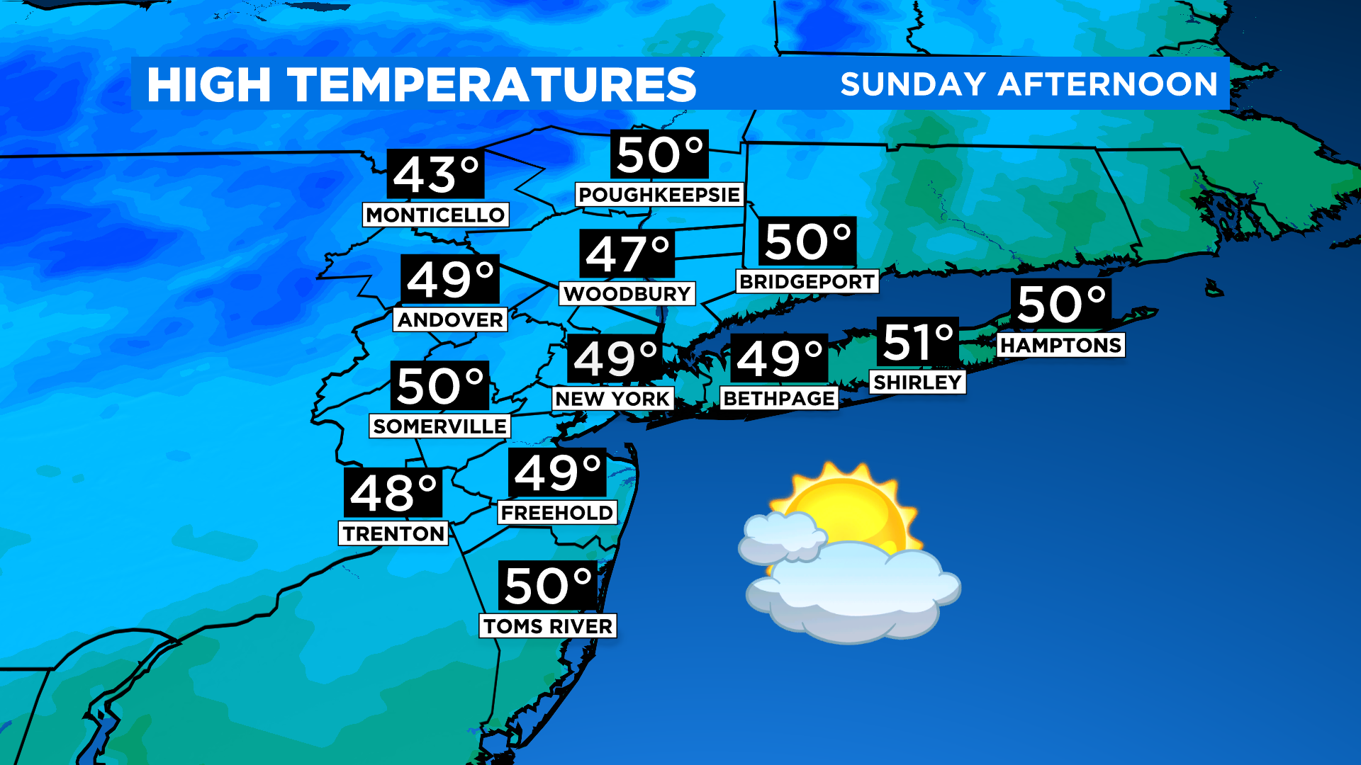
As expected, Saturday's strong cold front ushered in the chilly air and it's here to stay for the next few days. The plus side is while today will colder, it'll be much calmer. After morning sunshine, clouds will thicken into the afternoon ahead of our next system. Highs will be in the 40s to around 50 degrees.
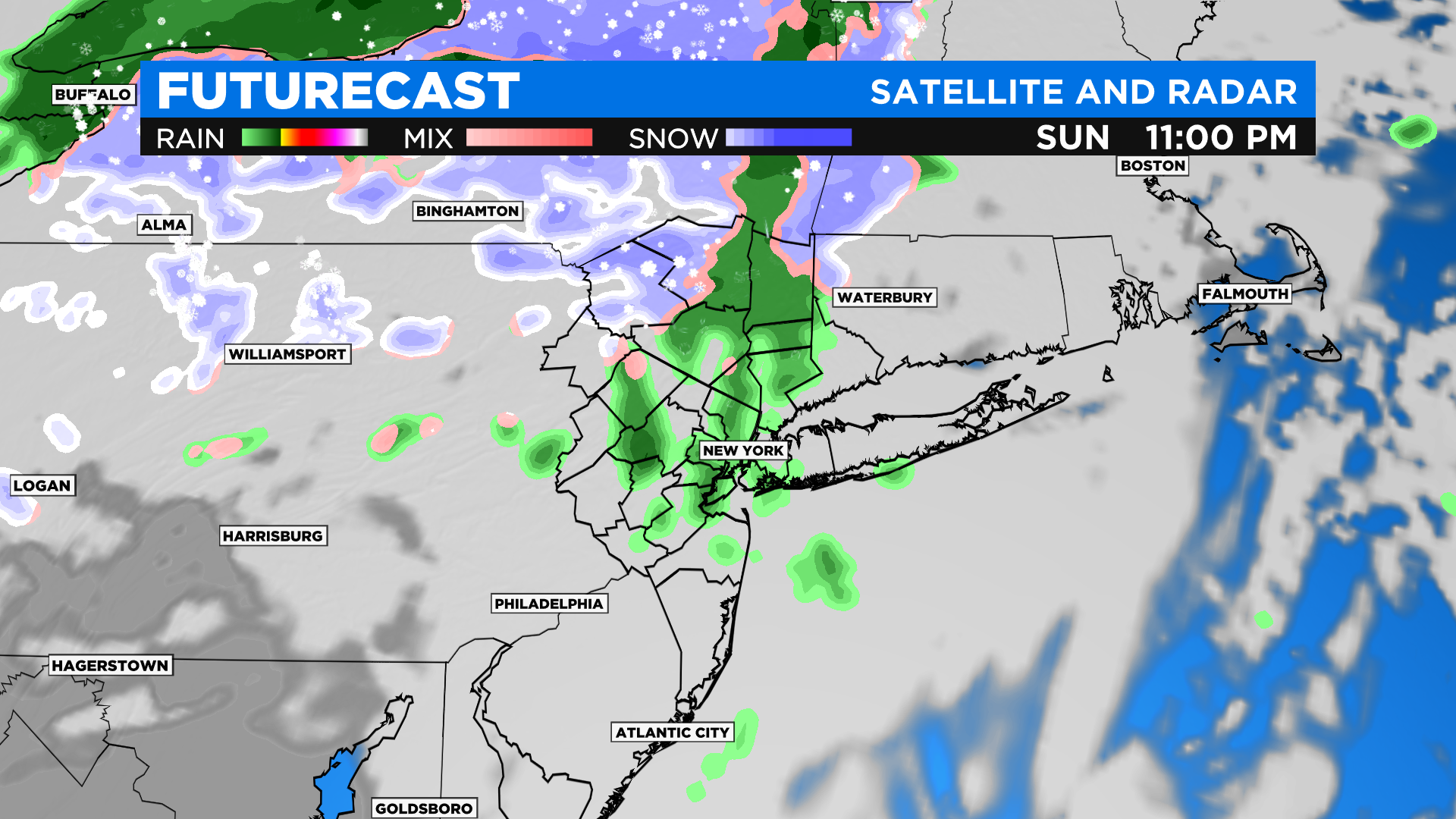
The daylight hours remain dry. Late at night, some showers move in, with snow showers in the higher elevations N&W. The Poconos, Catskills, and even parts of Sullivan, Ulster, and Dutchess could pick up some minor accumulations... not a big deal, but a reminder winter isn't far off.
Most of the overnight precip exits by early Monday morning, leaving us with a mix of sun and clouds. That said, some passing rain/snow showers remain possible through the day. It's breezy and chilly again with highs in the 40s.
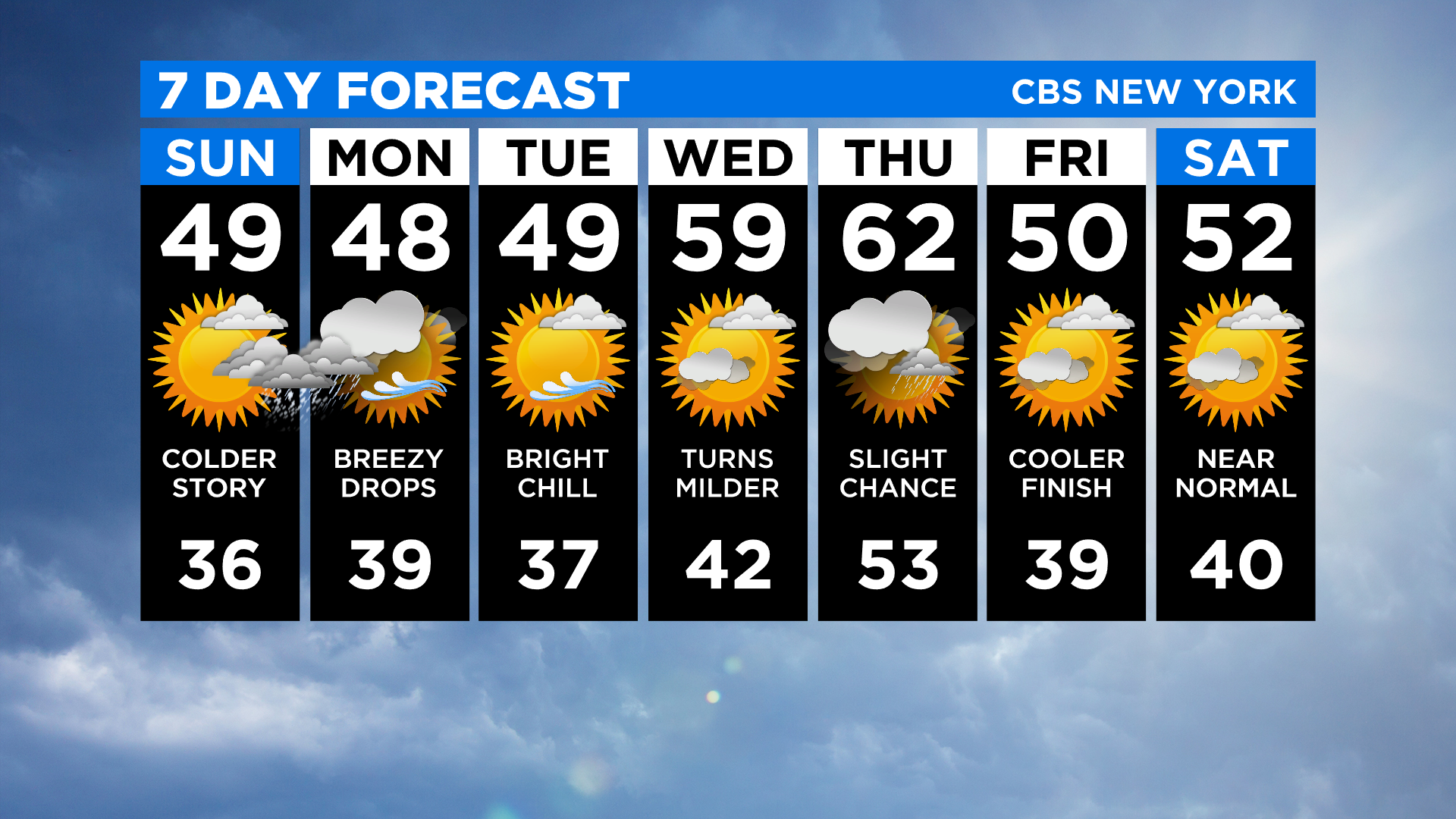
We'll briefly bounce back (say that five times fast!) to above normal temps for midweek. Have a good one!


