SNOW TIMELINE: 12-18 Inches Possible In New York City, Up To 2 Feet In Northern Suburbs
NEW YORK (CBSNewYork) -- A major winter storm has moved into the Tri-State Area. It's expected to stick around through Tuesday.
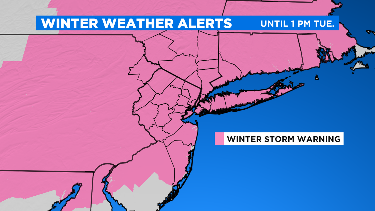
Parts of the area could see upwards of two feet of snow. Strong winds could also lead to power outages and coastal flood concerns.
LINK: Check The Latest Forecast
Here is an updated look at the storm's timeline:
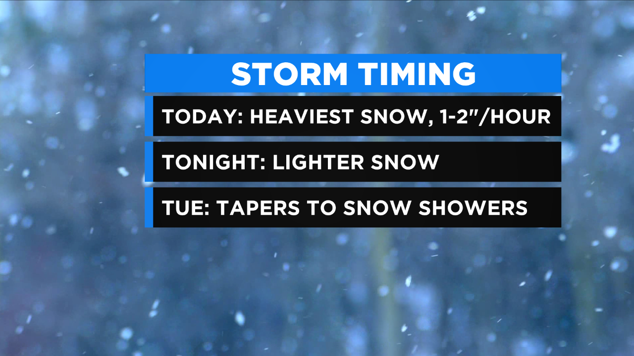
6 a.m. - 6 p.m. Monday: The brunt of the storm begins in New York City and its northern suburbs. As the storm pushes farther north, those areas will see heavier snow. Winds are expected to gust 40-45 mph in the city, and 50-plus mph along the coasts.
Snow could fall at rates of 1- to 2-inches per hour at times, leading to near whiteout conditions. Travel will be difficult, if not impossible.
LINK: Winter Storm Survival Guide
6 p.m. Monday – 6 a.m. Tuesday: The storm is expected to linger into Tuesday morning with gusty winds and light to moderate snow.
6 a.m. Tuesday: Lingering snow showers will taper off through the day.
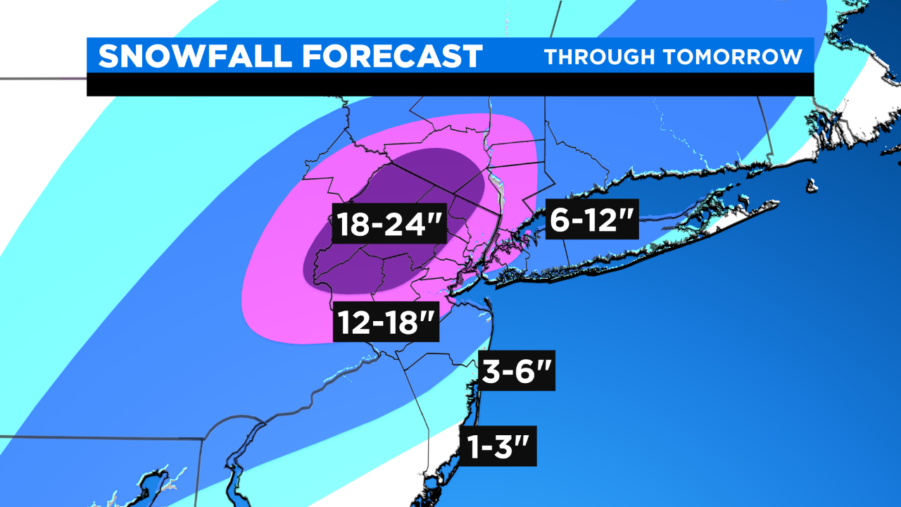
So how much snow should you expect by the time the storm moves out?
Most of the Tri-State Area will see 6-12 inches, but there is a pocket just northwest of New York City where up to 2 feet are possible.
MORE FROM CBS NEW YORK