Another Winter Storm? Parts Of Tri-State Area Could See Half A Foot Of Snow On Sunday
By Giorgio Panetta, CBS2 Chief Meteorologist/Weather Producer
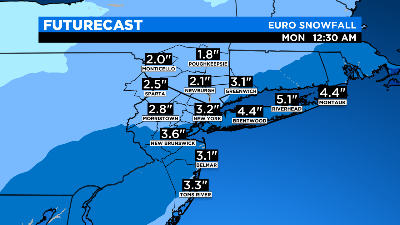
We are looking at yet another chance for accumulating snow this coming Sunday. The storm is following a very similar track to our last one, but it's such a fast mover and very far dynamically from the blockbuster Nor'easter we just went through. However, we can still see plowable snow on Sunday.
The bigger numbers are from NYC and areas south and east, with smaller totals north and west. A good chunk of the area sees 3-7 inches of heavy wet snow.
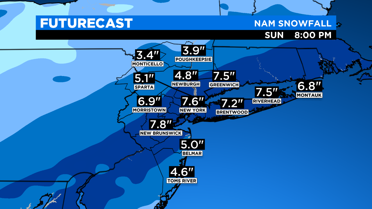
A Winter Storm Watch is in effect starting late Saturday night through Sunday PM. This could be expanded or upgraded to a Winter Storm Warning if the storm strengthens.
TRACK UNCERTAINTIES
Although we are seeing more consensus on the track, a shift west would throw a lot more snow north and west and bring significant rain/mix to the coast, thus lowering coastal numbers. We must watch tomorrow morning's runs for the latest trend. A fast or slower storm would also have influence on final numbers.
WIND/COASTAL EFFECTS?
Minimal, no big gusts or coastal erosion.
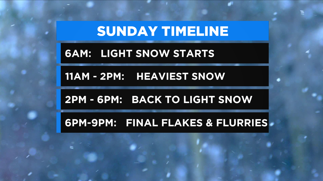
TIMING
5 a.m. - 10 a.m. Sunday -- Light snow
10 a.m. - 2 p.m. Sunday -- Brunt
2 p.m. - 6 p.m. Sunday -- Tapers east
6 p.m. - 9 p.m. Sunday -- Flurries and flakes
UPDATE: Weather Timeline: Winter Storm Could Bring Up To 8 Inches Of Snow Sunday
MORE FROM CBS NEW YORK